Show low
| Show low | |
|---|---|
|
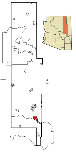
Location in County and Arizona
|
|
| Basic data | |
| Foundation : | 1870 |
| State : | United States |
| State : | Arizona |
| County : | Navajo County |
| Coordinates : | 34 ° 15 ′ N , 110 ° 3 ′ W |
| Time zone : | Mountain Standard Time ( UTC − 7 ) |
| Residents : | 9,885 (as of 2005) |
| Population density : | 137.1 inhabitants per km 2 |
| Area : | 72.3 km 2 (approx. 28 mi 2 ) of which 72.1 km 2 (approx. 28 mi 2 ) are land |
| Height : | 1935 m |
| Postcodes : | 85901, 85902, 85911 |
| Area code : | +1 928 |
| FIPS : | 04-66470 |
| GNIS ID : | 0042850 |
| Website : | ci.show-low.az.us |
| Mayor : | Rick Fernau |
Show Low is an American city in Arizona in Navajo County . The city has about 9100 inhabitants (as of 2004) on an area of 72.3 km². Arizona State Routes 77 and 260 and US Highway 60 run through Show Low .
Show Low is located in the middle of a forest region in central Arizona. In 2002 during a major forest fire , the entire city had to be evacuated.
Web links
Commons : Show Low - collection of pictures, videos and audio files
