Spieljoch
| Spieljoch | ||
|---|---|---|
|
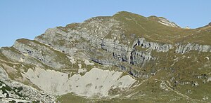
Spieljoch from the southwest ( Rotspitze ) |
||
| height | 2236 m above sea level A. | |
| location | Tyrol , Austria | |
| Mountains | Brandenberg Alps | |
| Dominance | 0.37 km → Seekarlspitze | |
| Notch height | 66 m ↓ Scharte to the Seekarlspitze | |
| Coordinates | 47 ° 27 '22 " N , 11 ° 46' 19" E | |
|
|
||
| Normal way | from the Erfurter Hütte via a path with rope insurance in the summit area | |
The Spieljoch is a 2236 meter high mountain in the Rofan , a subgroup of the Brandenberg Alps in the Austrian state of Tyrol . The summit lies in the west-east running main ridge of the Rofan Mountains. Its north side is formed by steeply sloping, massive and rugged rock formations, its western flank consists of steep crags and the east side of slabs interspersed with crags. The southern slope of the Spieljoch, on the other hand, is formed by a gently sloping grass ridge. To the west the mountain emits a pronounced ridge.
Surroundings
The Spieljoch lies in the south-western area of the Rofan and forms a prominent point of the main ridge that runs west-east here. Neighboring mountains in the course of the west ridge are the Rofan's highest mountain at 2299 meters, the Hochiss , and, separated by the Seekarlscharte at about 2000 m altitude, the 2261 meter high Seekarlspitze rises . To the north, the Spieljoch falls steeply with an approximately 150 meter high north face into a cirque west of the Ampmoosalm (1784 m). To the south, the terrain gently flattens towards the high alpine pastures near the Erfurter Hütte . The closest town is Maurach am Achensee in the south, about 4 kilometers as the crow flies ; Steinberg am Rofan is a good 6 km to the north .
geology
See article Hochiss
Tourist development
Since the area was populated early due to its fertile soil and the mountains are easy to climb from the south, there are no records of first ascents. A dense network of hiking trails leads through the Rofan Mountains and the Spieljoch is easy to reach from the Erfurter Hütte, at 1,831 meters north above Maurach. The normal route (facilitated tester rise) leads first as a simple footpath no. 413 on the Hochleger the Mauritzalm north to below the mountain. The last part to the summit is equipped with some rope insurance, the walking time according to literature is about 1½ hours. From the Seekarlscharte, the summit is accessible via an insured path of difficulty A , which is part of the Achensee 5-summit via ferrata , which opened in 2010 .
Climb
There are challenging climbing routes, similar to many Rofan peaks in the main ridge, in the approximately 150 meter high north face and over the west ridge . In 1906 the west ridge, consisting of brittle rock and crags, was first climbed downhill, and in 1911 also uphill. A route with the UIAA VI + level of difficulty has been leading through the equally brittle north face since 1940 in the key point . But both the west ridge and the north face are rarely used due to the danger of falling rocks. In spring, ski tours from the Erfurter Hütte to the Spieljoch are possible.
Literature and map
- Theodor Trautwein in: Eduard Richter, The Development of the Eastern Alps , Volume I, Berlin 1893
- Helmut Bögel, Klaus Schmidt: Small geology of the Eastern Alps , Ott-Verlag, Thun 1976
- Röder, Schmid, from Werden: Alpine Club Guide Rofangebirge - Brandenberger Alps , Munich 1983, ISBN 3-7633-1240-4
- Alpine Club Map 1: 25,000, sheet 6, Rofan
Individual evidence
- ↑ Achensee-5-Gipfel-Klettersteig on Achensee.info, accessed on November 30, 2012

