
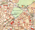
Spitalerstrasse
The Spitalerstraße in Hamburg is one of the main shopping streets of the city. It connects the middle part of Mönckebergstrasse and Gerhart-Hauptmann-Platz at the level of Mönckebergstrasse underground station with the east-facing, merging streets Glockengießerwall and Steintorwall opposite the western entrance to the main station's lobby .
According to pedestrian counts in shopping streets , Spitalerstraße was the second busiest street in Hamburg in 2013 with 9,215 pedestrians in one hour, after Mönckebergstraße. In a nationwide comparison, Spitalerstraße was ranked 12th in 2013 and in 2011 was even 7th with 11,190 pedestrians per hour, just behind Mönckebergstraße.
In addition to the line of sight of the hall of the main train station in the east and the Petrikirche on the edge of the axis in the west, Spitalerstraße is mainly characterized by commercial buildings that were built mainly from around 1900, some of which date from the post-war period. With the buildings Barkhof , Seeburg and Semperhaus , three of the large office buildings are on Spitalerstraße. The entire length of the street has been developed as a pedestrian zone , with typical group chain stores now dominating the scene, while retail stores were also found there in the 1970s and 1980s .
history


The name of Spitalerstraße is based on the fact that in earlier times alms in the form of food were collected twice a week in the city for the benefit of “the poor Seeken [sick]” and “up dem Stiege to St. Jürgen” - the St. Jürgen Hospital, first mentioned in 1190. Georg - were brought. This stairway leading from the city through the forest to the “Spital” was named “Spitaler Straße”, as was the “Spitaler Tor”, which was later built at the exit on the city wall. ( see also: List of former city gates in Hamburg )
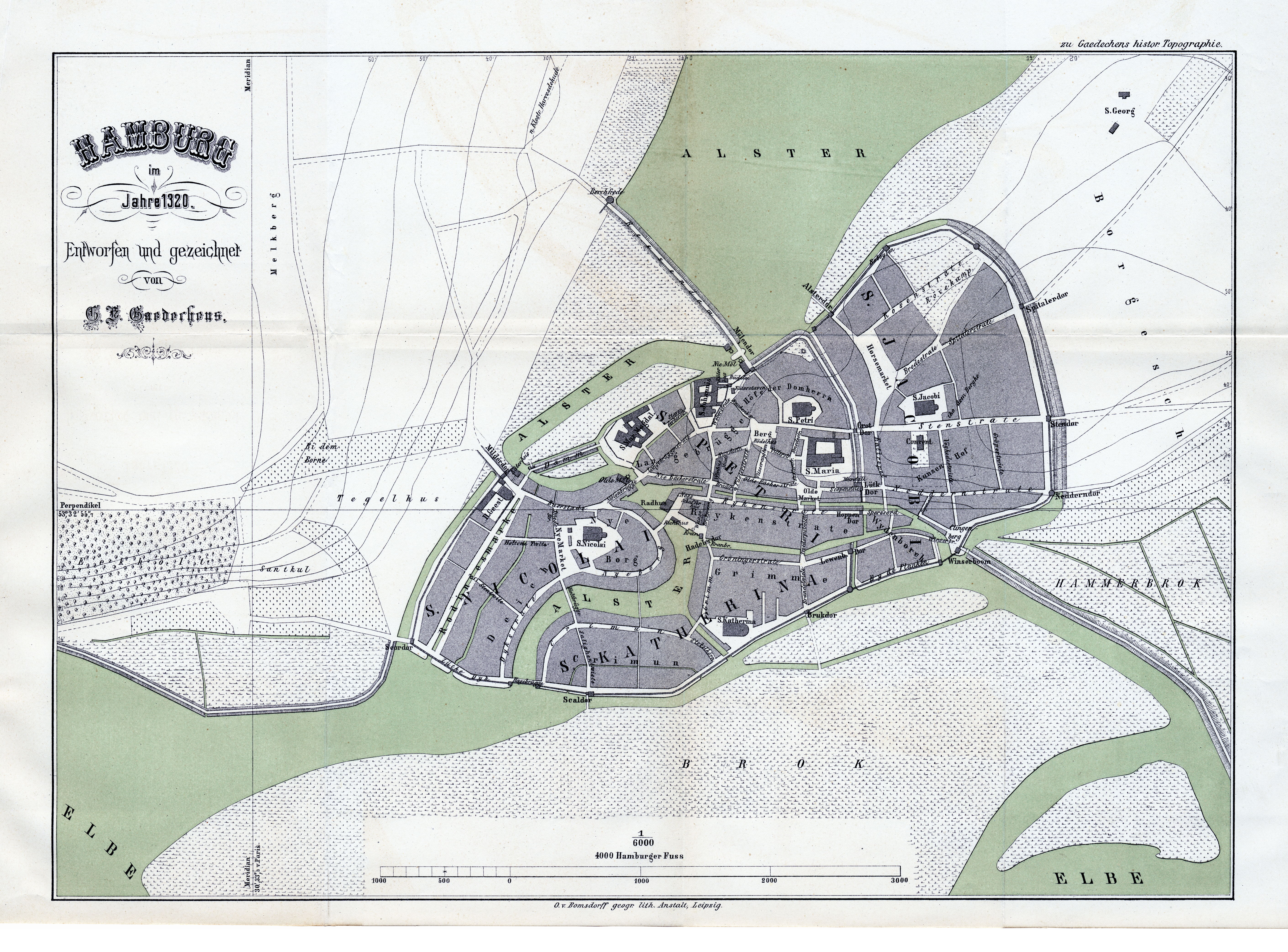
On old city maps from around 1200, the course up to “Secken” or “St. Georgs Hospital ”.
With the growing expansion of Hamburg around 1300, the "Stieg" leading to the hospital became an inner-city street with its own "Spitaler Tor" in the city wall and on a city map from 1320 the street is also named as Spitalerstrate . The Hiobs Hospital , which was at the end of Spitalerstraße at that time , is sometimes assumed to have given its name, but it was only built in 1509, when the name of the street had long since existed.
With the construction of the Hamburg ramparts around 1620, the Spitaler Tor was closed and converted into a bastion , the Spitalerstraße thus no longer had a direct continuation to the St. Georgs Hospital, it ended up to around 1830 on the Kurz Mühren / Lange Mühren road and the one at that time Pig market.
The houses in the dark alley survived the great fire of 1842 largely unscathed. It was not until the consequences of the cholera epidemic of 1892 that extensive renovation measures were carried out, which between 1906 and 1909 converted the street into a modern and elegant shopping street with office buildings such as the Barkhof, the Südseehaus and the Semper houses. Trading company offices occupied the upper floors, while the ground floors were often rented out as sales rooms. The central location and the proximity to the main train station made Spitalerstraße one of the most attractive shopping streets in Hamburg, although the growing car traffic increasingly disrupted it. The latter resulted in the street being converted into a pedestrian zone on September 7, 1968.
In the meantime, around 1880, Spitalerstraße was continued in the east to Glockengießerwall and Steintorwall streets.
The 100 meter long area between the south-eastern corner of the horse market and the then western end of Spitalerstraße, which was named "Breite Straße" until around 1915, is now assigned to Spitalerstraße according to the postal address.
Photographs and map

Spitalerstraße in Hamburg with Petrikirche in the background

"Leuchtfinger" aluminum stele by Hermann Goepfert (erected in 1969, removed again in 1999)

Shops on Spitalerstraße (February 1997)
Plan of the city center around 1890 with Spitalerstrasse (bottom right) in front of the construction of the main train station


Individual evidence
- ↑ List at joneslanglasalle.de ( memento from September 29, 2013 in the Internet Archive ), PDF
- ↑ Hamburg Stories and Thoughts
- ↑ Hamburg plan from 1200
- ↑ Hamburg plan from 1300
- ↑ Hamburg plan from 1320
- ↑ Hamburg topographically, politically and historically . 2nd edition Hamburg, Brüggemann 1810–1811, page 172, IV Das Hiobs Hospital
- ^ Website Hypovereinsbank - Hamburg Barkhof ( Memento of the original from February 28, 2013 in the Internet Archive ) Info: The archive link was automatically inserted and not yet checked. Please check the original and archive link according to the instructions and then remove this notice.
- ^ Die Welt, August 11, 1999
Web links
Coordinates: 53 ° 33 ′ 7.1 ″ N , 10 ° 0 ′ 9.4 ″ E