St. Martin (island)
| St. Martin | ||
|---|---|---|
| St. Martin (satellite image) | ||
| Waters | Caribbean Sea | |
| Archipelago | Leeward Islands | |
| Geographical location | 18 ° 4 ′ N , 63 ° 4 ′ W | |
|
|
||
| length | 14.3 km | |
| width | 13.3 km | |
| surface | 87 km² | |
| Highest elevation | Pic Paradis 424 m |
|
| Residents | 72,239 (2014) 830 inhabitants / km² |
|
| main place | F: Marigot / NL: Philipsburg |
|
| Map of the island of St. Martin with minor islands | ||
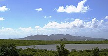
St. Martin is a hilly island in the Caribbean Sea , located in the north of the Lesser Antilles . In this group of islands , it is one of the Leeward Islands . It is of volcanic origin. The highest point is the Pic Paradis with a height of 424 m above sea level. The northern, larger part of the island is part of the French overseas territory of Saint-Martin . The southern part belongs to the autonomous country of Sint Maarten of the Kingdom of the Netherlands . St. Martin is thus the smallest inhabited island that belongs to two states.
geography
The approximately 87 km² island is located around 250 km east of the Greater Antilles island of Puerto Rico . St. Martin is politically divided between France and the Kingdom of the Netherlands. The Dutch part is part of the SSS islands .
The northern, larger part of the island, together with some secondary islands, forms the French overseas territory of Saint-Martin and belongs to the EU . The southern part forms the autonomous country of Sint Maarten in the Kingdom of the Netherlands with some minor islands. Summarized as "Saint-Martin / Sint Maarten" it is one of the smallest islands that belong to two states. Only here do France and the Kingdom of the Netherlands have a common land border.
The capital of the French territory is called Marigot ; further north is Grand Case on the bay of the same name. The capital of the Dutch part is Philipsburg . The Anguilla Channel separates St. Martin from the British neighboring island of Anguilla in the north. The Saint-Barthélemy Canal separates Sint Maarten from the French island of Saint-Barthélemy in the southeast.
history
The island was discovered by Christopher Columbus on November 11, 1493, the name day of St. Martin , and was once called Isla de San Martín .
In June 1633, the Spaniards occupied the island to take over the Dutch fortress on site. In 1648 the island was divided after French and Dutch prisoners of war drove out their Spanish guards. The Legend of the deportees divided the island among themselves by a Dutchman and a Frenchman circled the island in opposite directions until they met again on the beach. It is also said that the French gave the Dutchman a water bottle that contained gin , which is why the French part is larger than the Dutch today. Today's French-Dutch land border was established by the Treaty of Concordia on March 23, 1648. The Dutch part of the island (Sint Maarten) belonged politically to the Netherlands Antilles until its dissolution on October 10, 2010 .
With more than 72,000 inhabitants, the island is now heavily populated compared to neighboring islands. As of January 1, 2014, there were 37,132 inhabitants on the Dutch side, while 35,107 inhabitants were stated on the French side.
The official currency of the French part of the island is the euro , that of the Dutch part is the Antillean guilder . This is to be replaced by the equivalent Caribbean guilder . The US dollar is accepted on both parts of the island. The exchange rate of the Antilles guilder (ANG) to the US dollar is fixed at 1 USD = 1.79 ANG. In everyday business, it is not uncommon for euros and US dollars to be offset 1: 1.
climate
The island is subject to a tropical monsoon climate ; the dry season extends from January to April, the rainy and hurricane season from August to December. The wind usually blows from the east or northeast. The air temperature is between 20 ° C and 34 ° C; the annual mean is 27 ° C. The temperature of the sea water ranges from 25.9 ° C in February to 28.4 ° C in October with an annual mean of 27.2 ° C. Over the year, but only on 142 days, 1047 mm of rain falls. Thunderstorms are relatively rare: 18 days a year.
St. Martin is hit by hurricanes at irregular intervals . Since the 1990s, “ Luis ” (September 1995), “ Lenny ” (November 1999) and “ Irma ” (September 2017) raged the worst. "Irma" destroyed around 95 percent of the buildings and infrastructure in the French part of the island; in the Dutch part, the airport and port, among other things, were badly damaged. The responsible minister of the Kingdom of the Netherlands spoke of the "strongest hurricane in living memory in this area".
traffic
The population density corresponds to the heavy car traffic, which causes traffic jams on both parts of the island at peak times.
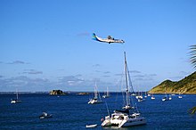
On the French side, in the north near Grand Case, there is the L'Espérance airfield , which is served by small scheduled aircraft and the postal plane for the regional connection of the Antilles .
On the Dutch side is the Princess Juliana International Airport , which was built by US engineer units in World War II and initially served as the Allied military airfield. It was opened in 1943 by the future Queen Juliana during a secret trip to the Netherlands Antilles. The runway is right on the coast, on the south of two narrow land bridges. The special thing is that the aircraft (including wide-body aircraft such as the Airbus A340 and the Boeing 747 ) only descend a few meters above the heads of the holidaymakers due to the proximity of the runway to the beach. That is why Maho Beach, which is open to the public, is provided with warning notices. The unusually short distance allows tourists to photograph the landing planes up close. On the beach, a surfboard on which the flight plan is written announces the flights.
See also
Web links
Individual evidence
- ↑ Saint-Martin - Situation geographique. In: iledesaintmartin.org. Office de Tourisme de Saint Martin, accessed on November 13, 2017 (French).
- ↑ Jean-Marie Paugam (ed.): Saint Martin - Rapport annuel 2015 . Institut d'émission des départements d'outre-mer (IEDOM), Paris 2016, Saint-Martin en bref, p. 11 , Les chiffres clés de Saint-Martin - Environnement (French, online [PDF; 2.6 MB ; accessed on November 13, 2017]).
- ↑ IMRAY: Chart A24: Anguilla, St Martin and St Barthelemy. Nautical chart 1: 100,000; St Ives, Cambridgeshire, UK, 2016, ISBN 978-1-84623-837-6 .
- ↑ Makini K. Hickinson (Ed.): Statistical Yearbook 2014 . Department of Statistics Sint Maarten, Philipsburg 2014, 2nd population, p. 17 , 2.1 Population of Sint Maarten, January 1st (English, accessible online on the website of the Department of Statistics Sint Maarten [PDF; 2,3 MB ; accessed on November 13, 2017]).
- ↑ Populations légales 2014: Recensement de la population - Régions, départements, arrondissements, cantons et communes. Populations légales 2014 des collectivités d'outre-mer. In: Statistiques. Institut national de la statistique et des études économiques (INSEE), January 2, 2017, accessed on November 13, 2017 (French).
- ↑ Climate Summary. The Dutch Windward Islands. In: meteo.cw. Meteorological Department Curaçao, accessed November 13, 2017 .
- ↑ Caribbean Islands: Hurricane devastates islands and moves on towards Florida. In: ZEIT ONLINE . September 6, 2017. Retrieved November 13, 2017 .
- ↑ Superorkaan Irma judges enormous ravage aan op Sint Maarten. In: de Volkskrant . September 7, 2017, accessed November 13, 2017 (Dutch).


