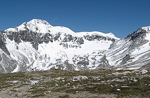
Piz Sardona
| Piz Sardona Surenstock |
||
|---|---|---|
|
Piz Sardona from Calfeisental seen from |
||
| height | 3057 m above sea level M. | |
| location | Canton Glarus / Canton St. Gallen , Switzerland | |
| Mountains | Glarus Alps | |
| Dominance | 1.6 km → Piz Segnas | |
| Notch height | 115 m ↓ Surenjoch | |
| Coordinates | 738 077 / 198 442 | |
|
|
||
|
The Piz Sardona seen from the Grisons side; the little Spitz on the right. Links of Piz Segnas . |
||
The Piz Sardona ( German, rare Surenstock ) is a 3057 m high mountain on the border between the Swiss cantons of Glarus and St. Gallen .
On the St. Gallen side is the Sardona Glacier, which flows into the Walsertal Calfeisen and then into the Tamina valley . On the Glarus side it goes down to Elm .
The Piz Sardona is connected to the Piz Segnas ( 3099 m ) by a wide saddle . The neighboring peaks include Piz Dolf ( 3,028 m ) in the southeast and the Ringelspitz further east .
See also
literature
- Manfred Hunziker: Ringelspitz / Arosa / Rätikon , Alpineouren / Bündner Alpen , Verlag des SAC 2010, ISBN 978-3-85902-313-0 , p. 156.
Web links
Commons : Piz Sardona - collection of images, videos and audio files
- Panorama from the Surenstock
- Piz Sardona tour reports and photos
- UNESCO World Heritage Site Sardona


