Tanaga Island
| Tanaga Island | ||
|---|---|---|
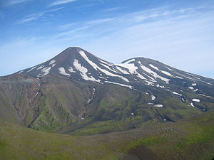
| Mount Tanaga on Tanaga Island | ||
| Waters | Pacific Ocean | |
| Archipelago | Aleutian Islands | |
| Geographical location | 51 ° 48 ′ N , 177 ° 57 ′ W | |
|
|
||
| length | 40 km | |
| width | 32 km | |
| surface | 530 km² | |
| Highest elevation | Mount Tanaga 1806 m |
|
| Residents | uninhabited | |
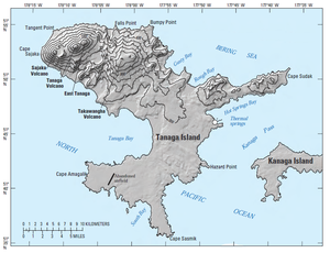
| Topographic map | ||
Tanaga Island is an island in the west of the Andreanof Islands , which in turn lie in the southwest of the Aleutian Islands .
The uninhabited island, part of the US state of Alaska , is about 40 km long and between 4 and 32 km wide. In the northwest of the island is the 1806 m high volcano Mount Tanaga , the last eruption of which so far occurred in 1914.
Web links
Commons : Tanaga Island - collection of pictures, videos and audio files
- Information to the volcano Mount Tanaga (Engl.)
- Tanaga Island in the Global Volcanism Program of the Smithsonian Institution (English)


