Tapachula
| Tapachula de Córdova y Ordóñez | ||
|---|---|---|
|
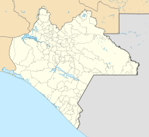
Coordinates: 14 ° 54 ' N , 92 ° 16' W Tapachula de Córdova y Ordóñez on the map of Chiapas
|
||
| Basic data | ||
| Country | Mexico | |
| State | Chiapas | |
| Municipio | Tapachula | |
| Residents | 202,672 (2010) | |
| - in the metropolitan area | 320.451 | |
| City insignia | ||
| Detailed data | ||
| height | 177 m | |
| Post Code | 30700-30837 | |
| prefix | 962 | |
| The "13 pvd sur", a small side street in the south of the city | ||
| Two men in the “9a Norte”, a larger street in the city center | ||
| Lonely stroller in front of a shabby house facade | ||
Tapachula (full name Tapachula de Córdova y Ordóñez ) is not far from the Pacific coast situated Mexican city, about 18 kilometers from the border with Guatemala in Ciudad Hidalgo removed. Tapachula is located in the municipality of the same name , of which it is the administrative center. Tapachula is the economically most important city in Chiapas with the highest GDP per capita in the state. A variety of industrial and agricultural products are produced in the area. Tapachula's most important role is the trade connection between Central and North America.
Toponym
The Nahuatl name tapachollan roughly means 'flooded place' and refers to the frequent rainfall, the many rivers and streams in the area and the almost tropical and humid climate.
Location and climate
Tapachula is about 25 km (as the crow flies) from the port city of Puerto Chiapas on the Pacific coast at an altitude of 177 m above sea level. d. M. The distance to Tuxtla Gutiérrez , the capital of the state of Chiapas, is almost 400 km (driving distance); it is just under 1100 km to Mexico City . Throughout the year the weather is extremely hot and rainy: 30–50 ° C, 70–90% humidity (tropical climate).
Transport and infrastructure
Tapachula has an international airport ( Aeropuerto Internacional de Tapachula ), a new big-scale port ( Puerto Chiapas ), a train station with direct connections to Texas and numerous import-export service providers. A six-lane highway runs along the coast. In addition, the city has shopping centers with department stores, customs agencies, foreign trade offices and the prison of the immigration authorities. The route of the Tica bus, which runs through all of Central America to Panama, also starts from Tapachula.
Residents
Most of the city's residents are mestizo ; less than 2% still describe themselves as pure-blooded Indians. According to the data of the Instituto Nacional de Estadística, Geografía e Informática of the year 2000, 63.22% of the residents are Catholic, 12.06% Protestant, 6.71% Christian sects ( Adventists , Mormons , Jehovah's Witnesses ), 16.88% atheist and 1.13% of other religions. The diocese of Tapachula has its seat in Tapachula.
history
The place was founded in pre-Hispanic times (1486) by the Aztecs , who set up a station here for trade with the tribes of the Guatemalan highlands ( Quiché , Cakchiqueles ). After the Conquista of Guatemala by a Spanish- Tlaxcaltic expeditionary army under Pedro de Alvarado , Tapachula seems to have lost some of its importance, but in 1794 it became the capital of the province of Soconusco , part of the later Mexican state of Chiapas; Tapachula received full city rights only in 1842. During the Porfiriat (1876 / 7-1911) many German settlers came from Guatemala to the Tapachula region (see Unión Juárez ) to build large coffee plantations there. During the Second World War, part of the coffee plantations that were in German ownership was expropriated and given to agricultural cooperatives. Because of its geographical location, Tapachula has been a meeting point for Central American immigrants who either want to emigrate to the USA or who want to work briefly in the Tapachulas coffee plantations since the end of the 20th century .
The tail of Hurricane Stan caused severe damage in October 2005.
Attractions
- City center
- The Archaeological Museum ( Museo Arqueológico del Soconusco en Tapachula ) in the Antiguo Palacio Municipal shows steles from Izapa , a skull covered with jade plates from Toniná and other finds from places in Chiapas.
- The former cathedral and today's parish church ( Iglesia San Agustin ) is a neoclassical building from the 19th century.
- The Parque Hidalgo in the city center is the evening meeting place for the local population.
- The new construction of the cathedral ( Catedral San José ) was designed in the 1950s, but was not completed until the 1980s.
- Surroundings
- A visit to the pre-Hispanic archaeological site ( Zona Arqueólogica ) of Izapa (12 km) is highly recommended.
- The Pico de Loro (German: "Parrot's beak") is a granite formation a few kilometers from Unión Juárez with a panoramic view of the Tacaná volcano and the Tajumulco volcano in Guatemala (43 km).
- The coffee plantations in Cacahoatán and the chalet area of Unión Juárez (40–50 km) offer a more pleasant climate that invites you to hike in the wooded area.
- The beaches of Puerto Chiapas (formerly Puerto Madero ) and the neighboring towns (25–40 km) on the Pacific coast are particularly popular with Mexicans.
Others
- Sons of the city:
- Fray Matías de Córdova (1768–1828), driving figure in the struggle for independence in Chiapas
- Sebastián Escobar (1831-1893), governor of Chiapas
- Amparo Montes (1925–2002), singer
- Carlos Olmos (1947–2003), writer and playwright
- Augusto Enrique Villarreal Quezada (1934–2005), writer and journalist; Fighters for the separation of the province of Soconusco from Chiapas
- Main newspapers: El Orbe , Cuarto Poder , El Día , La República en Chiapas


