Tardoire
| Tardoire | ||
|
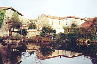
The Tardoire in La Rochefoucauld |
||
| Data | ||
| Water code | FR : R1-0400 | |
| location | France , Nouvelle-Aquitaine region | |
| River system | Charente | |
| Drain over | Bonnieure → Charente → Atlantic Ocean | |
| source | in the municipality of Pageas 45 ° 39 ′ 21 ″ N , 1 ° 0 ′ 44 ″ E |
|
| Source height | approx. 420 m | |
| muzzle | in the municipality of Saint-Ciers-sur-Bonnieure , in the Bonnieure coordinates: 45 ° 51 ′ 47 ″ N , 0 ° 14 ′ 31 ″ E 45 ° 51 ′ 47 ″ N , 0 ° 14 ′ 31 ″ E |
|
| Mouth height | approx. 65 m | |
| Height difference | approx. 355 m | |
| Bottom slope | approx. 3.1 ‰ | |
| length | 113 km | |
| Left tributaries | Trieux , bandiat | |
The Tardoire is a river in France that runs in the Nouvelle-Aquitaine region . It rises in the municipality of Pageas , in the Périgord-Limousin Regional Nature Park , generally drains in a north-westerly direction and after 113 kilometers flows into the Bonnieure as a left tributary in the municipality of Saint-Ciers-sur- Bonnieure . On its way it crosses the Haute-Vienne and Charente departments and, as a border river, also touches the Dordogne department for a few kilometers . Below Montbron it leaves the crystalline rock zone and reaches the karst area of La Rochefoucauld . There are always grottos and underground caves here that reduce the flow of water. Below Rivières , the river disappears completely from the surface with normal water flow; it only reaches its confluence with the Bonnieure when the water level is very high. The water masses of the Tardoire and its tributary Bandiat reappear near Angoulême to form the Touvre River .
Places on the river
- Châlus
- Champagnac-la-Rivière
- Cussac
- Maisonnais-sur-Tardoire
- Montbron
- La Rochefoucauld
- Rivières
- Agris
- Coulgens
- Saint-Ciers-sur-Bonnieure
