
Karst of La Rochefoucauld
The Karst of La Rochefoucauld extends over an area of more than 400 square kilometers in the Charente department ( Nouvelle-Aquitaine region ). It was formed as early as the Lower Cretaceous and during the Cenozoic in Limestone of the Jura .
etymology
The karst is named after La Rochefoucauld - the capital of the Pays d'Horte et Tardoire .
history
The karst phenomena in the Angoumois have been known for a long time. Their scientific understanding received a strong impetus through the speleological investigations by E.- A. Martel, who devoted himself to them in 1892 and 1900, and by N. Casteret in 1936. As early as 1932, R. Mailleux and then in 1933 the Abbot P. Lescuras linked the water losses from Bandiat and Tardoire to the Sources de la Touvre . The two geographers H. Enjalbert (1947) and Y. Guillien (1955) made decisive contributions to further understanding. More recent studies are now based on the actual karstification processes of endogenous (so-called phantomization of the calcareous sediments, ie their alteration in situ while maintaining their volume) and exogenous nature as well as on the accumulated deposits in endocarctic cave systems.
geography

The karst area extends from Marthon via Montbron and La Rochefoucauld in the east to the north-northwest trending fault along the Échelle in the west (8 kilometers east of Angoulême ). The north-western tip is at Saint-Ciers-sur-Bonnieure . In the north the area touches the Bonnieure and in the south the Bandiat up to Javerlhac-et-la-Chapelle-Saint-Robert . In the southwest, it abuts the escarpment of Turoniums . The karst area has roughly the shape of a parallelogram, the length of which more or less follows the north-northwest direction for 27 kilometers. The expansion in width in east-west direction is 15 kilometers.
Hydrology
Three different hydrogeological networks can be distinguished in the karst :
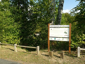
- a fossil network. This mainly consists of the Grand Fosse , located in the Forêt de la Braconne , a 55 meter deep sinkhole with a diameter of 200 meters.
- a semi-active network. This includes the Fosse mobile in the municipality of Agris (also in the Forêt de la Braconne). This represents the largest cave system in the karst area of La Rochefoucauld and forms an underground labyrinth of more than 8 kilometers in length. The Grottes du Quéroy have both a fossil and a semi-active network.
- an active network of underground watercourses:
- the dwindling river of the bandiats and the tardoire , partly also of the Bonnieure and the Échelle
- the karst springs of the Touvre .
The source of the Touvre has an average buoyancy volume of 13 cubic meters per second. It is the second largest of its type in France and guarantees the water supply for the city of Angoulême.
River dwindling
In the karst of La Rochefoucauld there are numerous river shrinkages . So the bandiat already experiences 3 kilometers downstream from Marthon first, but heavy losses at Chez Roby (municipality of Bunzac ) - and then again at La Caillère . In summer the river is already dry from Chez Roby and only reaches its confluence with the Tardoire near Agris during very unusual winter floods . The Tardoire has river shrinkage at Montbron, La Rochefoucauld, Agris and just before Saint-Ciers. The Bellonne , a right tributary of the Tardoire, already seeps away completely about 4 kilometers northeast of La Rochefoucauld and only exists as a dry valley until it flows into the Tardoire . Another dry valley is the Grande Combe in the Forêt de la Braconne, moving northwards , which joins the Tardoire on the left 4 kilometers below Agris.
geology
introduction
The karst area of La Rochefoucauld lies in the transition area from the crystalline basement of the Massif Central to the flat lying Upper Chalk sediments , which are discordant and transgressive on the Jura. The basement is located in the eyrie of the Massif de l'Arbre and immediately north and east of Montbron. Here it forms a spur-like foothill located on the northeast- trending Orgedeuil Fault , which is the westernmost occurrence of crystalline rocks in the Massif Central. This spur is superimposed discordantly by rather thin lias (a few tens of meters) (transgression of the hettangium ).
The karst affects layers lying flat to slightly west to south-west (5 to 7 degrees), which extend from the Bajocium ( Dogger ) up to the Kimmeridgium (Upper Jura or Malm ). The locations of the Oxfordium are particularly affected . These limestone karst sediments from the Middle to Upper Jurassic belong to the northeastern edge of the Aquitaine basin . Important for the hydrological behavior of the 635 to 740 (including the upper Kimmeridgian) thick, water-conducting layer package is its sealing in the hanging wall by impermeable marls of the upper Kimmeridgian, its sealing in the lying area by clays and marls of the Toarcian , as well as its strong tectonic fissures through the north-northwest. and especially northeast trending faults.
stratigraphy
The following layers are affected by the karst (from hanging to lying ):
- Lower Kimmeridgian - white, partly sublithographic, lamellar branching limestone, rich in clay and marly, especially in the lying area - 155 meters
- Oxfordium - oolite limestone , clayey and marly in the lying area, compact in the hanging wall - 175 meters
- Callovium - fine-grained, clay-rich lime, with layers of chert in the central area and fine-grained detritus in the hanging wall - 145 meters
- Bathonium - fine-grained, partly oolithic limestone - 70 meters
- Bajocium - beige and gray, fine-grain, dolomitized lime with layers of chert on the hanging wall - 90 meters
The 105 meter thick upper Kimmeridgium consists of marls and clay-rich limestone.
tectonics
Lias, together with Dogger and Malm following above, girdle the basement in an approximately semicircular shape, but are tectonically disturbed in their original storage conditions. Two significant rift structures have formed - the north-northeast trending, a good 5 kilometers wide depression from La Rochefoucauld-Chasseneuil and the almost 3 kilometers wide Bandiat trench from Marthon to Nontron . The Bandiatgraben strikes east-southeast and continues westward in the Touvregraben , which reaches as far as the Charente . In the latter is the already mentioned karst spring - at only 45 meters above sea level. It serves as a catch basin or drainage channel for the seepage waters of the Bandiat (primarily) and, in the summer months, also for the other watercourses in the Karst area (in comparison: the Bandiat flows at 85 meters above sea level and the Tardoire at 88 meters). The seepage water that has penetrated the ponors follows the gentle westerly plunge of the stratification and communicates with a sufficient gradient under the raised block of the Forêt de la Braconne (including Bois Blanc ) towards Touvre.
Morphological-sedimentary development
The sedimentary and morphological evolution of the Karst of La Rochefoucauld can be divided into five parts:
- Transgression of the Jurassic Sea in the Hettangian over the Variscan basement and sedimentation to the end of the Kimmeridgian. A limestone platform grows up with high threshold areas which cause facies changes. For example, the thresholds in the Forêt de la Braconne and in the Bois Blanc consist of hard reef limestone , whereas in the western and southern Angoumois marl is sedimented.
- Regression in the Lower Cretaceous and general drying out. Over a period of 35 million years, the threshold areas are covered by a pervasive structural change that reaches down into the depths along diaclases and faults ( precarstification ). The reef of the Bois Blanc is raised.
- Renewed transgression in the Upper Cretaceous (from the Cenomanian ). The eastern Angoumois, however, remains mainland. Leveling and alteration of the Jurassic sediments continue here. The first detritus deposits from the Massif Central begin. In western Angoumois, the sea retreats completely from the Campanium / Maastrichtian .
- In the Tertiary , the sediment platform rises. A mighty continental layer of sand and clays covers the western edge of the Massif Central from the Eocene and during the Oligocene and fossilizes the karst formations of the eastern Charente. Note: the continental tertiary is often assigned to the Miocene / Pliocene .
- From the Pliocene, the Massif Central was then raised. The resulting increased erosion causes the development of the current river network. The paleo-polje of the bandiats and the paleo-tardoire arise. At the same time, the Jura karst is being exhumed, but the deep karst is being redesigned and reactivated.
Photo gallery
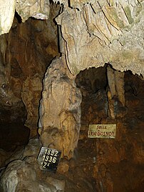
Grottes du Quéroy

Grande fosse in the Braconne forest
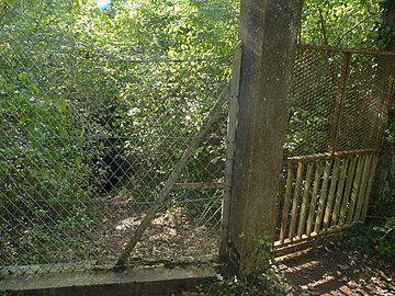
Fosse mobile in the Braconne forest
Fosse limousine in the Braconne forest

Karst springs of the Touvre
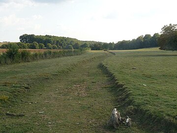
River bed of the Bandiat at Rivières

Bandiat's dwindling river near Bunzac in winter

Dried up river bed of the Tardoire near La Rochette in summer


literature
- A. Bambier et al .: La Rochefoucauld 1831 . In: Carte géologique de la France at 1/50 000 . BRGM, 1983.
- G. Le Pochat et al .: Montbron . In: Carte géologique de la France at 1/50 000 . BRGM, 1986.
- Jean-François Tournepiche: Géologie de la Charente . édition du Germa, musée des Beaux-arts d'Angoulême, 1998, ISBN 2-905221-28-3 , p. 141 .
See also
- Pays d'Horte et Tardoire
- Forêt de Bois Blanc (Charente)
- Forêt de la Braconne
- Bandit
- Bonnieurs
- Échelle (river)
- Tardoire
- Touvre (river)
Individual evidence
- ↑ : E.- A. Martel ignorée La France . Paris 1928.
- ^ N. Casteret: Études locales . Angoulême 1939.
- ^ R. Mailleux: Aux origines de la Touvre. Etude sur le Bandiat . In: Bulletin de la Société archéologique et historique de la Charente . tape X . Angoulême 1932.
- ↑ P. Lescuras: Les origines de la Touvre. Congrès de l'Arbre et de l'eau . Librairie Couturier, Place Marengo, Angoulême 1933, p. 77 .
- ^ A b Henri Enjalbert: Le karst de la Rochefoucauld (Charente) . In: Annales de Géographie . tape 302 , 1947, pp. 104-124 .
- ↑ Y. Guillien: Grottes, abris et terrasses de la Basse Tardoire. Essai chronologique . In: Bulletin de la Société Préhistorique Française . tape 52 (5) , 1955, pp. 268-274 .
- ↑ Grégory Dandurand: Cavités et remplissages de la nappe karstique de Charente (bassin de la Touvre, La Rochefoucauld). Spéléogenèse par fantômisation, archives pléistocène et holocène, rôle de l'effet de site. (PhD thesis in geomorphology) . Université Michel de Montaigne - Bordeaux III, 2011.
- ↑ Jean Gabilly, Élie Cariou and colleagues: Guides géologiques régionaux, Poitou, Vendee, Charentes . Masson, Paris 1997, ISBN 2-225-82973-X , pp. 223 .
- ↑ P. Glangeaud: La bordure jurassique you NO du Bassin aquitain (PhD) . Paris 1896.