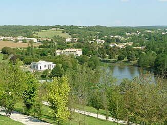
Touvre (river)
| Touvre | ||
|
The Touvre in Magnac |
||
| Data | ||
| Water code | FR : R2330500 | |
| location | France , Nouvelle-Aquitaine region | |
| River system | Charente | |
| Drain over | Charente → Atlantic Ocean | |
| source | in the municipality of Touvre 45 ° 39 ′ 43 ″ N , 0 ° 15 ′ 24 ″ E |
|
| Source height | approx. 50 m | |
| muzzle | in the municipality of Gond-Pontouvre in the Charente Coordinates: 45 ° 39 ′ 59 ″ N , 0 ° 9 ′ 31 ″ E 45 ° 39 ′ 59 ″ N , 0 ° 9 ′ 31 ″ E |
|
| Mouth height | approx. 30 m | |
| Height difference | approx. 20 m | |
| Bottom slope | approx. 1.7 ‰ | |
| length | 12 km | |
| Left tributaries | Échelle | |
| Medium-sized cities | Angoulême | |
| Small towns | Ruelle-sur-Touvre , Gond-Pontouvre | |
|
The source area of the Touvre |
||
The Touvre is a river in France that runs in the Charente department in the Nouvelle-Aquitaine region . It rises in the municipality of Touvre from a large number of spring pots and flows into the Charente in the municipality of Gond-Pontouvre .
geography
Sources de la Touvre
The Sources de la Touvre (Eng. Sources of the Touvre) are located on the edge of the karst area of La Rochefoucauld . There are grottos and underground caves everywhere that drain the water and make entire rivers disappear. In the town of Touvre, this water comes back to the surface in several strong karst springs , thus forming the Touvre River.
The total flow of all springs averages 13,070 l / s, but varies between 7000 and 17,600 l / s. Together they form the second most powerful spring in France after the Fontaine de Vaucluse . The individual sources are named Bouillant , Dormant , Font de Lussac and Lèche . The bouillant is 15 meters deep and its water is used to supply drinking water. The dormant is about 25 meters deep. The 17 km long Échelle stream flows into the source area of the somewhat remote Lèche.
Investigations have shown that the majority of the water that escapes there comes from the rivers Tardoire and Bandiat , which only take their normal course when the water level is high and otherwise end in nothing for the viewer. The Bellonne river also has an underground inlet to the source area of the Touvre.
course
The Touvre generally drains in a westerly direction and flows into the Charente as a left tributary after about 12 kilometers in the municipality of Gond-Pontouvre , right next to Angoulême .
Tributaries
- Échelle (left)
- Ruisseau de Bellevue (left)
- Ruisseau de Viville (right)
- Ruisseau de la Font-Noire (left)
- Ruisseau de Lunesse (left)
Places on the river
Web links
- Interesting information on the website of the municipality of Touvre (French + partly English)


