
Bandit
| Bandit | ||
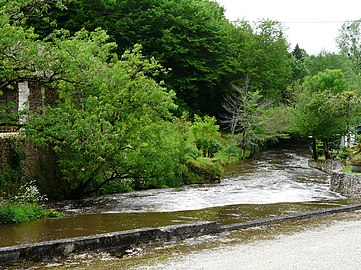
 The bandiat in Javerlhac |
||
| Data | ||
| Water code | FR : R11-0400 | |
| location | France , Nouvelle-Aquitaine region | |
| River system | Charente | |
| Drain over | Tardoire → Bonnieure → Charente → Atlantic Ocean | |
| source | in the municipality of La Chapelle-Montbrandeix 45 ° 39 ′ 48 ″ N , 0 ° 52 ′ 36 ″ E |
|
| Source height | approx. 443 m | |
| Mouth only with large water flow | at Agris in the Tardoire coordinates: 45 ° 46 ′ 43 ″ N , 0 ° 20 ′ 22 ″ E 45 ° 46 ′ 43 ″ N , 0 ° 20 ′ 22 ″ E |
|
| Mouth height | approx. 70 m | |
| Height difference | approx. 373 m | |
| Bottom slope | approx. 4.1 ‰ | |
| length | 91 km | |
| Catchment area | 559 km² | |
| Right tributaries | Doue , Varaignes | |
 The waterless bandiat 5 km from the mouth |
||
The Bandiat is a river in southwest France that runs in the Nouvelle-Aquitaine region . It rises in the municipality of La Chapelle-Montbrandeix and flows 91 kilometers as a left tributary into the Tardoire . Its average gradient is 4.06 m / km.
Crossed departments
- Haute-Vienne , in the Nouvelle-Aquitaine region
- Dordogne , in the Nouvelle-Aquitaine region
- Charente , in the Nouvelle-Aquitaine region
Places on the river
In the Haute-Vienne department :
- Abjat-sur-Bandiat
- Augignac
- Savignac-de-Nontron
- Nontron
- Saint-Martial-de-Valette
- Saint-Martin-le-Pin
- Lussas-et-Nontronneau
- Javerlhac-et-la-Chapelle-Saint-Robert
- Varaignes
- Souffrignac
- Feuillade
- Marthon
- Saint-Germain-de-Montbron
- Chazelles
- Pranzac
- Bunzac
- Saint-Projet-Saint-Constant
- Rivières
- Agris
Hydronymy
The oldest recorded name of Bandiats - in Occitan also Bandiat called - dates back to 1294, in which he as ripperia de Bandeato appears. In 1300 it was then dubbed the fluvium de Bandeato . The origin of the word is obscure. It may be derived from the preceltic root ° ban , which can be found in several French watercourses - for example in the river name Banège .
geography

The bandiat has its source in the Monts de Châlus - 443 meters above sea level on the southern slope of the Puy Chauvet - in the municipality of La Chapelle-Montbrandeix , Haute-Vienne. It then flows in the north of the Dordogne department first to the southwest. After Nontron , it changes its direction of flow to the northwest and leaves the crystalline of the Massif Central ( granodiorite and paragneiss ) to enter the Jurassic limestone formations underlying the Bandiat Graben . Already from the hamlet of Montagenet (municipality of Saint-Martial-de-Valette) down the valley, the river constantly loses water in karstic cavities in the rock bedrock, so that instead of widening towards the mouth, from the municipality of Bunzac onwards due to the river shrinkage at Chez Roby , La Racine , Gauffry and La Cuve is becoming increasingly narrow. With normal rainfall it disappears completely in the karst of La Rochefoucauld a few kilometers before its confluence with the Tardoire near Agris (at an altitude of 70 meters) .
Hydrography
The catchment area of the Bandiat is 559 square kilometers with a height difference of 373 meters.
The water flow of the Bandiat can be subject to very strong fluctuations over the course of the year, depending on the amount of precipitation. The maximum rainfall occurs in the winter half year and usually register in February. The lowest water level of the summer half year is recorded in August. When it rains heavily, the river usually overflows its banks very quickly and only then does it actually reach the Tardoire.
Together with the Tardoire, in which karst-related water losses also occur in the direction of Touvre , it provides the majority of the spring water for the drinking water reservoir of the city of Angoulême .
geology

The source of the bandiat is located in the leptynite gneiss of the lower gneiss cover in the north-western massif Central. After crossing a thin ribbon of mica slate , it meets the Saint-Mathieu-Leukogranit shortly before La Chapelle-Montbrandeix . Upon reaching the municipal boundary of Pensol (the hamlet of Lavaud ) of the river changes again in the Parautochthone mica schist unit to get back in front of the center of Pensol leucogranite return. In the hamlet of Lascaux, which belongs to the municipality of Marval, the bandiat encounters the Piégut-Pluviers-Granodiorit , which it follows to Nontron to the southwest. The previously quite narrow valley widens slightly from Nontron and the Bandiat now flows through plagioclase-bearing paragneiss. At Saint-Martial-de-Valette, the river makes an abrupt change of direction of 90 degrees and turns - since its further course to the southwest is blocked by a ridge - into the west-north-west to north-west trending Bandiatgraben. He follows this to near Chazelles. After leaving the trench , the bandiat turns first to the north-northwest and, after Chazelles, finally to the north, which it maintains until its mouth at Agris.
From Montagenet below the Bandiat Trench lies flat to very slightly (5 to 7 degrees) dipping west to south-west dipping middle Bajocium - gray oolite limestone or their recrystallized equivalents. From Marthon then the higher members follow upper Bajocian, Bathonian and lower Callovian - crypto to microcrystalline Fossilkalke and white inclined stratified limestones - and down to the mouth Chazelles oolitic limestones of the Oxfordian . All these limestone-rich Jurassic sediments were exposed to the karstification processes in the Karst of La Rochefoucauld from the Lower Cretaceous - an in situ increase in porosity (a so-called phantomization , which can progress to a complete loss of cohesion of the rock) followed by classic lime dissolution processes at discontinuities.
ecology
.jpg)
The Bandiat flows through the Parc naturel régional Périgord-Limousin in the Haute-Vienne and Dordogne departments .
In the Haute-Vienne department there are four ecological protection zones (ZNIEFF type 1) on the Bandiat with a total of 1220.88 hectares:
- the Bois des Essarts forest at the source with 702.41 hectares
- the heather and meadows at the hamlet of Le Puy Doumeau with 257.45 hectares
- the heaths and wet meadows near the hamlets of Theillaud and Les Tuilières with 133.92 hectares
- the banks of the Étang de Ballerand with 127.10 hectares
The following plants are at the headwaters of Bandiats in the Haute-Vienne: Gold thistle ( Carlina vulgaris ), marsh cinquefoil ( Comarum palustre ), which Sonnentaue sundew ( Drosera intermedia ) and Sundew ( Drosera rotundifolia ), the heathers Dorset Heath ( Erica ciliaris ) and ( Erica scoparia ), Eriophorum angustifolium ( Eriophorum angustifolium ), marsh gentian ( Gentiana pneumonante ) country lobelia ( Lobelia urens ), luronium ( luronium natans ), ( Lycopodiella inundata ), bog lily ( Narthecium ossifragum ), swamp -Herzblatt ( Parnassia palustris ), the Schnabelriede Weißes Schnabelried ( Rynchospora alba ) and Brown Schnabelried ( Rynchospora fusca ), Summer rootwort ( Spiranthes aestivalis ), swamp violet ( Viola palustris ) and Ivy bog bell ( Wahlenbergia hederacea ).
The insects are worth mentioning: Narrow cychrus ( Cychrus attenuatus ) Mulmbock ( Ergates Faber ), Marsh Fritillary ( Euphydryas aurinia ), a noble scratching beetle ( Gnorimus octopunctatus ) Large Checkered Skipper ( Heteropterus morpheus ), Hermit ( Osmoderma eremita ), Orange-Red Federlibelle ( Platycnemis acutipennis ) and marsh cricket ( Pteronemobius heydenii ).
Among the amphibians, yellow-bellied toad ( Bombina variegata ) and natterjack toad ( Epidalea calamita ).
Among the birds are to perform: teal ( Anas crecca ), Wiesenpieper ( Anthus pratensis ), Purpurreiher ( Ardea purpurea ), Tafelente ( Aythia ferina ) Ziegenmelker ( Caprimulgus europaeus ), dipper ( Cinclus cinclus ), Harrier ( Circus cyaneus ), cisticola ( cisticola juncidis ) Zippammer ( Emberiza cia ) and Reed Bunting ( Emberiza schoeniclus ) Bekassine ( Gallinago gallinago ), Wendehals ( Jynx torquilla ), Heringsmöwe ( Larus fuscus ) Braunkehlchen ( Saxicola rubetra ), Siskin ( spinus spinus ) and Provence warbler ( Sylvia undata ).

In the mammals of the otter ( Lutra lutra ) and water shrew ( Neomys fodiens ).
In the Dordogne department, a total of 1717.79 hectares are protected as continental type 1 ZNIEFF. They are distributed over 16 municipalities and also include tributaries of the bandiat, such as Ruisseau de Fargeas , Ruisseau de l'étang Millau , Ruisseau de l'étang du Moulin de Lestrade , Ruisseau du Moulin de Rhins , Ruisseau de Saint-Martin , the Doue (with its tributary Ruisseau des Forges ), the Marcourive and the Ruisseau de Varaignes (or Crochet ). These protection zones occupy heights between 115 and 280 meters.
97 plant species are protected. Noteworthy among these are the great ormennig ( Agrimonia procera ), European beach lingon ( Littorella uniflora ), Atlantic hare bell ( Hyacinthoides non-scripta ), blueberry ( Vaccinium myrtillus ), king fern ( Osmunda regalis ) and awned shield fern ( Polystichum setiferum ). The rare bat species pug bat ( Barbastella barbastellus ), which is protected throughout France, deserves attention .
Landmarks on the river

- The old town of Nontron
- The Saint-Martial church in Saint-Martial-de-Valette
- The Saint-Étienne church in Javerlhac
- The Saint-Pierre church in Feuillade
- The donjon in Marthon
- The Saint-Paul church in Chazelles
- The death lantern in Pranzac
- The Saint-Caprais church in Agris
See also
Photo gallery
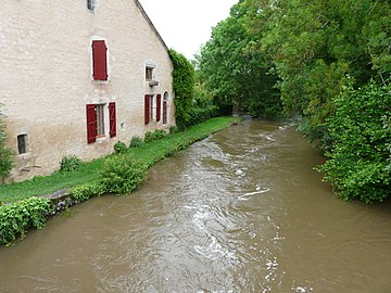
Bandiat at Saint-Martial-de-Valette

Weir at Feuillade
Bandiat with Marthon

Gradual seepage near Pranzac

.JPG)

