
Abjat-sur-Bandiat
| Abjat-sur-Bandiat | ||
|---|---|---|

|
|
|
| region | Nouvelle-Aquitaine | |
| Department | Dordogne | |
| Arrondissement | Nontron | |
| Canton | Périgord Vert Nontronnais | |
| Community association | Périgord Nontronnais | |
| Coordinates | 45 ° 35 ' N , 0 ° 46' E | |
| height | 196–355 m | |
| surface | 27.62 km 2 | |
| Residents | 620 (January 1, 2017) | |
| Population density | 22 inhabitants / km 2 | |
| Post Code | 24300 | |
| INSEE code | 24001 | |
 Abjat-sur-Bandiat |
||

Abjat-sur-Bandiat , Occitan Ajac de Bandiat , is a French village with 620 inhabitants (at January 1, 2017) in the Dordogne in the region Nouvelle-Aquitaine (before 2016 Aquitaine ). It belongs to the Arrondissement of Nontron and the canton of Périgord Vert Nontronnais (until 2015: Nontron ). The responsible community association is the Communauté de communes du Périgord Nontronnais . The inhabitants are called Abjacois or Abjacoises .
etymology
The origins of the name Abjat go back very likely to the Latin male name Apicius or the Gallo-Roman proper name Avitius with the suffix -acum as a place name or claim to ownership.
The place appeared as Abjac on the Cassini map issued in 1756 and 1789 . In 1864 it was renamed "Abjat-de-Nontron". The current name has existed since 1975. The name addition refers to the river Bandiat , a left tributary of the Tardoire, which drains the community .
geography
Abjat-sur-Bandiat is a border municipality to the Haute-Vienne department and is located around 60 kilometers southwest of Limoges . The town center is ten kilometers (as the crow flies) from Nontron in the south - west, and it is seven kilometers to Piégut-Pluviers in the north-west.
Abjat-sur-Bandiat is surrounded by the following 8 municipalities:
| Piégut-Pluviers | Saint-Barthélemy-de-Bussière | Marval (Haute-Vienne) |
| Augignac |
.svg)
|
Pensol (Haute-Vienne) |
| Savignac-de-Nontron | Champs-Romain | Saint-Saud-Lacoussière |
The municipality of Abjat-sur-Bandiat includes the following hamlets, farms, mills, castles, an estate and landmarks:
Barthouleix , Belle Vue , Bigaumont , Bois d'en Pied , Bois de la Croix , Bois de Lestrade , Bois de Mirandon , Bois de Rhins , Bois des Charelles , Bois des Landes , Bois du Mas , Bost du Play , Chabanas , Chachat , Chantecor , Château de l'Etang , Chez Gouyout , Chez Tárlat , Domaine de la Malignie , Étang Blanchet , Etang de la Foret , Etang des Chasseries , Etang du Moulin de Lestrade , Étang Millau , Fargeas , Forêt de la Malignie , Grafeuille , Gros Puy , La Blanchardie , La Chapelle Verlaine , La Charelle , La Collina , La Combette , La Juvénie , La Mazaurie , La Ripole , La Rivière , La Roderie , La Vigeonie , Labrousse , Laulandie , Le Bouchage , Le Chatenet , Le Grand Gollier , Le Moulin de Gros Puy , Le Moulin de Masfrolet , Le Moulin de Rhins , Le Petit Fargeas , Le Petit Peyrat , Les Arnaudies , Les Aumèdes , Les Bardeaux , Les Cautas , Les Chasseries , Les Granges , Les Landes (two different hamlets with the same name ), Les Petits Bardeaux , Masfrolet , Maumont , Mén esplier , Petit Masfrolet , Peyrat , Pont Chaulet , Pont de la Vigeonie , Puizillout , Puyfromental , Quartier de Bel-Air , Rhins and Savanat .
The topographically lowest point of the municipality is 196 meters above sea level near Le Bouchage am Bandiat in the southwest. The highest point at 355 meters above sea level is near La Chapelle Verlaine in the southeast. The absolute height difference is 159 meters. The town center is at 271 meters above sea level.
Transport links

The center of Abjat-sur-Bandiat is crossed by the D 87 (or D 64 in the Haute Vienne department) from Marval to Nontron in a south-westerly direction. It also crosses the northwest-southeast running D 96 from Piégut-Pluviers to Saint-Saud-Lacoussière. The municipality touches the northern edge of the D 93 (or D 75) from Piégut-Pluviers to Marval. The main traffic axis D 85 from Nontron towards Châlus touches the southeast edge .
Long-distance hiking trails
The GR 4 long-distance hiking trail runs through Abjat-sur-Bandiat in an east-west direction. From here the GR 654 branches off at La Mazaurie to the south in the direction of Saint-Saud-Lacoussière (connection to the GR 36 ); the GR 654 forms part of the Way of St. James ( Via Lemovicensis ).
Hydrology
The municipality is crossed by the Bandiat from northeast to southwest, the direction of flow is southwest towards Nontron. The bandiat has many smaller, especially left side arms, but they are all nameless and are mostly dammed up into a sequence of ponds .
geology

Abjat-sur-Bandiat lies entirely on the Variscan basement of the northwestern Massif Central . Most of the municipality is occupied by the Piégut-Pluviers-Granodiorit . It occurs mainly in its coarse-grained normal facies ( γ 3M ). In the extreme south-east there is also the Saint-Mathieu leukogranite ( γ 2M ). The contact area between the two granitoids is predominantly fine-grained. The leukogranite at Chachat and La Chapelle Verlaine contains larger enclaves of mica schists ( ξ 1 ) of the parautochthonous mica schist unit . In the south near Belle Vue and Savanat , plagioclase-bearing paragneiss ( ζ 1–2 ) are found, which are enclosed as an enclave in the granodiorite near Chabanas . The strike direction of their foliation is north. The paragneiss are higher metamorphic than the mica schists, they are located in the sillimanite facies , whereas the mica schists have only exceeded the staurolite grade .
At Le Chatenet a lamprophyre duct ( ν ) occurs, which follows the contact of the two granitoids in a north-south direction. Also microgranite transitions ( microns .gamma. ) are present, especially in the granodiorite (at Chez Gouyout , Labrousse and Rhins ). They strike northeast. The micro- granite dike at Château de l'Étang follows the contact of the granitoids towards the north-northeast. In the granodiorite there is also a quartz vein ( Q ) that strikes north of Chabanas north-northwest. Several faults run through the granodiorite with typical Variscan strike directions (NNW, N, NNE and OSE).
In the quarry of Abjat-sur-Bandiat along the right side of the valley of the Bandiat, the red facies ( a γ 3M ) of the Piégut-Pluviers granodiorite are mined and mainly processed into gravel and granulate; the gravel (grit) is a popular raw material for road and road construction because of its strong color.
The Bandiattal widens before La Roderie - the river has deposited the Holocene Alluvium ( Fz ) here .
ecology

Natural park
The municipality of Abjat-sur-Bandiat has been an integral part of the Périgord-Limousin Regional Nature Park since 1998 .
Protected area
The entire Bandiattal and the lower reaches of two tributaries are under nature protection . These areas are designated as continental ZNIEFF (French zone naturelle d'intérêt écologique, faunistique et floristique ) of type 1 under the name Vallées du réseau hydrographique du Bandiat . Its flora consists of more than 100 plant species with large ormennig ( Agrimonia procera ) and Atlantic hare bells ( Hyacinthoides non-scripta ) as indicator plants.
history
The municipality is mentioned in a document in 1185 as Abjac .
In the course of the croquant rebellion , on May 3, 1640 in Abjat-sur-Bandiat - after the town had been barricaded - a 25-man horse company from Thiviers was attacked by three to four hundred angry peasants and their commander was killed.
In the year II of the French Revolution (1793/1794) the former municipality of Laborie Loubeyrat (now Peyrat ) merged with Abjat.
Population development
| Population development in Abjat-sur-Bandiat | ||
|---|---|---|
| year | Residents |

|
| 1962 | 949 | |
| 1968 | 837 | |
| 1975 | 716 | |
| 1982 | 687 | |
| 1990 | 693 | |
| 1999 | 624 | |
| 2006 | 640 | |
| 2011 | 650 | |
| 2016 | 617 | |
| 2017 | 620 | |
Source: INSEE
The population of Abjat-sur-Bandiat is generally declining with slight fluctuations (population loss of 35 percent).
With an area of 27.62 square kilometers, the municipality has a population density of 22 inhabitants / km².
mayor
Mayor of Abjat-sur-Bandiat has been the non-party pensioner Jean-Claude Massiou since 2001. In March 2014 he was replaced by the non-party insurance employee Jean-Pierre Villechalane.
2017 presidential election
| Candidates | Parties | 1st ballot | 2nd ballot | ||||
|---|---|---|---|---|---|---|---|
| be right | % | be right | % | ||||
| Emmanuel Macron | En marche! | EM | 65 | 18.11% | 203 | 66.78% | |
| Marine Le Pen | Front national | FN | 76 | 21.17% | 101 | 33.22% | |
| François Fillon | Les Républicains | LR | 78 | 21.73% | |||
| Jean-Luc Mélenchon | Front de gauche | FDG | 71 | 19.78% | |||
| Benoît Hamon | Parti socialist | PS | 26th | 7.24% | |||
| Nicolas Dupont-Aignan | Debout la République | DLR | 18th | 5.01% | |||
| Nathalie Arthaud | Lutte Ouvrière | LO | 9 | 2.51% | |||
| Jean Lassalle | Resistons! | R. | 8th | 2.23% | |||
| Philippe Poutou | Nouveau Parti anticapitaliste | NPA | 6th | 1.67% | |||
| Jacques Cheminade | Solidarité et Progrès | SP | 1 | 0.28% | |||
| François Asselineau | Union popular republicaine | UPR | 1 | 0.28% | |||
| total | 359 | 100% | 304 | 100% | |||
| Valid votes | 359 | 95.48% | 304 | 80.64% | |||
| Invalid votes | 17th | 4.52% | 73 | 19.36% | |||
| voter turnout | 376 | 80.34% | 377 | 79.37% | |||
| Abstentions | 92 | 19.66% | 98 | 20.63% | |||
| Registered voters | 468 | 475 | |||||
|
Source: Ministère de l'Intérieur |
|||||||
Attractions
The oldest building in Abjat-sur-Bandiat is the Romanesque church of Saint-André from the 12th century, which was rebuilt in the 16th and 17th centuries, Monument Historique since 1994. Also worth mentioning are the castles Château de l'Étang from 1846– 1850 and the 13th century Château de Gros Puy .
Photo gallery

Royal fern on the Bandiat near Maumont

Saint André church

Interior of Saint André

Château de l'Étang castle

Château de Gros Puy castle
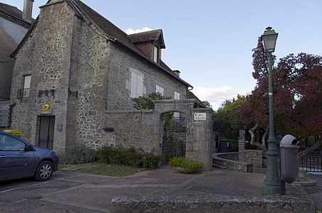
post Office

Mairie

Quarry in the red facies of the Piégut-Pluviers-Granodiorite

Etang des Chasseries pond

Weiher along the D 87
.jpg)

.jpg)

.jpg)


.jpg)
.jpg)
.jpg)
literature
- B. Briand et al. a .: Feuille Châlus . In: Carte géologique de la France at 1/50 000 . BRGM.
Web links
- Website with Occitan place names in the Dordogne department
- Abjat-sur-Bandiat on the annuaire-mairie.fr website
- Abjat-sur-Bandiat on cartesfrance.fr in French
- Population development since 1793 on cassini.ehess.fr
Individual evidence
- ↑ Abjat-sur Bandiat on the Insee website
- ↑ Ministère de l'Intérieur - Dordogne (Nouvelle-Aquitaine): Résultats de l'élection présidentielle de 2017 à Abjat-sur-Bandiat . May 7, 2017 ( gouv.fr [accessed May 18, 2017]).