
Saint-Pardoux-la-Rivière
|
Saint-Pardoux-la-Rivière Sent Pardol la Ribiera |
||
|---|---|---|
.svg)
|
|
|
| region | Nouvelle-Aquitaine | |
| Department | Dordogne | |
| Arrondissement | Nontron | |
| Canton | Périgord Vert Nontronnais | |
| Community association | Périgord Nontronnais | |
| Coordinates | 45 ° 30 ′ N , 0 ° 45 ′ E | |
| height | 132-332 m | |
| surface | 23.84 km 2 | |
| Residents | 1,179 (January 1, 2017) | |
| Population density | 49 inhabitants / km 2 | |
| Post Code | 24470 | |
| INSEE code | 24479 | |
 The town hall of Saint-Pardoux-la-Rivière |
||

Saint-Pardoux la Rivière ( Occitan Sent Pardol la Ribiera ) is a commune of 1,179 inhabitants (at January 1, 2017) of the North department Dordogne in the region Nouvelle-Aquitaine . It belongs to the Arrondissement of Nontron and the canton of Périgord Vert Nontronnais (until 2014: Saint-Pardoux-la-Rivière ). The responsible community association is the Communauté de communes du Périgord Nontronnais . The inhabitants are referred to as Spardociens or Spardociennes .
etymology
The Occitan Sent Pardol is derived from the Holy Pardulphus (Sanctus Pardulphus) , la Ribiera means the river , what is meant here is the drone .
geography
Saint-Pardoux-la-Rivière is surrounded by the following seven municipalities:
| Nontron , Savignac-de-Nontron (point of contact) | Champs-Romain | Saint-Saud |
| Sceau-Saint-Angel |
.svg)
|
Milhac-de-Nontron |
| Sceau-Saint-Angel | Saint-Front-la-Rivière | Milhac-de-Nontron |
In addition to the town center, the municipality of Saint-Pardoux-la-Rivière includes the following hamlets, farmsteads and landmarks:
Beaumont , Bois de Neymard , Bon Ombre , Bordessoule , Bos-Brûlat , Brande , Brin , Chaumeille , Chez Bathe , Chez Boissard , Chez Boutard , Chez Neymard , Grands Bois , Jamaye , La Briderie , La Dorie , La Font du Prince , La Grange , La Nanotte , La Noujarède , La Plassade , Langlade , Lapeyronnie , Le Buisson , Le Chatenet , Le Clos , Le Clos de la Noujarède , Le Couvent , Le Maine , Le Mandereau , Le Moulin de la Dorie , Le Queyroi , Le Petit Villars , Les Batisses , Les Combes , Les Granges , Les Grands Bois , Les Grelières , Les Rebières , Les Roches , Lescure , Maliba , Négrecombe , Neuil , Noujarède , Puy d'Arnac and Puypelat .
The topographically lowest point of the municipality is at 132 meters above sea level on the Dronne near Jamaye in the south, the highest point at 332 meters near Bos-Brûlat in the extreme northeast corner . The maximum height difference is 200 meters. The town center is at 140 meters.
Transport links

The center of Saint-Pardoux-la-Rivière crosses the D 707 from Nontron to Thiviers in a west-east direction . From the north, the D 83 comes from Saint-Saud-Lacoussière and Champs-Romain; it then follows the left bank of the Dronne to the south in the direction of Brantôme . The D 83 E1 leaves the town center to the northeast; it enables a connection to the D 82 from Mialet to Villars . The D 83 E2 finally leads north-northwest to the D 85 from Nontron to Châlus .
Saint-Pardoux-la-Rivière once owned a train station on the Quéroy-Pranzac-Thiviers railway line, which has now been closed . The route is now a pedestrian and bicycle path towards Milhac-de-Nontron.
Hydrography
The municipality of Saint-Pardoux-la-Rivière is crossed roughly centrally by the Dronne . Initially it meanders in a narrow, ravine-like valley to the southwest and at the same time forms the northern border to Champs-Romain, but then turns south. Shortly before reaching the town center, the valley widens. Saint-Pardoux-la-Rivière was built on a ford over the Dronne.
A right tributary of the Dronne is the Ruisseau de Lachenaud . Its course, directed to the southeast, flows into the Dronne in the north of the municipality. It is also the border river to the Champs-Romain. In the town center, the Dronne then takes on a left tributary, the Ruisseau de Chantres , which comes towards it from the east.
geology

The municipality of Saint-Pardoux-la-Rivière is divided into two by two intersecting fault systems (65 ° north and 160 ° north). To the north and east of this fracture system are basement rocks of the northwestern Massif Central , in the southern gusset sediments of the northeast Aquitaine Basin . The metamorphic basement has been lifted out from the sediment shell on the basis of these marginal faults.
Tectonically deepest basement units are mica slates of the parautochthonous mica slate unit ( ξ 1 ); they are in the eastern part of the municipality (near Chantres and Le Chatenet ) and strike in a north direction with an angle of incidence of 40 to 60 ° to the east. In it penetrated during the upper carboniferous the Saint-Mathieu-leucogranite (here in its Saint-Saud facies γ 2 b-m ) a. The leuco granite is exposed in the upper Dronnetal. It is traversed by north-northwest trending micro -granite dikes ( μ γ 3 ).
Plagioclase-carrying paragneiss ( lich 1 and ζ 1-2 ) appear to the north of the east-northeast trending marginal fault . Since they have exceeded the degree of anatexis here, they are occasionally interspersed with smaller granodiorite bodies associated with the Piégut-Pluviers granodiorite ( γ 3-4 b in Beaumont and Brin ). They also contain Ordovician leptynites ( f λ 3-4 b - on the right side of the valley of the Dronne below Beaumont , and further upstream at La Dorie ) and small, northwest- trending graphite ranges ( gra at Brin ). The paragneiss generally strike to the northwest, its angle of incidence is 20 to 60 ° to the northeast. The paragneiss are often folded , their fold axis direction is northeast and secondary east-northeast.
The flat sediments around the town center consist of Lias and calcareous Dogger . The Lias, which is partially silicified near the faults, is made of Hettangium ( sandstones , coarse sandstones and conglomerates of the formation l1 ), Sinemurium ( oolite limestone , partly dolomitic, of the formation l3-4 ) and Toarcium ( clay stones and gray marls of the formation l7-9 ) built up. These toarcian clays were used by a brick factory that has now been closed . The Dogger consists of cryptocrystalline limestones, bioklastischen liming and Oolithkalken of Oberbajocs and Bathoniums together (formations J1B , J1C-2a and J2B ). The Saint-Pardoux church stands on the Upper Bajoc.
So-called Sidérolithique (iron-bearing, red, clayey sands of the ep formation ) and solidified, conglomerate alluvium ( HF formation ) have been preserved along the marginal fault . Both formations are likely to go back to the Eocene , although the conglomerates are possibly only Pleistocene . The conglomerates are genetically related to late movements along the edge faults - recognizable by the very strong spread of their angle of incidence in the vicinity of the fault. Pliocene to Pleistocene plateau sediments ( gravels in a sandy-clay matrix) of the Fs formation cover the slopes east of Lapeyronnie and near Les Combes .
All sedimentary formations of the southern gusset are covered in places by colluvial gravel from the Pleistocene (Formation CF ). The mica schists of the high elevations in the east (near Bos-Brûlat ) can also be masked by colluvium ( reclaimed basement sands with quartz pebbles of the AC formation ), which, however, is attributable to the last glacial period. In the Dronnetal you can see gravel terraces from both the Mindel (Formation Fv near Chez Boissard ) and the Würm glacial period (Formation Fw around the town center). The limestone debris on the Doggers sediments (Formation GP ) also comes from the last Ice Age . The current river bed of the Dronne runs in the Holocene alluvium of the formation K up to 3 meters thick .
It is worth mentioning occurrences of galena with a slight silver content in the paragneiss and barite, mainly in the Lias. Also tourmaline can occasionally occur in the paragneisses. Manganese (manganese dioxide) was also mined (at Le Mandereau ), whereby nontronite was discovered ( type locality ). In addition to galena and barite, the Neuil deposit in the paragneiss also contains chalcopyrite , gypsum , marcasite , pyrite , pyromorphite and zinc blende .
ecology
The commune of Saint-Pardoux-la-Rivière is an integral part of the Périgord-Limousin Regional Natural Park .
history

There was a monastery in Saint-Pardoux-la-Rivière from the 13th century until the French Revolution . Unfortunately only very sparse remains of it have survived, as most of the building fabric was looted for the construction of the town center. The Saint-Pardoux church dates from the 17th and 18th centuries , it was thoroughly renovated in the 19th century , including the church tower was completely rebuilt. The Château de Vaugoubert on the Dronne belongs to the same period. Only a round tower of an even older castle can be seen.
During the Vichy regime were in Saint-Pardoux-la-Rivière in August 1942 172 Jewish citizens from a command under the command of René Bousquet rounded up and after Nexon transported from where then made it to the transit camp Drancy and on to Auschwitz transferred were.
Population development
In terms of population, Saint-Pardoux-la-Rivière is the second largest municipality in the canton of Périgord Vert Nontronnais, just before Piégut-Pluviers.
| Population development in Saint-Pardoux-la-Rivière | ||||
|---|---|---|---|---|
| year | Residents |

|
||
| 1962 | 1453 | |||
| 1968 | 1360 | |||
| 1975 | 1347 | |||
| 1982 | 1309 | |||
| 1990 | 1174 | |||
| 1999 | 1091 | |||
| 2006 | 1155 | |||
| 2007 | 1149 | |||
| 2011 | 1199 | |||
| 2016 | 1182 | |||
| 2017 | 1179 | |||
Source: INSEE
The population of Saint-Pardoux-la-Rivière had steadily decreased until 1999, but seems to be recovering somewhat since then.
With an area of 23.84 square kilometers, the municipality has a population density of 49 inhabitants / km².
mayor
The mayor of Saint-Pardoux-la-Rivière has been the non-party pensioner Maurice Combeau since March 2001.
Attractions
- The Saint-Pardoux church with a beautiful sundial.
- The postcard museum. It houses a collection of old Périgord postcards from 1898–1920.
Photo gallery
 The postcard museum
 Bridge over the Dronne
 Wash house on the Dronne
 Rue de la Barre
 Saint-Pardoux grandstand and rose window
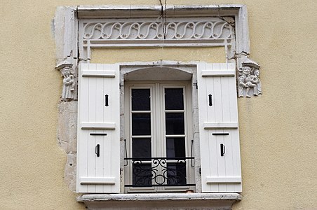 16th century window on rue de la Barre
 Interior of the Saint-Pardoux church
 Rose window over the entrance portal of Saint-Pardoux


Individual evidence
literature
- J.-P. Floc'h ao: Feuille Nontron . In: Carte géologique de la France à 1/50000 . BRGM.
- P.-L. Guillot and others: Feuille Thiviers . In: Carte géologique de la France à 1/50000 . BRGM.