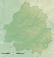
Neuil mine
| Neuil mine | |||
|---|---|---|---|
| General information about the mine | |||
| other names | Mine de Neuil | ||
| Mining technology | Civil engineering | ||
| Funding / total | <1000 t lead gloss | ||
| Rare minerals | Barite , galena , sphalerite , marcasite , pyromorphite , pyrite , chalcopyrite , cerussite , dolomite , solid sulfur , ozokerite | ||
| Information about the mining company | |||
| Start of operation | 1921 | ||
| End of operation | 1984 | ||
| Funded raw materials | |||
| Degradation of | Galena | ||
| Geographical location | |||
| Coordinates | 45 ° 30 '8.8 " N , 0 ° 43' 2.3" O | ||
|
|||
| local community | Saint-Pardoux-la-Rivière | ||
| Department | Dordogne department | ||
| Country | France | ||
The mine Neuil ( French mine de Neuil ) is a former French ore mine in Saint-Pardoux-la-Rivière in the department of Dordogne . Mined was silver- galena .
geography
The Neuil mine is at 250 m about 1 km north of the Neuil homestead . The mine is located in a wooded area between the D707 ( Nontron - Thiviers ) in the south and the Saint-Pardoux-la-Rivière-Le Puy road.
investment
The partly buried production shaft was once 47.50 meters deep and was connected to three production levels . A tunnel is now under water.
The ore was to the hamlet Nègrecombe located processing plant brought and then by train (route Angoulême -Thiviers) transported for smelting.
history
The mine was mainly operated from 1921 to 1928, 1956-1959 and again from 1976-1984. A total of several hundred tons of ore were mined. The remaining stocks are estimated at several thousand tons.
geology
The Neuil deposit is located in paragneiss of the Variscan basement of the northwestern Massif Central . The partially folded paragneiss mainly strike from southeast to northwest with about 210 ° and dip at 35 ° to the northeast. The corridors stroke discordantly to the stroke of the paragneiss south-west-northeast between 45 and 65 °, roughly parallel to the edge fault of the Massif Central; they fall at 65 ° to the northwest.
To the north-west of the Neuil deposit there are further tunnels that have been largely dismantled ( Le Puy mine , Cantonnier corridor , Tabataud quarry, etc.). The D707 is called les Mines here .
mineralogy
The central part of the deposit consists of a quartz matrix , which can be enriched to a greater or lesser extent in barite . Occasionally the barite completely displaces the quartz. Numerous transverse fractures and fissures run through the core area made of quartz-barite. The sulphide mineral galena , which forms octahedral coatings in the centimeter range, coarse zinc blende as well as powdered marcasite occurring in cockscomb habit are enclosed in quartz or barite. The sal bands are generally mylonitized and contain sheared sulphide mineral secretions . These secondary deposits cover the transverse fracture surfaces and the mylonitic edge zones. In the silica core are also occasionally quartz and chalcedony - geodes . The quartz in the quartz geodes usually takes on its hexagonal pyramidal habit, but can also form rare double pyramids. Cavities in the barite can be lined with plaster of paris. It is also worth mentioning the occurrence of apple-green pyromorphite in a hexagonal prism habit.
The mineralization occurred hydrothermally at temperatures ranging between 150 and 300 ° C. Mineralization took place in two phases, which produced characteristic parageneses : a high-temperature phase with deposition of galena and quartz and a low-temperature phase with barite and marcasite. Accompanying minerals are sphalerite, pyrite and chalcopyrite . The mineralization belongs to the type sphalerite-pyrite-galena-chalcopyrite .
Other mineral finds include cerussite , dolomite , native sulfur and the bituminous pseudo- mineral ozokerite .
genesis
A radiometric isotope investigation carried out on the galena revealed an age between 300 and 250 million years BP for the veins of the basement . It originated in the late Variscan phase after the penetration of the Piégut-Pluviers granodiorite into the paragneiss, but is likely to have been genetically linked to the granodiorite .
The arrangement of the veins generally indicates a local expansion of the basement rock in a southeast direction. The paragneiss had already cooled to below 300 ° C during this late variscan phase. In addition, there were shear movements in the corridors, recognizable by the mylonised edge zones. This fact, along with the spreads in strike directions, may suggest a southeast facing shear zone ; the 65 ° trending corridors would then be interpreted as antithetical faults and the 45 ° trending as R'-Riedel . The north-westerly dipping of the corridors also suggests a sense of movement hanging from the south-east .
The mineralizing hydrothermal solutions are likely to be associated with the Piégut-Pluviers granodiorite.
literature
- P.-L. Guillot et al .: Feuille Thiviers . In: Carte géologique de la France à 1/50000 . BRGM.
- N. Legrand et al .: Minéralogie des Mines du Nontronnais, Dordogne . In: Le Règne Minéral . tape 84 . Munich 2008.
Individual evidence
- ↑ J. Lougnon et al. 1974
