
La Chapelle-Montmoreau
|
La Chapelle-Montmoreau La Chapela de Mont Maurelh |
||
|---|---|---|
|
||
| region | Nouvelle-Aquitaine | |
| Department | Dordogne | |
| Arrondissement | Nontron | |
| Canton | Brantôme | |
| Community association | Dronne et Belle | |
| Coordinates | 45 ° 27 ' N , 0 ° 39' E | |
| height | 150-226 m | |
| surface | 8.09 km 2 | |
| Residents | 68 (January 1, 2017) | |
| Population density | 8 inhabitants / km 2 | |
| Post Code | 24300 | |
| INSEE code | 24111 | |
 Chapel in the center of La Chapelle-Montmoreau |
||

La Chapelle-Montmoreau , Occitan la Chapela de Mont Maurelh is a French municipality with 68 inhabitants (at January 1, 2017) of the North department Dordogne in the region Nouvelle-Aquitaine . It belongs to the canton of Brantôme . The responsible community association is the Communauté de communes Dronne et Belle . The inhabitants are known as chapellois or chapelloises .
etymology
La Chapelle-Montmoreau, in Occitan La Chapela de Mont Maurelh is derived from the North Occitan chapela (chapel) and mont (mountain, hill). Maurelh is probably a proper name.
geography
La Chapelle-Montmoreau is located nine kilometers south-southwest of Nontron and nine kilometers north of Brantôme (as the crow flies). The municipality is surrounded by the following five neighboring municipalities:
| Saint-Front-sur-Nizonne | Sceau-Saint-Angel | |
.svg)
|
Quinsac | |
| Brantôme en Périgord (formerly Saint-Crépin-de-Richemont ) | Saint-Pancrace |
In addition to the town center, the community consists of the following hamlets, farmsteads, a former mill, a castle, a manor and a site:
Château de Lannet , Chaumon , Chez Picayne , Domaine de Montmoreau , Filoine , Fruchaudière , Jourdonnière , La Pépie , Lamond , Le Grand Clos , Maison Neuve , Moulin de Bernillou , Parelière , Pradarian , Puysec and Sainte Marie des Bois .
The topographically lowest point in the municipality at 150 meters above sea level is on the Boulou in the southwest, the highest point at 225 meters is north of Fruchaudière on the northern border with Saint-Front-sur Nizonne. The maximum difference in altitude is 75 meters.
Transport links

The center of La Chapelle-Montmoreau can be reached via two municipal roads, which branch off from the D 675 (Nontron - Brantôme) in a westward direction. Both Saint-Front-sur-Nizonne and the D 84 from Nontron to Ribérac can be reached via a municipal road leaving the town center in a north-westerly direction . A municipal road running along the right side of the Boulous valley enables the connection to the D 939 Périgueux - Angoulême expressway via Saint-Crépin-de-Richemont .
Hydrography
The municipal area is traversed in the middle by the Boulou , which drains to the southwest. On the south-western border, it takes up a left branch that pulls down from the Pradarians and marks the municipal boundary with Brantôme en Périgord (formerly Saint-Crépin-de-Richemont). On the left side of the Boulou also receives two dry valleys , the northern ends just below the now dilapidated mill Moulin de Bernillou and the further south located, only very short, just north of the Domaine de Montmoreau . A dry valley also runs on the right side of the valley; it also marks the border with Brantôme en Périgord (formerly Saint-Crépin de Richemont).
geology

The municipality of La Chapelle-Montmoreau is completely underlain by flat-lying ( angle of incidence up to a maximum of 8 ° to the southwest) sediments of the northeast Aquitaine basin . Structurally, the shift structure belongs to the north wing of the Combiers-Saint-Crépin-de-Richemont-Synklinale . The oldest open formation is the Angoulême Formation of the Lower Angoumiens ( Turonium - Formation c 3b ). It is here to massive Rudistenkalke , the layer ribs and smaller cliffs with off-road rock shelters and caves can form. You are open-minded on both sides of the Boulous. Above that follows Upper Angoumien (formation c 3c ) - somewhat more finely banked, cryptocrystalline rudist limestone, which also occur detritic. The relatively hard fossil limestone of the Coniacium (formation c 4 ) lies over the Turon , standing on the southwest border along the two side valleys of the Boulous. At Sainte Marie des Bois there is also a small deposit of Untersanton (Formation 5 a ) - chalky, platy limestone containing glauconite .
Alterites ( colluvium of the formations AC and ACF - sands and gravel ) of the Tertiary lie discordant over the layers of the Upper Cretaceous . You can find them on the two high altitudes northwest and southeast of the Bouloutal. These shell sediments, which were rearranged in the Pleistocene, are crowned by two fossil river systems , the gravel of which is formed in places as solidified conglomerates (formation HF ). Their age is classified as Eocene or Lower Oligocene . The continental sediments come from the Massif Central near Nontron and were poured towards the southwest. They are found along the north-western border at Filoine and along the south-eastern border at Le Claud (municipality of Saint-Pancrace). The high altitudes along the D 675 in the east crown Pliocene to Old Pleistocene gravel in a sandy-clay matrix (formation Fs ).
The dry valleys are filled with ice-age limestone debris (formation GP ). Very recent alluvial sediments of the Holocene have been deposited in the Bouloutal (Formation K ).
ecology

Natural park
The municipality of La Chapelle-Montmoreau is an integral part of the Périgord-Limousin Regional Natural Park .
Protected area
La Chapelle-Montmoreau belongs to two protection zones along the Boulous. Over three kilometers, the Boulou and its tributaries form a ZNIEFF ( French zone naturelle d'intérêt écologique, faunistique et floristique ) of type 1 with great biodiversity. However, this protected area forms only part of a much more extensive protection zone (ZNIEFF type 2), which encompasses the entire course of the Boulous from its source to the confluence with the Dronne .
The taxa of 248 insects , 11 amphibians , 7 reptiles , 79 birds and 10 plants are encountered . Characteristic of the fauna are jackdaw crabs ( Austropotamobius pallipes ), slow worm ( Anguis fragilis ), common frog ( Rana temporaria ), western mud diver ( Pelodytes punctatus ), European tree frog ( Hyla arborea ), yellow-bellied toad ( Bombina vararmoratus ) and marble newt ( Triturus ). Characteristic among the insects are coenagrion mercuriale ( Coenagrion mercuriale ) Cupido Alcetas ( Cupid Alcetas ) -spotted blue ( Phengaris Arion ) golden-ringed dragonfly ( Cordulegaster boltonii ) Large Copper ( Lycaena dispar ), Marsh Fritillary ( Euphydryas aurinia ) , Common antlion ( Myrmeleon formicarius ), Common Clubtail ( Gomphus vulgatissimus ) Large pliers Dragonfly ( Onychogomphus uncatus ), the Weber blocks Judolia erratica and Musaria rubropunctata that Schwebfliege Milesia crabroniformis , mirror spot Dickkopffalter ( Heteropterus morpheus ) apatura ilia ( Apatura ilia ) and Evening primrose hawk ( Proserpinus proserpina ).
Population development
| Population development in La Chapelle-Montmoreau | ||||
|---|---|---|---|---|
| year | Residents |

|
||
| 1962 | 96 | |||
| 1968 | 85 | |||
| 1975 | 79 | |||
| 1982 | 88 | |||
| 1990 | 87 | |||
| 1999 | 91 | |||
| 2005 | 81 | |||
| 2006 | 80 | |||
| 2008 | 75 | |||
| 2010 | 74 | |||
| 2015 | 71 | |||
| 2016 | 69 | |||
| 2017 | 68 | |||
Source: INSEE
The population in the municipality of La Chapelle-Montmoreau is declining, but it had recovered from 1975 to 1999 in the meantime.
With an area of 8.09 square kilometers, the population density is 8 inhabitants / km². The commune has the lowest population density and the second lowest population in the canton of Brantôme.
mayor
Mayor of La Chapelle-Montmoreau has been Alain Peyrou, who belongs to the UMP , since 2008 .
Attractions
- Chapel in the center of La Chapelle-Montmoreau
- Castle Château de Lannet
- Domaine de Montmoreau manor house
Photo gallery
 Town hall (Mairie) of La Chapelle-Montmoreau
 Wash basin (lavoir) at the entrance to the village
 Town view from the west
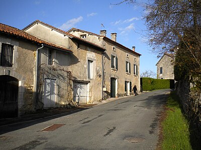 Row of houses in the town center
 Entrance to the Château de Lannet
 The Boulou northeast of the town center

.JPG)


.JPG)
Individual evidence
- ^ Website of the Conseil général de la Dordogne with the Occitan community names
- ↑ La Chapelle-Montmoreau on the Insee website