Brantôme en Périgord
| Brantôme en Périgord | ||
|---|---|---|
|
|
||
| region | Nouvelle-Aquitaine | |
| Department | Dordogne | |
| Arrondissement | Nontron | |
| Canton | Brantôme | |
| Community association | Dronne et Belle | |
| Coordinates | 45 ° 22 ′ N , 0 ° 39 ′ E | |
| height | 92-246 m | |
| surface | 133.33 km 2 | |
| Residents | 3,702 (January 1, 2017) | |
| Population density | 28 inhabitants / km 2 | |
| Post Code | 24310, 24530 (Cantillac), 24460 (Eyvirat) | |
| INSEE code | 24064 | |
| Website | www.brantomeenperigord.fr | |
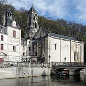
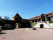
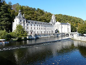 Town hall (Mairie) of Brantôme en Périgord (former Saint-Pierre monastery) |
||
Brantôme en Périgord is a French commune with 3,702 inhabitants (at January 1, 2017) in the department of Dordogne in the region Nouvelle-Aquitaine . The municipality belongs to the Arrondissement of Nontron and the canton of Brantôme .
It was created with effect from January 1, 2019 as the Commune nouvelle of the same name by amalgamating the previously independent municipalities of Brantôme en Périgord , Cantillac , Eyvirat , La Gonterie-Boulouneix , Saint-Crépin-de-Richemont , Sencenac-Puy-de-Fourches and Valeuil who have the status of Communes déléguées . The administrative headquarters are in Brantôme en Périgord.
geography
Brantôme en Périgord is located about 20 km south of Nontron and about 20 km north of Périgueux in the Périgord Central area of the historic province of Périgord .
Brantôme en Périgord is surrounded by fourteen neighboring municipalities:
Brantôme en Périgord lies in the catchment area of the Dordogne river .
The Dronne , a tributary of the Isle , crosses the area of the parish along with its tributaries,
- the Côle ,
- the Libourny and
- the Boulou with its tributaries,
- the Jallieu with its tributary,
- the Paulette, and
- the Belaygue, which is also called Ruisseau le Pré Pinson on its upper reaches and rises in Cantillac.
- the Jallieu with its tributary,
structure
| Commune déléguée | former INSEE code |
Postcode | Area (km²) | Population (2017) |
|---|---|---|---|---|
| Brantôme en Périgord (administrative headquarters) | 24064 | 24310 | 40.60 | 2.176 |
| Cantillac | 24079 | 24530 | 8.12 | 189 |
| Eyvirat | 24170 | 24460 | 17.95 | 289 |
| La Gonterie-Boulouneix | 24198 | 24310 | 11.79 | 249 |
| Saint-Crépin-de-Richemont | 24391 | 24310 | 25.58 | 223 |
| Sencenac-Puy-de-Fourches | 24530 | 24310 | 10.79 | 236 |
| Valeuil | 24561 | 24310 | 18.50 | 340 |
Attractions
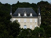
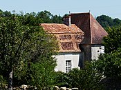
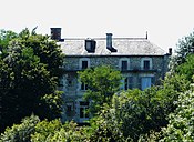
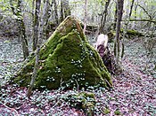
The places in the municipality of Brantôme en Périgord are rich in places of interest:
| Surname | place | Remarks | image |
|---|---|---|---|
| Saint-Pierre abbey with castle and church | Brantôme | 12th century, inscribed as Monument historique | |
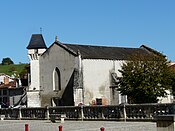
| Former parish church of Notre-Dame | Brantôme | 16th century, inscribed as Monument historique | |
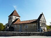
| Former parish church of Saint-Pardoux-de-Feix | Brantôme | 12th century, inscribed as Monument historique | |
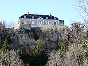
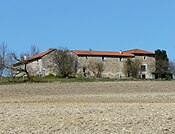
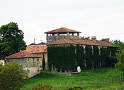
| Les Balans Castle | Brantôme | 17th century | |
| La Hierce Castle | Brantôme | 16th century, inscribed as Monument historique | |
| Puymarteau Castle | Brantôme | 16th century, inscribed as Monument historique | |
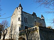
| Les Roches Castle | Brantôme | 15th century | |
| Chatenet Mansion | Brantôme | 17th century | |
| Chambon mansion | Brantôme | 13th Century | |
| Peyrelevade dolmen | Brantôme | ||
| Grotto of Chambre Brune | Brantôme | 10th century, inscribed as Monument historique | |
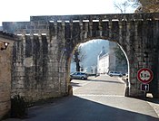
| Porte des Réformés | Brantôme | 15th century | |
| Former hospital | Brantôme | 18th century | |
| Parish Church of Saint-Julien | Saint-Julien-de-Bourdeilles | 12th Century | |
| Parish Church of Notre-Dame-de-la-Nativité | Cantillac | 12th century, inscribed as Monument historique | |
| Saint-Michel manor | Cantillac | 17th century | |
| Chartreuse Puyservier | Cantillac | 17th century | |
| Church Saint-Pierre-ès-Liens | Eyvirat | Romanesque apse from the 12th century | |
| Meneyplé manor | Eyvirat | 15th century | |
| Parish Church of Notre-Dame in Boulouneix | La Gonterie-Boulouneix | 12th century, inscribed as Monument historique | |
| Parish Church of Notre-Dame-de-l'Assomption in La Gonterie | La Gonterie-Boulouneix | 18th century | |
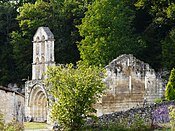
| Saint-Jean Priory in Belaygue | La Gonterie-Boulouneix | Ruins from the 12th century, inscribed as Monument historique | |
| Chartreuse La Gonterie | La Gonterie-Boulouneix | 18th century | |
| Chartreuse La Nègrerie | La Gonterie-Boulouneix | 17th century | |
| Archaeological site of Tabaterie | La Gonterie-Boulouneix | Paleolithic , as monument historique classified | |
| Parish Church of Saint-Crépin | Saint-Crépin-de-Richemont | Late Romanesque | |
| La Barde Castle | Saint-Crépin-de-Richemont | 15th century | |
| Richemont Castle | Saint-Crépin-de-Richemont | 16th century, inscribed as Monument historique | |
| Saint-Crépin Castle | Saint-Crépin-de-Richemont | 19th century | |
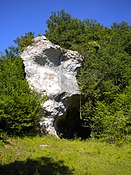
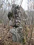
| Menhir of Champredon | Saint-Crépin-de-Richemont | ||
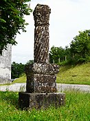
| Gallo-Roman column | Sencenac-Puy-de-Fourches | 3. century when historique monument classified | |
| Saint-Symphorien Church in Sencenac | Sencenac-Puy-de-Fourches | 12./13. century | |
| Church Saint-Mande-et-Notre-Dame in Puy-de-Fourches | Sencenac-Puy-de-Fourches | 19th century | |
| La Borie-Fricart mansion | Sencenac-Puy-de-Fourches | 16th Century | |
| Le Teyrat manor house | Sencenac-Puy-de-Fourches | 14th Century | |
| Vialle Manor | Sencenac-Puy-de-Fourches | 16th Century | |
| Parish Church of Saint-Pantaléon | Valeuil | 12th century, inscribed as Monument historique | |
| Les Andrivaux Castle | Valeuil | 19th century | |
| Les Biards Castle | Valeuil | 18th century | |
| Les Granges Castle | Valeuil | 19th century | |
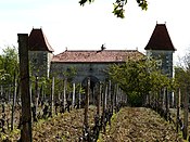
| Ramefort Castle | Valeuil | 13th century, inscribed as Monument historique | |
| Dolmen Laprougès | Valeuil | Classified as a monument historique | |
| Megalith Les Coutoux | Valeuil | As historique monument inscribed |
Economy and Infrastructure
Brantôme en Périgord is located in the AOC zones of the Charentes-Poitou , Charentes and Deux-Sèvres butter varieties as well as the Noix du Périgord , the walnuts of the Périgord, and the nut oil of the Périgord.

total = 525
education
In the Commune déléguée Brantôme en Périgord, the commune has:
- the public preschool "Odette et Georges Bonnet" with 73 pupils in the school year 2018/2019.
- a public preschool and elementary school with 120 pupils in the 2018/2019 school year. and
- the "Aliénor d'Aquitaine" college .
The commune déléguée Sencenac-Puy-de-Fourches has:
- a public preschool and elementary school with 23 pupils in the school year 2018/2019.
sport and freetime
- The long-distance hiking trail GR 654 from Namur in Belgium via Vézelay to Saint-Jean-Pied-de-Port leads through the center of the municipality. It follows the Via Lemovicensis, one of the four Camino de Santiago in France.
- The GR 36, a long-distance hiking trail from Ouistreham in Normandy to Bourg-Madame in the eastern Pyrenees , also runs through the center of the municipality.
- The Boucle de l'abbaye de Brantome circular route is 9.4 km long with a difference in altitude of 72 m. It leads from the center through the area of the municipality.
- The Brantôme en val de Dronne circular route is 9.6 km long with a difference in altitude of 75 m. It is a bridle path and leads from the center through the area of the municipality.
- The Autour du cabécou à Puy de Fourches circular route is 12 km long with a difference in altitude of 111 m. It leads from Sencenac-Puy-de-Fourches on foot, by bike or by path through the territory of the municipality.
traffic
- The Route départementale 675, the former Route nationale 675 , connects the town to the north of Nontron.
- Route départementale 939, the former Route nationale 139 , connects the municipality in a north-westerly direction with Angoulême .
- Route départementale 69 connects the center of the municipality in a south-easterly direction with the neighboring municipality of Agonac.
- Route départementale 78 crosses the municipality from west to east and connects it to the west with Ribérac and to the east with Thiviers on the Limoges –Périgueux transport axis.
- Route départementale 82 connects Cantillac in an easterly direction with the neighboring municipality of Champagnac-de-Belair.
- Route départementale 98 connects Saint-Crépin-de-Richemont in the east with the neighboring municipality of Saint-Pancrace.
Brantôme en Périgord is connected to other municipalities in the department via lines of the Transpérigord bus network , which run from Périgueux to Nontron and Angoulême, in Angoulême, among others, to the Paris – Bordeaux line.
Individual evidence
- ↑ RECUEIL DES ACTES ADMINISTRATIFS N ° 24-2018-038 ( fr , PDF) Dordogne department. Pp. 13-16. November 6, 2018. Retrieved January 1, 2019.
- ↑ Ma commune: Brantôme en Périgord ( fr ) Système d'Information sur l'Eau du Bassin Adour Garonne. Retrieved January 1, 2019.
- ↑ Ma commune: Cantillac ( fr ) Système d'Information sur l'Eau du Bassin Adour Garonne. Retrieved January 1, 2019.
- ↑ Ma commune: La Gonterie-Boulouneix ( fr ) Système d'Information sur l'Eau du Bassin Adour Garonne. Retrieved January 1, 2019.
- ↑ Ma commune: Saint-Crépin-de-Richemont ( fr ) Système d'Information sur l'Eau du Bassin Adour Garonne. Retrieved January 1, 2019.
- ↑ Ma commune: Valeuil ( fr ) Système d'Information sur l'Eau du Bassin Adour Garonne. Retrieved January 1, 2019.
- ↑ Institut national de l'origine et de la qualité: Rechercher un produit ( fr ) Institut national de l'origine et de la qualité . Retrieved January 1, 2019.
- ↑ Caractéristiques des établissements en 2015 Commune de Brantôme (24064) ( fr ) INSEE . Retrieved January 1, 2019.
- ↑ Caractéristiques des établissements en 2015 Commune de Saint-Julien-de-Bourdeilles (24430) ( fr ) INSEE . Retrieved January 1, 2019.
- ↑ Caractéristiques des établissements en 2015 Commune de Cantillac (24079) ( fr ) INSEE . Retrieved January 1, 2019.
- ↑ Caractéristiques des établissements en 2015 Commune d'Eyvirat (24170) ( fr ) INSEE . Retrieved January 1, 2019.
- ↑ Caractéristiques des établissements en 2015 Commune de La Gonterie-Boulouneix (24198) ( fr ) INSEE . Retrieved January 1, 2019.
- ↑ Caractéristiques des établissements en 2015 Commune de Saint-Crépin-de-Richemont (24391) ( fr ) INSEE . Retrieved January 1, 2019.
- ↑ Caractéristiques des établissements en 2015 Commune de Sencenac-Puy-de-Fourches (24530) ( fr ) INSEE . Retrieved January 1, 2019.
- ↑ Caractéristiques des établissements en 2015 Commune de Valeuil (24561) ( fr ) INSEE . Retrieved January 1, 2019.
- ^ École maternelle ( fr ) National Ministry of Education. Retrieved January 1, 2019.
- ^ École maternelle et élémentaire ( fr ) National Ministry of Education. Retrieved January 1, 2019.
- ↑ Collège ( fr ) National Ministry of Education. Retrieved January 1, 2019.
- ^ École maternelle et élémentaire ( fr ) National Ministry of Education. Retrieved January 1, 2019.
- ↑ La voie de Vézelay ( fr ) Agence de Coopération Interrégionale et Réseau “Chemins de Saint-Jacques de Compostelle”. Retrieved January 1, 2019.
- ↑ GR36 - Randonnée de La Rochefoucauld (Charente) à Bourdeilles (Dordogne) ( fr ) gr-infos.com. Retrieved January 1, 2019.
- ↑ Boucle de l'abbaye de Brantome ( fr ) Institut national de l'information géographique et forestière (IGN). January 10, 2018. Retrieved January 1, 2019.
- ↑ Brantôme en val de Dronne ( fr ) Institut national de l'information géographique et forestière (IGN). February 13, 2018. Retrieved January 1, 2019.
- ↑ Autour du cabécou à Puy de Fourches ( fr ) Institut géographique national (IGN). August 1, 2018. Retrieved January 1, 2019.


