
Saint-Barthélemy-de-Bussière
|
Saint-Barthélemy-de-Bussière Sent Bartomiu de Bussiera |
||
|---|---|---|
|
||
| region | Nouvelle-Aquitaine | |
| Department | Dordogne | |
| Arrondissement | Nontron | |
| Canton | Périgord Vert Nontronnais | |
| Community association | Périgord Nontronnais | |
| Coordinates | 45 ° 38 ′ N , 0 ° 45 ′ E | |
| height | 218-366 m | |
| surface | 15.01 km 2 | |
| Residents | 214 (January 1, 2017) | |
| Population density | 14 inhabitants / km 2 | |
| Post Code | 24360 | |
| INSEE code | 24381 | |
 Saint Barthélemy Church |
||

Saint-Barthélemy-de-Bussière , Occitan Sent Bartomiu de Bussiera , is a French municipality with 214 inhabitants (at January 1, 2017) in the Dordogne in the region Nouvelle-Aquitaine (before 2016: Aquitaine ). It belongs to the Arrondissement of Nontron and the canton of Périgord Vert Nontronnais (until 2015: Bussière-Badil ). The responsible community association is the Communauté de communes du Périgord Nontronnais .
etymology
The Occitan word Bussiera , French bussière , is derived from buis meaning box trees . Sent Bartomiu or Saint-Barthélemy , derived from the Latin Sanctus Bartholomaeus , is Saint Bartholomew .
geography
The municipality of Saint-Barthélemy-de-Bussière in the north of the Périgord is about 11 kilometers from Saint-Mathieu and about 21 kilometers from Nontron . Closest larger cities are Angoulême (48 kilometers west) and Limoges (58 kilometers northeast of Saint-Barthélemy-de-Bussière).
The commune of Saint-Barthélemy-de-Bussière borders the Haute-Vienne department . It is surrounded by the following 5 communities:
| Champniers-et-Reilhac | Saint-Mathieu (Haute-Vienne) | |
| Piégut-Pluviers |
.svg)
|
Marval (Haute-Vienne) |
| Piégut-Pluviers | Abjat-sur-Bandiat | Marval (Haute-Vienne) |
In the municipality of Saint-Barthélemy-de-Bussière there are the following hamlets, farms, a mill, ponds and other landmarks: Beaulieu, Bois de Granjou, Bouleyrou, Chez Guaud, Chez Jambel, Chez Verger, Étang de Jacques, Étang de la Fauvilie , Étang de la Salamonie, Étang de Laborde, Étang de Viradie, Étang du Teillet, Fon du Caillou, Forêt du Châtenet, Gaury, L'Étang, La Doume, La Fauvilie, La Planche, La Salamonie, Laborde, Lacourarie, Lafarge, Lamorinie, Lamothe, Lapeyre, Lascaud, Le Badil, Le Genêt, Le Grafeuil, Le Mas, Le Mesnieux, Le Moulin de la Salamonie, Le Repaire, Le Trieux, Les Bitardes, Les Petites Brousses, Les Suchaux, Pech du Bournat, Pech du Loup, Petit Beaulieu, Puyfromental, Rebeyrat, Villechalane and Villemercier .
The topographically lowest point of the municipality is at 218 meters above sea level in the Trieux valley in the west, the highest point at 366 meters in the far northeast near Les Bitardes . The town center is located at 311 meters. The maximum height difference is 148 meters.
Transport links
Saint-Barthélemy-de-Bussière is away from major traffic routes. The north-south axis D 675 from Nontron to Saint-Mathieu passes on the western edge of the municipality . The village is connected to Piégut-Pluviers in the west, 7 kilometers away, via the D 112 branch line, while the D 73 leads to Marval 6 kilometers away in the southeast. The D 91 runs along the southern border from Piégut-Pluviers to Marval.
Hydrography

The municipality is traversed by the upper reaches of the Trieux , a left tributary of the Tardoire . The general direction of drainage is west. The Trieux forks into several smaller side branches, which are mostly dammed in the form of ponds .
geology
The municipality of Saint-Barthélemy-de-Bussière is completely underlain by Variscan basement rocks of the north-western Massif Central . The northern half is occupied by the Saint-Mathieu-Leukogranit with its fine-grained ( f γ 2M ) and its coarse-grained facies ( γ 2M ). The southern half comes to lie on the Piégut-Pluviers-Granodiorit ( γ 3M ). The mutual intrusion relationships of the two Upper Carboniferous granitoids is not clear, as both are in fine crystalline facies in the contact area. The fine-grained facies of the granodiorite ( f γ 3M ) also appear outside the contact area at Petit Beaulieu and north of Puyfromental . The granodiorite is deeply weathered in places to form alterites, especially in the Trieux valley west of the town center.
Hektometrische lenses of Parautochthonen mica schist ( ξ 1 ) can be found sporadically in leucogranite such as in Lamothe and northeast of Rebeyrat on Trieux. Even small micro granitic veins ( microns .gamma. ) are available in the two granitoids, such as Lapeyre , La Fauvilie and west of Lacourarie . They strike north-northwest, north, north-northeast, and northeast.
Both granitoids are criss-crossed by faults that predominantly strike north-northeast and north-northwest.
ecology

Natural park
The territory of the municipality is part of the Périgord-Limousin Regional Natural Park .
Protected area
Because of its flora and water quality, the Trieux valley forms an ecological protection zone of type 1 ( French ZNIEFF - zone naturelle d'intérêt écologique, faunistique et floristique) under the name "Vallées du réseau hydrographique de la Tardoire et du Trieux" (valleys of the Tardoire and Trieux river network). Of the 40 or so plant species, four taxa are considered characteristic: musk herb ( Adoxa moschatellina ), fingered larkspur ( Corydalis solida ), rue mussel flowers ( Isopyrum thalictroides ) and Atlantic hare bells ( Hyacinthoides non-scripta ).
Monument protection
Since 1977, 3 hectares of the picturesque town center have been listed as site naturel inscrit .
history
Neolithic traces are present in the area around Saint-Barthélemy-de-Bussière . The megalithic culture left a stone chest at Lacourarie . In Lacourarie and Villechalane the remains of were Gallo-Roman oppidum, a villa and a blacksmith found.
As the side walls show, the parish church of Saint-Barthélemy is of Romanesque origin, but the current vaults only date from the 16th century. The Manoir de Lamorinie was built in the 15th century .
The first written records of the parish under the name Parochia Sanctus Bartholomei go back to the year 1265. It was called Sanctus Bartolomeus in 1365, Saint-Bartolmieu in 1500 , Saint-Barthélemy-de-Villechalane in 1591 and Saint-Barthélemy-de-Pluviers in 1780 . During the French Revolution (period of the National Convention from 1792 to 1795) the municipality was called Montagne-le-Trieux .
Population development
| Population development | ||
|---|---|---|
| year | Residents |

|
| 1962 | 374 | |
| 1968 | 345 | |
| 1975 | 307 | |
| 1982 | 270 | |
| 1990 | 271 | |
| 1999 | 244 | |
| 2006 | 229 | |
| 2007 | 227 | |
| 2008 | 231 | |
| 2012 | 230 | |
| 2016 | 212 | |
| 2017 | 214 | |
Source: INSEE
The population has been generally declining since 1962 (population loss of 43 percent), with slight recoveries in 1990 and 2008. With an area of 15.01 square kilometers, the population density is now very low at 14 inhabitants / km².
mayor
The mayor of Saint-Barthélemy-de-Bussière has been the neurobiologist Bernard Bioulac since March 2008 ; he belongs to the Parti socialist .
economy
employment
In 2012, the working age population aged between 15 and 64 was 90 or 39.1% of the total population. The number of unemployed had increased from 6 to 11 in 2007 and the unemployment rate is now 12.2%.

Companies
As of December 31, 2013, there were 25 companies in the municipality of Saint-Barthélemy-de-Bussière, of which 12 were in the trade, transport and services sector, 7 in industry, 3 in construction, 2 in the agriculture, forestry and fisheries sector and one company in the administration sector.
Attractions
- The Saint-Barthélemy Church
- the megalithic stone chest of Lacourarie
- the mineral spring Fontaine de dévotion on the edge of the town center
- the Manoir de Lamorinie from the 15th century.
Photo gallery
 The town center with Saint-Barthélemy church
 Stained glass window in the Saint Barthélemy church
 Stained glass windows and interior painting of the Saint-Barthélemy church
 The natural history showroom Espace Découverte Nature et Patrimoine
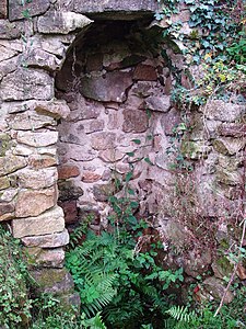 The healing spring
 The Manoir de Lamorinie


.JPG)

swell
- B. Briand et al .: Feuille Châlus . In: Carte géologique de la France at 1/50 000 . BRGM.
Individual evidence
- ↑ Chantal Tanet and Tristan Hordé: Dictionnaire des noms de lieux du Périgord . éditions Fanlac, 2000, ISBN 2-86577-215-2 , p. 305-307 .
- ↑ Saint-Barthélemy-de-Bussière on the Insee website
- ↑ Guy Penaud: Dictionnaire des châteaux du Périgord . Éditions Sud Ouest, 1996, ISBN 2-87901-221-X , p. 191 .