Saint-Félix-de-Bourdeilles
|
Saint-Félix-de-Bourdeilles Sent Feliç de Bordelha |
||
|---|---|---|

|
|
|
| region | Nouvelle-Aquitaine | |
| Department | Dordogne | |
| Arrondissement | Nontron | |
| Canton | Brantôme | |
| Community association | Dronne et Belle | |
| Coordinates | 45 ° 25 ' N , 0 ° 34' E | |
| height | 116-227 m | |
| surface | 6.06 km 2 | |
| Residents | 62 (January 1, 2017) | |
| Population density | 10 inhabitants / km 2 | |
| Post Code | 24340 | |
| INSEE code | 24403 | |
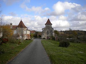
 Church and town center of Saint-Félix-de-Bourdeilles |
||
Saint-Félix-de-Bourdeilles ( Occitan Sent Feliç de Bordelha ) is a French commune in the north-west of the Dordogne department in the Aquitaine region . It has 62 inhabitants (as of January 1, 2017) and belongs to the canton of Mareuil in the Arrondissement of Nontron .
geography
Saint-Félix-de-Bourdeilles, sometimes referred to as Saint-Félix-de-Mareuil , is located in the Périgord-Limousin Regional Nature Park , nine kilometers northwest of Brantôme en Périgord . The small community is surrounded by the following communities:
- Mareuil en Périgord in the northwest
- Brantôme en Périgord in the southeast.
In addition to the town center, the community consists of the following hamlets, farmsteads, a mill and a castle:
Château Mondevit , Combaronie , La Berterie , La Cotencie , La Monerie , Le Brouillac , Le Creyssac , Le Moulin de la Berterie , Maison Neuve and Pontarnaud .
The southern part of the municipality is drained by the Ruisseau le Jallieu , a right side stream of the Boulou . The stream initially flows to the east, but turns to the south-south-east after the Ruisseau la Paulette has been taken on the left. The southern part of the eastern border of the municipality is formed by the Boulou, which stretches to the southwest.
Topographically the lowest point of the municipality at 116 meters above sea level is located south of the La Cotencie estate , here the Boulou leaves the municipality. The highest point at 227 meters is located south of the hamlet of Pontarnaud (Monsec municipality). The maximum height difference is therefore 111 meters.
geology
The municipality of Saint-Félix-de-Bourdeilles is completely underlain by sediments from the northeast Aquitaine basin . The flat layer sequence begins with the Rudist limestone of Angoumia ( Turonium ). Lower Angoumien on the lower reaches of the Ruisseau la Paulette is open , while Upper Angoumien borders the Ruisseau le Jallieu . Hard fossil limestone of the Coniacium follows above . The Coniacium takes up most of the southern municipality area. Santonium lies on top of the coniacium . The Santonian consists of gray, glauconite -führenden limestones of the Lower Santoniums (digested at Le Brouillac and Le Creyssac ) and from the oyster Schill containing Mergelkalken the Upper Santoniums (south of Le Brouillac ). In the northern part of the municipality and south of La Monerie , alluvial sediments of the Eocene or Lower Oligocene lie over the Upper Chalk sediments . They are interpreted as alluvial fans moving to the southwest. These sediments are conglomerated in places and contain rounded quartz and silicified arkose rocks . The areas near the town center are covered by Pleistocene colluvium .
Two branches of the Mareuil fault traverse the municipality in an east-south-east and south-east direction. These are offshoots of the Mareuil anticline . They cause the central and southern clods to be raised like a staircase by 30 meters each.
Population development
| year | 1962 | 1968 | 1975 | 1982 | 1990 | 1999 | 2007 | 2016 |
| Residents | 105 | 85 | 85 | 61 | 53 | 58 | 72 | 65 |
| Sources: Cassini and INSEE | ||||||||
