
Pays d'Horte et Tardoire
The Pays d'Horte et Tardoire is a traditional landscape in the south-east of the Charente department ( Nouvelle-Aquitaine region ).
etymology
The Pays d'Horte et Tardoire is named after the forest landscape Forêt d'Horte and the river Tardoire .
geography

The Pays d'Horte et Tardoire, often just referred to as Horte et Tardoire , Occitan Òrta e Tardoira , is a more recent creation. The landscape forms the border region to the Haute-Vienne department further to the east and to the Dordogne department immediately to the south-east. It lies at the transition from the Aquitaine Basin to the Massif Central . Its main town is La Rochefoucauld . To the south, the Pays d'Horte et Tardoire extends to Vaux-Lavalette , to the north to Coulgens . To the east it touches the Charente limousine with the municipalities of Écuras and Rouzède . The western border forms Angoulême with the Angoumois . The maximum extension in the north-south direction is around 40 kilometers, but in the east-west extension it is only 20 kilometers. The highest point at 254 meters above sea level is in the municipality of Eymouthiers , the lowest at 66 meters on the Tardoire near Coulgens.
The Pays d'Horte et Tardoire is surrounded by the following landscapes:
- the Confolentais in the north
- the Pays de la Vienne in the northeast
- the Nontronnais in the east
- the Ribéracois in the south
- the Montmorélien in the southwest
- the Angoumois in the west
- the Ruffécois in the northwest
More important municipalities in the Pays d'Horte et Tardoire are (besides La Rochefoucauld):
In terms of landscape geography, the Pays d'Horte et Tardoire consists of two different units, both of which are very rich in archaeological evidence and historical buildings ( Monuments historiques ):
- the Kalkplateus mainly on the left side of the Tardoire ( Causses de Tardoire )
- the forests of the Forêt d'Horte
Causses de Tardoire

The Causses de Tardoire, often also Causses de La Rochefoucauld , represent a transition zone between the crystalline basement of the Massif Central and the sediments of the Charente plain. The limestone plateaus are heavily karstified and are interspersed with numerous hydrological curiosities such as caves , shafts and river shrinkage . They are largely forested, such as in the Forêt de la Braconne or in the Forêt de Quatre Vaux (also Bois de Quatre Vaux ). Grain is grown between walnut plantations in valleys.
The Pays d'Horte
The Pays d'Horte is separated from the Causses de Tardoire by the bandiat. The landscape is very wooded. Among the forests, the Forêt d'Horte is best known. Pines, chestnuts and oaks share the barren sand and gravel soils of this area.
Hydrography
The main rivers are the Tardoire , which flows to the northwest between La Rochefoucauld and Montbron, and the Bandiat , which also drains to the northwest , and which flows into the Tardoire at Agris as a left tributary (only when there is high water, otherwise the river seeps away after Bunzac ). The Échelle flows along the western border in a north-north-westerly direction and drains through the Touvre towards Charente . The southern section of the Pays d'Horte is drained by the Voultron , which flows south to the Lizonne , the border river to the Ribéracois.
geology

Geologically, the Pays d'Horte et Tardoire is underlain by flat sediments from the Aquitaine Basin. Upcoming are the basement of the transgressive Jura , discordant Upper Cretaceous , discordant Tertiary and Quaternary . The already mentioned limestone plateaus on the Tardoire are built up from layers of the Bajocium up to and including Oxfordium ( Dogger and Lower Malm ). The Forêt d'Horte lies on the Upper Cretaceous sequence Cenomanium to Coniacium , which is covered by river sediments of the Tertiary and their Pleistocene colluvium. The valley of the Tardoire is bordered by three terrace systems from the Pleistocene. The alluvium in the river valleys comes from the Holocene .
The metamorphic basement appears east of Montbron with the strongly tectonized Saint-Mathieu leukogranite and migmatites as well as the green slate facial Mazerolles unit north of Orgedeuil, which forms the Massif de l'Arbre .
history

The valleys of the Tardoire and the Bandiat were visited by humans very early on, as numerous prehistoric sites clearly show. The Jura rocks on the left bank of the Tardoire are home to several caves and abrises . Examples are:
- the La Chaise site with human remains from the early Paleolithic
- the Abri cave system of Montgaudier with finds from the Middle Paleolithic up to the Bronze Age
- the Vilhonneur cave-abric complex with artefacts from Magdalenian and Solutréen as well as from the Bronze Age and the Early Iron Age . Human remains from the Upper Paleolithic were found in the Grotte du Visage . The Grotte du Placard near Rochebertier contains cave paintings of the same style as in Pech Merle . Even Roman coins were found here. The Abri du Bois-du-Roc was unfortunately looted before a scientific investigation.
Other well-known sites are the Roc-de-Sers (Upper Palaeolithic) near Sers and La Quina near Gardes-le-Pontaroux , with Neanderthals being discovered in the latter . In Angoulême, more than 200,000 artifacts from the Upper Paleolithic are known to date.

Some dolmens date from the megalithic period , for example at Édon ( Necropolis of Édon ) and Ronsenac . They are thought to date from around 2900 to 1800 BC. Go back. Ceramic remains can be assigned to the Vienne-Charente cultural area.
Traces from the Bronze Age are a flat ax from the Chalcolithic Artenac culture of Édon.
The find of a Gallic helmet from the 4th century BC is noteworthy. At Agris ( helmet of Agris ). A Gallo-Roman burial place is in the municipality of Ronsenac. An oppidum once stood on the spur of Angoulême with finds from the Iron Age to the Gallo-Roman era.
The Roman road Saintes-Périgueux ( Chemin Boisné ) once passed north-east of Ronsenac . The Roman roads Angoulême-Limoges and Poitiers-Périgueux crossed south of Mornac . The remains of Roman villas (pars urbana) can be found near Villebois-Lavalette (finds from Tegulae), as well as with mosaics in the municipality of Montbron. Montbron very likely also owned a Roman oppidum.
The Great Migration saw the passage of the Vandals in 407 , devastating Angoulême. They were followed from 412 the Visigoths , who settled in the area and only 508 from Franken ruler Clovis have been defeated.
In the 6th century a first abbey was founded in Angoulême, the Abbey of Saint-Cybard .
In 732 the Arabs crossed the region on their way north, devastating Angoulême.
Remains of a sarcophagus from the Merovingian period are preserved in Ronsenac, which can be assigned to either the Visigoths or the Franks. Between 760 and 768, Pepin the Short conquered Aquitaine. Charlemagne stayed in the region in 768 to take action against insurgents in the Périgord.
In the 9th century the Vikings raided Angoulême over the Charente in 848 and 863. The Viking threat was finally averted around 930.
Sights from the Middle Ages are:
- the fortress of Villebois-Lavalette from the 10th century
- the 12th century church in the rock ( Chapelle Saint-Georges ) of Gurat
- the Romanesque parish church of Saint-Maurice in Montbron from the 12th century
- the Grosbois monastery near Charras
- the Rauzet monastery near Combiers
The Hundred Years War also spread to the Pays d'Horte et Tardoire. For example, the English set fire to Marthon Fortress in 1347. In 1360 Angoulême became English.
In the Huguenot Wars Angoulême was Protestant from 1568. In the same year the Huguenots expelled the monks in Grosbois monastery and the monastery church was badly damaged. Villebois-Lavalette, the domain La Couronne near Marthon and the Abbey of Saint-Cybard in Angoulême also suffered severe damage .
The Grosbois Monastery fell victim to the dechristianization during the French Revolution , and its monks were driven out.
administration
As Pays d'hoards et Tardoire a concentration of 50 Towns (administratively Syndicat intercommunal ) in the district Angoulême denotes that distributes to the following cantons:
- Canton of Boëme-Échelle
- Canton of Touvre-et-Braconne
- Canton of Tude-et-Lavalette
- Canton of Val de Tardoire .
The municipal associations ( Communauté de communes ) are also responsible :
- Communauté d'agglomération du Grand Angoulême (urban association)
- Communauté de communes La Rochefoucauld-Porte du Périgord
- Communauté de communes Lavalette Tude Dronne .
Photo gallery

Saint-Jean-Baptiste church in Coulgens

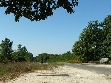
The Forêt de Quatre Vaux near Agris

The Saint-Caprais church in Agris

Carmelite Convention in La Rochefoucauld

Saint-Maurice church in Montbron
The Forêt d'Horte near Grassac

Inner courtyard of the Grosbois monastery near Charras

Grammontens Church of the Rauzet monastery near Combiers

Marthon with donjon from the 12th century

Main entrance to the rock church of Gurat

Villebois-Lavalette Castle


literature
- A. Bambier et al .: La Rochefoucauld 1831 Charente limousine . In: Carte géologique de la France at 1/50 000 . BRGM, 1983.
- G. Le Pochat et al .: Montbron . In: Carte géologique de la France at 1/50 000 . BRGM, 1986.
Individual evidence
- ↑ Frederic Zégierman: Le Guide des Pays de France, Sud (tome 1: North et tome 2: sud) . Fayard, 1999, ISBN 2-213-59960-2 , pp. 638 .