Forêt d'Horte
The Forêt d'Horte is a domain forest in the Charente department in the Nouvelle-Aquitaine region . The forest is located about 25 kilometers southeast of the prefectural city of Angoulême .
etymology
The Forêt d'Horte was named after the Château d'Horte or the Horte homestead northwest of Grassac .
history

Before the 12th century, the Forêt d'Horte was part of the much larger forest area of Gros Bosc , which then disintegrated through clearing into the Forêt de Dirac , the Forêt de la Braconne , the Bois Blanc and the Forêt d'Horte. The forest once reached as far as the Bandiat in the east, but then experienced massive deforestation around Charras , Mainzac , Grassac and Vouzan .
geography
The very old domain forest completely or partially covers the territory of the communes of Dignac , Rougnac , Charras, Combiers, Vouzan, Sers and Les Graulges in the Dordogne department, which are part of the Charente department . It is based on a huge plateau between the valleys of the Échelle in the northwest, the Bandiat in the northeast, the course of the D 939 from Angoulême to Périgueux in the southwest and the villages of Combiers and Hautefaye in the southeast. To the northwest of Dignac, the forest merges into the Forêt de Dirac and merges with the forests of the Périgords in the southeast towards Connezac . The forest area measures 12 kilometers in north-south direction and is 9 kilometers wide. The surface area is around 10,000 hectares or 100 square kilometers.
The plateau area is at an average altitude of 180 meters. Their highest points reach 220 meters at Dignac, Beaulieu , Grassac and Charras. The base of the forest is at a height of around 150 meters.
The Forêt d'Horte is centrally crossed by the D 16 from Montmoreau-Saint-Cybard to Confolens (via Villebois-Lavalette and Montbron ) and by the D 25 from Angoulême to Combiers (via Sers and Charras). The former railway line from Angoulême to Périgueux once ran through the forest. It followed up the valley of the Échelle, passed Charbontière and Rougnac and then left the forest at La Rochebeaucourt .
In the Forêt d'Horte, formerly independent forests are integrated - such as the 968 hectare domain forest Forêt domaniale de la Mothe-Clédou (now only called La Mothe , formerly Forêt du Clédou ) and the Forêt de la Rochebeaucourt , the southeast of the line Charras-Rougnac are located.
geology
The forest has established itself on a broad, detritic layer body from the Miocene / Pliocene , which in turn sits on a substrate of Upper Cretaceous limestone. The latter form a layer ( Cuesta ) at Grassac and Charras compared to the underlying Jura, which is further open to the east . From the Massif Central originating Plateau gravel - clayey, gravelly sands - had in the late Tertiary About laid the Upper Cretaceous sediments. These continental sediments have been preserved on the upper chalk ridges at a high topography and are now made up of forest and heather vegetation adapted to acidic locations . The transition from the limestone subsoil to acidic, sandy-clayey and gravelly soils occurs at around 150 meters above sea level and causes a drastic change in vegetation.
ecology
The forest consists of low and high forest, with the low forest occupying a dominant position and only 10 to 15 percent of high forest. The composition of the forest is highly dependent on height and reflects the geological conditions. Lime-avoiding plants such as chestnuts and maritime pines can be found at decalcified high altitudes in the center, whereas holm oaks , common oaks , hornbeams and Scots pines can be found in lower elevations between lime-loving undergrowth, mainly on the southern edge of the forest.
The species originally native to the forest are becoming increasingly rare nowadays, as coniferous forests are being planted, which already account for up to 20 percent. Introduced species are spruce , common Douglas fir and pine (Scots pine, maritime pine and black pine).
Attractions
- Roc de Sers - Upper Paleolithic site
- Grosbois Monastery (Charras municipality)
- Rauzet Monastery (Combiers municipality)
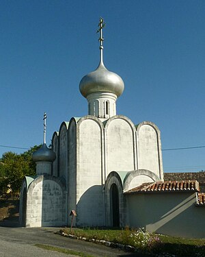
- Orthodox monastery church Notre-Dame-de-Chersonèse in Doumérat (Grassac municipality)
- La Mothe-Clédou arboretum
- Tour du Breuil (Dignac municipality)
- Convalescence Center Monchoix in the Château de Monchoix (municipality of Rougnac)
See also
literature
- B. Bourgueuil, P. Moreau et al .: Angoulême XVII-32 . In: Carte géologique de la France at 1/50 000 . BRGM.
- G. Le Pochat et al .: Montbron . In: Carte géologique de la France at 1/50 000 . BRGM, 1986.
Individual evidence
- ↑ LF. Alfred Maury: Les forêts de la Gaule et de l'ancienne France . Ladrange, Paris 1867, p. 501 .
Web links
Coordinates: 45 ° 33 ′ 30 ″ N , 0 ° 22 ′ 30 ″ E


