Eymouthiers
|
Eymouthiers Aimostier |
||
|---|---|---|
|
|
||
| region | Nouvelle-Aquitaine | |
| Department | Charente | |
| Arrondissement | Angoulême | |
| Canton | Val de Tardoire | |
| Community association | La Rochefoucauld-Porte du Périgord | |
| Coordinates | 45 ° 39 ′ N , 0 ° 33 ′ E | |
| height | 118-254 m | |
| surface | 8.68 km 2 | |
| Residents | 302 (January 1, 2017) | |
| Population density | 35 inhabitants / km 2 | |
| Post Code | 16220 | |
| INSEE code | 16135 | |
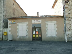
 Town Hall (Mairie) of Eymouthiers |
||
Eymouthiers ( Occitan : Aimostier ) is a multi-places community with 302 inhabitants (as of January 1 2017) in the western French department of Charente in the region Nouvelle-Aquitaine . It belongs to the Arrondissement of Angoulême and the canton of Val de Tardoire . The responsible community association is the Communauté de communes La Rochefoucauld-Porte du Périgord . The inhabitants are called Moustériens or Moustériennes .
etymology
Eymouthiers is mentioned in a document in the 13th century as Mostiers , other old spellings are Monasteriis, Monasterio Ferrario and Antemonasterio . The Latin Ante monasterium means before the monastery, monastery . The later name Eymoutier-Ferrier refers to ore mining and a former forge. It is doubtful whether an etymological connection to Eymoutiers in the Haute-Vienne department can be established. Rather, a relationship with Mouthiers-sur-Boëme can be recognized through Monasteriis .
language
The municipality of Eymouthiers is located in the Occitan-speaking eastern third of the Charente department, the local dialect is Limousin . In Occitan it is called Aimostier .
history
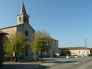
It is said that the remains of a Gallo-Roman settlement called Ville de Conan were found in the 19th century . However, Christian Vernou mentions only monolithic sarcophagi in his treatise . In the Middle Ages, the parish was under the Chapter of Saint-Martial in Limoges . In 1689 the Junker Arnaud du Lau, lord of Saint-Julien, owned the noble estate Le Chambon and appeared in the aristocracy in the Périgord. In Chez Manot once stood a chapel for lepers, the Saint Roch was dedicated. The chapel was partially renewed in the 16th century and completely restored in 1862. The construction costs were borne by Nicolas Guimbelot - former mayor and Knight of the Legion of Honor , whose tomb is in the middle of the chapel. On August 16th, the name day of Saint Roch, an annual conference was held in Eymouthiers. At the beginning of the 20th century, Léonard Voisin composed a ballad in his honor called Notro Balêdo . The church and town hall in La Tricherie were built towards the end of the 19th century. However, the church houses a bell from 1581 with the following inscription: Ihs ma petre ora pro nobis 1581 Te deum landamus. Te Deum Landamus. It is recognized as a monument historique .
location
Eymouthiers is located about 35 kilometers east of Angoulême on the eastern border of the Charente department. Eymouthiers is a municipality on the border with the granitic Périgord vert in the Dordogne department . The main traffic connection is the D 6, which runs from the department border via Montbron and La Rochefoucauld to Mansle .
Eymouthiers is surrounded by the following neighboring municipalities:
- Écuras in the north
- Bussière-Badil (Dordogne) to the east
- Soudat (Dordogne) in the south
- Varaignes (Dordogne) in the southwest
- Montbron to the west and northwest.
The following districts, hamlets and individual farms belong to the municipality of Eymouthiers: Beaulieu , Bellevue , Chez Manot , Eymouthiers , La Tricherie , Le Chambon , Le Champ , Le Moulin du Maine Pachou , Les Justices , Marsac , Maudeuil , Moulin du Chambon , Puyservaud and Saint- Romain .
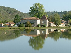
The name-giving district Eymouthiers is just a small hamlet on a spur that has neither a church nor a town hall. The district of La Tricherie (5 kilometers east of Montbron) located on the D 6 from Montbron to Piégut-Pluviers , however, forms the real heart of the community with its church and town hall. The hamlet of Le Chambon is idyllically situated in a bend in the Tardoire river, not far from the mouth of the stream that flows from the Fontaine d'Eymouthiers . The hamlet of Puyservaud is on the eastern border with the Périgord.
The municipality extends over the southern slopes of the Tardoire valley, which runs in a rather striking gorge along the northern border. The highest point in the area is 254 meters above sea level on the eastern municipal boundary. The lowest point at 118 meters is on the Tardoire on the northwest corner. The town center of La Tricherie with the church and town hall is 245 meters above sea level - which means that a good view of the surrounding landscapes of the Périgord and Angoumois is guaranteed.
Hydrography

The northern boundary of the municipality of Eymouthiers is formed by the meandering Tardoire, which drains to the northwest . The Tardoire receives smaller tributaries on the left, which are fed by sources such as Saint-Pierre in Eymouthiers or the source at Marsac . The eastern border to Bussière-Badil is also formed by a small tributary on the left. A small dry valley on the left flows into Montbron immediately before the north-western border. Lush meadows, ideal for cattle breeding, lie along all of these watercourses. At Le Chambon , the left tributary coming down from Eymouthiers was dammed up to two larger ponds not far from the Tardoire, which are used for tourism and fishing purposes. The large dry valley of the Grand Ruisseau du Vallon de la Tricherie begins south below La Tricherie and runs southwest towards Bandiat and flows into the municipality of Feuillade .
climate
Eymouthiers has a weakened maritime climate . This is typical for the entire Charente limousine , which is much more humid and cooler than the rest of the department due to its elevated topography - even if certain meridional nuances of the Périgord immediately to the south are already noticeable.
geology
The municipality of Eymouthiers lies in the transition area between the Variscan crystalline basement of the northwestern Massif Central and its sediment cover from layers of the northeast Aquitaine Basin .
The basement is in the northern third of the municipality, especially along the Tardoire. It consists of migmatitic gneisses (metatexites) and the Saint-Mathieu leuco granite that penetrates them . The foliation of the gneisses strikes northeast and dips at 40 to 50 degrees to the northwest. In the gneiss there are trains of micro-granites , lamprophyren and graphite-containing slates , which show roughly the same strike direction. Upstream from Le Chambon , leuco granite can be found for the first time . This forms part of the medium-grain facies of the Saint-Mathieu-Leukogranite, the so-called Champniers-Reilhac granite . The leuco granite is folded in concordant to the gneiss foliation.
To the north of Marsac , the basement is covered by flat-lying sediments of the Lower Jurassic . Upcoming are Hettangian , Sinemurian (questionable) and Pliensbachian to Toarcian - arkoses , reddish cryptocrystalline dolomites , oolite limestone in the Hettangian and gray clays and marls in the Pliensbachian / Toarcian. In the valley of the Grand Ruisseau du Vallon de la Tricherie there is even a Middle Bajocium with gray oolite limestone.
The sediments are then in turn covered by tertiary colluvium - plateau sediments consisting of a sandy-clay matrix with embedded pebbles made of predominantly pure quartz . The deposits of a fossil tertiary river , which follows the high elevations of the community in the south, lay over the colluvium . Its age is not dated, but the period Eocene to Pliocene or Miocene to Pliocene is assumed . The Tardoire flows in a Holocene alluvium - predominantly sandy clays with gravel pebbles from the basement.
Population development
| Population development in Eymouthiers | ||||
|---|---|---|---|---|
| year | Residents |

|
||
| 1962 | 298 | |||
| 1968 | 237 | |||
| 1975 | 242 | |||
| 1982 | 235 | |||
| 1990 | 279 | |||
| 1999 | 296 | |||
| 2004 | 312 | |||
| 2006 | 304 | |||
| 2009 | 302 | |||
| 2013 | 295 | |||
| 2014 | 292 | |||
| 2017 | 302 | |||
Source: INSEE
The parish of Eymouthiers experienced a significant population decline from 1968 to 1990, but has since returned to its previous level of the early 1960s. Their population density was thus (in 2017) an area of 8.68 square kilometers with 35 inhabitants / km².
mayor
Mayor of Eymouthiers has been the non-party pensioner Jean-Pierre Chamoulaud since 2001.
economy
The most important branch of industry in Eymouthiers is agriculture (raising cattle, sheep and pigs, as well as some viticulture with an attached distillery). The Le Chambon leisure center and the rental of holiday homes have given tourism a great boost.
free time activities
The Le Chambon leisure center on the road to Écuras on the Tardoire has several very beautiful, insured climbing routes in the Kristallin. Canoeing and kayaking are possible on the river . During the summer holidays, the center accommodates groups, particularly from the Angoulême area.
Attractions
- Saint-Pierre church
- Le Chambon leisure center
Long-distance hiking trails
Two long-distance hiking trails run through Eymouthiers :
- the GR 4 from Royan to Grasse and
- the GR de Pays Entre Angoumois et Périgord , which connects the Angoumois with the Périgord .
literature
- J.-P. Floc'h et al .: Montbron . In: Carte géologique de la France at 1/50 000 . BRGM.
Individual evidence
- ^ Albert Dauzat and Charles Rostaing: Dictionnaire étymologique des noms de lieux en France . Librairie Guénégaud, Paris 1989, ISBN 2-85023-076-6 , pp. 738 .
- ^ Adolphe Laurent Joanne: Géographie de la Charente . Hachette, 1909, p. 68 .
- ^ Christian Vernou: La Charente . In: Carte archéologique de la Gaule . Maison des Sciences de l'Homme, Paris 1993, ISBN 2-87754-025-1 , pp. 253 .
- ^ Aymard de Saint-Saud: Rôle des bans et arrière-bans de la noblesse du Périgord from 1689 to 1692 . Féret et Fils, 1930, p. 100 .
- ↑ Eymouthiers on the Insee website


