
Yvrac-et-Malleyrand
| Yvrac-et-Malleyrand | ||
|---|---|---|
|
||
| region | Nouvelle-Aquitaine | |
| Department | Charente | |
| Arrondissement | Angoulême | |
| Canton | Val de Tardoire | |
| Community association | La Rochefoucauld-Porte du Périgord | |
| Coordinates | 45 ° 45 ′ N , 0 ° 27 ′ E | |
| height | 109-318 m | |
| surface | 18.9 km 2 | |
| Residents | 547 (January 1, 2017) | |
| Population density | 29 inhabitants / km 2 | |
| Post Code | 16110 | |
| INSEE code | 16425 | |
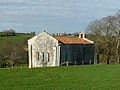
 Town hall (Mairie) of Yvrac-et-Malleyrand |
||

Yvrac-et-Malleyrand ( Occitan : Ivrac e times Irand ) is a southwestern French community with 547 inhabitants (as of January 1 2017) in the Charente in the region Nouvelle-Aquitaine . The municipality belongs to the Arrondissement of Angoulême and the canton of Val de Tardoire . The inhabitants are called Yvracois .
location
Yvrac-et-Malleyrand is about 25 kilometers east-northeast of Angoulême . Yvrac-et-Malleyrand is surrounded by the neighboring communities of Taponnat-Fleurignac in the north and north-west, Saint-Adjutory in the north and north-east, Mazerolles in the east, Orgedeuil in the south and south-east, Saint-Sornin in the south and south-west and Marillac-le-Franc in the West.
history
From the 12th century there was a command of the Knights Templar here in Malleyrand until the order was dissolved.
Population development
| year | 1962 | 1968 | 1975 | 1982 | 1990 | 1999 | 2007 | 2013 |
| Residents | 506 | 481 | 420 | 403 | 432 | 465 | 515 | 523 |
| Source: Cassini and INSEE | ||||||||
Attractions
- Saint-Vivien church in Yvrac, built at the end of the 12th century
- Old command station with the Saint-Jean-Baptiste chapel from the 12th century

Saint Vivien Church
Saint-Jean-Baptiste Chapel

Taponnat Castle

Pigeon towers in Fleurignac


