
Ribéracois
The Ribéracois is a French landscape in the north-west of the Dordogne department in the Nouvelle-Aquitaine region . It forms part of the Périgord vert tourist region .
etymology
The Ribéracois is named after the city of Ribérac .
geography

The Ribéracois consists of the actual area around Ribérac in the south, the distribution lacois in the center and the Mareuillais in the north. It is surrounded by the following landscapes:
- the Pays d'Horte et Tardoire in the northwest
- the Nontronnais in the north
- the Périgord central in the east
- the double in the south
- the Montmorélien in the west.
administration
Administratively, the Ribéracois belongs to the Arrondissement Périgueux and the Arrondissement Nontron with the cantons Ribérac , Brantôme and Nontron . Responsible community associations ( French communauté de communes ) are Communauté de communes du Pays Ribéracois , Communauté de communes Dronne et Belle and Communauté de communes du Périgord Nontronnais .
Hydrography
.jpg)
The main river in the Ribéracois is the Dronne , which, coming from the northeast, initially forms the eastern border to the Périgord central. After a change of direction, it flows west past Ribérac, then turns to southwest and at the same time marks the border to Montmorélien. At Saint-Aulaye she achieved the double. A right tributary of the Dronne is the Boulou . The northern part is drained by the Nizonne and its left tributary of the Belle in a westerly direction. The Nizonne changes its course from La Rochebeaucourt-et-Argentine to the southwest, becomes the border river with the Montmorélien and at the same time is now called Lizonne. The border river in the north is the Bandiat flowing off to the northwest .
geology
Geologically, the Ribéracois lies entirely in the shallow Mesozoic and Tertiary sediments of the Aquitaine Basin . Upcoming are the Upper Jurassic , Upper Cretaceous and Continental Tertiary . The Malm consists mainly of calcareous Kimmeridgium and Portlandium and is only found in the heart of the La Tour Blanche anticline and the Mareuil anticline . The discordant, up to 400 meters thick Upper Cretaceous range from Cenomanium to Campanium . The 40-meter-thick continental Tertiary is discordant on the upper campan and consists of Ypresian to Oligocene . It is essentially made up of clayey sands, in which gravel layers and boulders, but also green, kaolin-rich clay flaps and lignite (lying down) are inserted. These sediments, also known as Sidérolithique or Sables du Périgord , were deposited in an inner-continental delta under warm humid conditions. The ypresium has dug itself into the upper campan and is in turn covered discordantly by the lutetium.
In the valley of the Dronne a total of up to 9 terraces can be separated, which were created during the Quaternary (Old Pleistocene to recent) in the course of the last ice ages .
tectonics
.JPG)
The flat layer sequence is interrupted by two anticline trains, the Mareuil anticline in the north and the La Tour Blanche anticline further south. Both bulges line south-south-east to south-east. Parallel to the La Tour Blanche anticline, a large flexure runs from Distribution Lac to Lisle about 5 kilometers further south . The two anticline structures were created in the course of the Upper Cretaceous, but, like the flexure, only received their final form in the Middle Eocene through the remote effects of the Pyrenees orogenesis .
economy
The decisive factor for the economy of the Ribéracois is still the agriculture . Wheat , oats , sunflowers and maize are grown in the mild but humid Atlantic climate . Other typical products are black truffles , porcini mushrooms , foie gras and walnuts.
Photo gallery

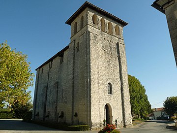
Saint-Martial church in Ribérac
Church of Saint-Martial-Viveyrol
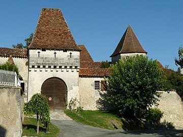
Castle of Lusignac

La Tour-Blanche Castle

View of the village from Paussac
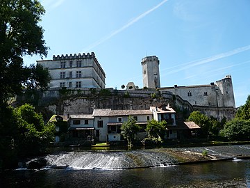
Castle of Bourdeilles

Castle of Mareuil
.JPG)


.jpg)

.JPG)
.JPG)
See also
literature
- J.-P. Floc'h et al: Nontron XVIII-33 . In: Carte géologique de la France at 1/50 000 . BRGM.
- J.-P. Platel and others: Périgueux (Ouest) . In: Carte géologique de la France at 1/50 000 . BRGM, 1989.
- Frédéric Zégierman: Le Guide des Pays de France, Sud . Fayard, 1999.
Individual evidence
- ↑ Frederic Zégierman: Le Guide des pays de France, Sud . Fayard, 1999.