
Périgord central
The Périgord central is a traditional French landscape in the center and in the east of the Dordogne department . The capital is the city of Périgueux in the Nouvelle-Aquitaine region .
geography

The Périgord central covers the middle and the east of the Dordogne department.
The landscape is surrounded by the following natural spaces:
- the Nontronnais in the north
- the Briver Basin in the east
- the Périgord noir in the southeast
- the Bergeracois in the south
- the Landais in the southwest
- the double in the west
- the Ribéracois in the northwest.
Other landscape subdivisions within the Périgord central are:
- the Pays d'Ans
- the Pays d'Hautefort
- the Pays de Bourdeilles
- the Pays de Brantôme
- the vernois

The Vernois or Pays de Vergt is located on the upper reaches of the Vern and occupies the south of the Périgord central. The border to the Périgord noir further east is formed by the Manoire stream and the municipality of Le Lardin-Saint-Lazare . The eastern border is occupied by the Pays d'Ans and the Pays d'Hautefort. The Briver Basin begins behind the municipality of Coubjours , but geologically before Hautefort . The northern border to the Nontronnais is somewhat imprecise. It runs roughly along the municipalities of Excideuil , Corgnac-sur-l'Isle , Saint-Jean-de-Côle and Saint-Front-la-Rivière and roughly follows the marginal fault of the Massif Central . The Dronne marks the north-western border of the Périgord central.
The term Périgord central is to be clearly distinguished from the term Périgord blanc , which is mainly used in tourism. The Périgord blanc extends to the area around Périgueux, the Vernois and the Isle of Montpon-Ménestérol , so it still includes parts of the Double and Landais.
administration
.JPG)
Administratively, the Périgord central corresponds essentially to the entire Arrondissement of Périgueux and the northern part of the Arrondissement of Sarlat-la-Canéda . It is made up of the following cantons:
- Canton of Brantôme (parts)
- Canton of Coulounieix-Chamiers
- Canton of Haut-Périgord Noir (parts)
- Isle-Manoire Canton
- Canton of Périgord Central
- Canton of Périgueux-1
- Canton Périgueux-2
- Canton of Saint-Astier
- Canton of Trélissac
- Canton Vallée de l'Isle (parts)
From the canton of Isle-Loue-Auvézère , the municipality of Savignac-les-Églises belongs to the Périgord central, from the canton of Thiviers the municipality of Sorges et Ligueux en Périgord .
In addition, the Périgord central contains the following associations of communes ( French communauté de communes ):
- Community de communes Isle et Crempse en Périgord
- Communauté de communes Isle Double Landais
- Community de communes Isle Vern Salembre en Périgord
as well as the municipal association Communauté d'agglomération Le Grand Périgueux .
Hydrography

The landscape of the Périgord central consists of limestone ranges of hills, which are interrupted by the valleys of the Isle , the Beauronne , the Loue and the Vern . The meadows in the valley lowers alternate with forests predominantly composed of chestnuts, oaks and pines.
The main river in Périgord central is the Isle, which flows roughly in the middle from northeast to southwest, on which Périgueux - the capital of the Dordogne department - is located. Tributaries of the Isle are Auvézère on the left and Beauronne on the right. The extreme north of the Périgord central runs through the Dronne, which comes from the northeast, in a south-south-west to south-west direction. Your left tributary is the Côle , which flows into it shortly before Brantôme . The Vern drains the south of the landscape in a westerly direction and also flows into the Isle as a left tributary.
geology
.JPG)
With the exception of the Pays d'Ans and the Pays d'Hautefort, the Périgord central is built up from 600 meters thick sediments of the Aquitaine Basin that plunge gently to the southwest - Jura , Upper Cretaceous and continental Tertiary . The angle of incidence is less than 10 °, whereby the sediment sequence is inclined slightly monoclinally towards the inside of the basin.
Shortly before Hautefort, the Permian and Triassic of the Briver Basin appear and to the northwest of Terrasson-Lavilledieu the Horst von Châtres - a break of the Variscan basement with rocks of the Thiviers-Payzac unit .
Sediment sequence
The Jura, which is up to 180 meters thick, leads up the Lias and Dogger levels . It is open in the northeast of the Périgord central in the area of Savignac-les-Églises (south of Excideuil and Thiviers ), but is covered in the rest of the Périgord central by layers of the Upper Cretaceous. Its southern limit opposite the Upper Cretaceous is determined by the southeast trending Le Change Fault , along which the Jura was raised. The layer sequence of the Upper Cretaceous, which was partly karstified in the Tertiary, begins with the transgressive Cenomanium and extends up to the Chalky Campanian . The discordant continental Tertiary can be assigned to the Eocene and the Oligocene .
The Liasmeer transgresses in the Hettangium over the pen-planed Massif Central including the Briver Basin. The marine influence is initially only slightly noticeable, as the sands of granitic composition are reprocessed and deposited on site. The upper hettangium and the sinemurium are mostly dolomitic and thus indicate a constricted sedimentation space. Only in the Toarcium do open marine conditions arise with uniformly pelagic marls .
During the Dogger, the Périgord central is part of an epicontinental shelf platform on which limestone is deposited. The Bajocium is characterized by oolite limestone. In the bathonium there are initially high-energy conditions with detritic sedimentation, which then calm down again under continental influence. These two poles alternate with each other several times, to finally end in calm sedimentation. Smaller reefs are then removed and leveled again in the course of the Oxfordium .
The Malm is not directly pending, but it is there and is only covered by the transgressive Cenomanium.
During the entire Lower Cretaceous, the Périgord central reappeared, as well as the entire rest of the North Aquitan platform.
The Upper Cretaceous can reach a total thickness of up to 400 meters. The Cenomanium has detritic sediments that indicate a nearby continental area. In the lower turon there are again open marine conditions which, however, already give way to regression in the upper turon. There are however a significant increase in water temperatures, thereby Rudistenkolonien can settle on an inter-platform. After a sedimentation standstill at the end of the Turon, a new sea advance takes place with relatively shallow water in the Coniacium . In the subsequent santonium , the access to the open sea widens, recognizable by the presence of cephalopods and pelagic foraminifera . In the Campanian, the sea then reaches its highest level with characteristic chalk sedimentation. Towards the end of the Upper Cretaceous the Atlantic definitely withdraws from the Périgord central.
The continental Tertiary, which is up to 40 meters thick, extends from the Ypresian to the Oligocene. It essentially consists of clayey sands, in which gravel layers and boulders, but also green, kaolin-rich clay flaps and lignite (lying down) are inserted. These sediments, also known as Sidérolithique or Sables du Périgord , were deposited in an inner-continental delta under warm humid conditions. The ypresium has dug itself into the upper campan and is in turn covered discordantly by the lutetium .
In the valley of the Dronne and the Isle, a total of up to 9 terraces can be separated that were created during the Quaternary ( Old Pleistocene to recent) in the course of the last ice ages . The oldest terraces on the Isle, for example, are an impressive 80 to 100 meters above the current river.
tectonics
The already mentioned monoclinal structuring of the sediment sequence is joined by three anticline structures , the southeast-trending Périgueux anticline and, with the same orientation, the Brantôme anticline . The small Bussac anticline is painting the N 170 and is flanked by a parallel fault. The structure at Brantôme is apparently an extension of the Mareuil anticline and the Périgueux anticline is likely a continuation of the La Tour Blanche anticline . The structures were laid out in the course of the Upper Cretaceous, but received their final form in the Middle Eocene through the remote effects of the Pyrenees orogenesis .
history


The Périgord central has a very varied history. Its early history is not as spectacular as in the neighboring Périgord noir, but many sites are known here too (caves, abrises and, above all, outdoor settlement areas), such as the cave of Villars , the Abri von Raymonden near Chancelade , Croix du Duc and Gour de l'Arche near Périgueux, Les Rebières south of Brantôme and Pont d'Ambon near Bourdeilles . The finds range in time from the Acheuléen to the Sauveterrien .
Only a few and mostly poorly preserved dolmens and menhirs are from the megalithic period . Worth mentioning are the dolmen Peyrelevade near Brantôme, the dolmen Pierre Rouille near Valeuil and the remains of dolmen and menhirs near Condat-sur-Trincou . The dolmen Peyre-Brune near Saint-Aquilin yielded lithic artifacts and ceramic remains that can be assigned to the Artensac culture .
Périgueux was founded by the Gallic tribe of the Petrocorians . After the conquest of Gaul, the city grew under the Romans from 52 BC. BC as Vesunna became an important center with a fortress tower, its own arena , water supply and city wall.
During the Great Migration in 410 AD, Périgueux was sacked by the Visigoths . From the end of the 5th century, the Franks ruled the Périgord central. There were countless quarrels among the Merovingians and so the region was terrorized in 766 by Pippin the Short , who was at odds with the Duke of Aquitaine Waifar . In 840 and 865 the Normans invaded the province via the Isle and plundered and pillaged Périgueux several times.
Numerous cultural monuments such as castles, palaces and sacred buildings have been preserved in the Périgord central from the Middle Ages . Some examples are listed here:
- Périgueux Cathedral
- Chancelade Abbey
- Saint-Pierre-de-Brantôme Abbey
- Saint-Pierre-ès-Liens Abbey
- Ayat Castle
- Château d'Essendiéras
- Excideuil Castle
- Badefols-d'Ans Castle
- Château de Caussade
- Château de Lasfond (municipality of La Chapelle-Faucher )
- Hautefort Castle
- Rognac moated castle
- Les Bories Castle
- Château du Lieu-Dieu
- Merlande Priory
During the Hundred Years War (1337 to 1453), the Périgord was central French territory and Périgueux was an important garrison town, which was nevertheless conquered by the English in 1360 and 1363. The border with English territory ran further south roughly along the Dordogne. Due to the war and the plague , there was a sharp decline in population in the middle of the 14th century. The Huguenot Wars (1562 to 1598) hit the region very hard, with Périgueux being taken by the Huguenots in 1575 and the Romanesque church of Saint-Étienne-de-la-Cité being badly damaged in 1577. Capable merchants and craftsmen had mostly joined the Reformation and left the country after the turmoil ended. Troubled times came over the Périgord central in the 17th century during the croquant rebellion and during the Fronde .
economy
In addition to the partly industrially oriented urban center of Périgueux, the Périgord central is still dominated by agriculture and its products. Particularly noteworthy are black truffles , porcini mushrooms , foie gras , walnuts and walnut oil , chestnuts and strawberries. In the past, tobacco and maize were also grown on a large scale.
Tourism is of great importance during the summer months.
Photo gallery

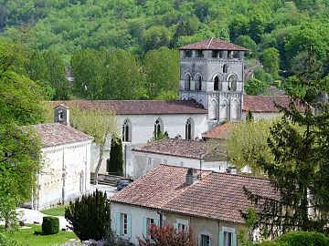
Brantôme Abbey on the Dronne
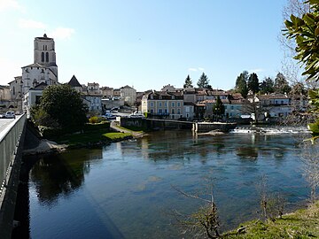
Saint-Astier on the Isle
Chancelade Abbey
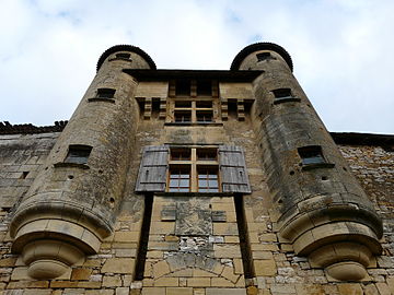
Entrance to Excideuil Castle

Ayat Castle

West facade of the Merlande Priory

The Vern valley near Pont-Romieux

Hautefort Castle


.jpg)

See also
literature
- Gilbert Le Pochat et al: Périgueux (Est) . In: Carte géologique de la France at 1/50 000 . BRGM.
- J.-P. Platel and others: Périgueux (Ouest) . In: Carte géologique de la France at 1/50 000 . BRGM, 1989.
- Frédéric Zégierman: Le Guide des Pays de France, Sud . Fayard, 1999.