
Landais (landscape)
The Landais is a heavily forested French heathland in the southwest of the Dordogne department in the Nouvelle-Aquitaine region .
etymology
The Landais, French le Landais or Forêt du Landais , Occitan lo Landés , is etymologically derived from the French feminine noun la lande - meaning heather (landscape) .
geography

The Landais lies between the towns of Mussidan and Montpon-Ménestérol in the north and Bergerac and Port-Sainte-Foy in the south. In the east it almost approaches Vergt , its western boundary follows the border with the Gironde department .
The Landais is surrounded by the following landscapes:
- the double in the north
- the Périgord central in the east
- the Bergeracois with the Pays de Vélines in the south
- the Libournais in the west.
The topographically deepest point with 22 meters is in the northwest corner on the Isle, the highest point with 219 meters is southeast of Villamblard in the eastern central section. The average height of the Landais is around 100 meters.
The Landais is criss-crossed by numerous smaller valleys. It is clear that non-carbonate, sandy, more or less gravelly soils or very clayey soils predominate in it. More than 50 percent of it is made up of forest , which is very dense, especially in the north, but loosens to the south and even gives way to wine-growing areas such as Sainte-Foy-la-Grande or Montravel on molasse sediments . In the Second Empire , the Landais and the neighboring Double were drained and reforested, mainly with maritime pines , which displaced the original oak forest , which was dominated by the sessile oak ( Quercus petraea ) . The plantations are now largely in very scattered private ownership.
administration
Administratively, the Landais share the Arrondissement Périgueux and the Arrondissement Bergerac with the cantons of Pays de la Force , Pays de Montaigne et Gurson and Vallée de l'Isle . At the intermunicipal level, the Communauté de communes Isle Double Landais , the Communauté de communes Isle et Crempse en Périgord , the Communauté de communes de Montaigne Montravel et Gurson and the Communauté d'agglomération Bergeracoise are responsible.
Hydrography

The Isle , which meanders to the west, forms the northern boundary of the Landais. In the south, the Landais extends within a few kilometers of the Dordogne , which also meanders to the west . The Crempse flowing to west-northwest drains the northeast sector and flows into the Isle at Mussidan as a left tributary. The Vern , which also flows into the Isle as a left tributary at Neuvic, represents the northeast border of the Landais. The Eyraud is a right tributary of the Dordogne that drains to the southwest and into which it flows at Bergerac. The Lidoire drains the south-west of the Landais in a south-west direction and also flows into the Dordogne as a right tributary at Castillon-la-Bataille .
geology

Geologically, the Landais forms part of the Aquitaine Basin and is mainly covered by tertiary and quaternary formations. In the eastern section - separated by a discordance - appears under the predominantly detritic, continental sediments marine Upper Cretaceous . After the Atlantic had completely retreated at the end of the Upper Cretaceous, the limestone platform fell victim to severe weathering and karstified . From the Lower Eocene , inland deltas were installed on this, which were fed from the Massif Central . In the Middle Eocene there was a strong increase in volume and grain size of the detritus. At the same time, the sea transgressed again with the Calcaires de Blaye in the western section of the Landais.
Further transgressions occurred in the Upper and Oligocene (for example, the Calcaire à astéries near Le Fleix was deposited in the Lower Oligocene ), but molasse sediments influenced by the Pyrenean orogenesis were also deposited. In the Miocene and Pliocene the sedimentation decreased very strongly, and the Oligocene alluvial plains were now subject to severe alteration.
In the course of the Quaternary, the river network was formed and structured, deepened and gradually acquired its current course.
During the entire course of the sedimentation, two facies areas can be distinguished in the Landais. The north-east section was under continental fluvial influence, while the south-west was dominated by palustrines, lacustrines and marine sediments.
The finds of Palaeotherium magnum and Xiphodon intermedium in the Upper Eocene are paleontologically significant .
economy
In addition to the dominant forestry , the existing agriculture is limited to clearings with meadows and pastures. The extensive cattle farming operated on them is intended for milk and meat production. Corn , tobacco and strawberries are also grown . Further south, there is also viticulture.
Photo gallery

The Landais near Sainte-Foy-des-Vignes

The RD 709 at Les Lèches

Forests near Lunas
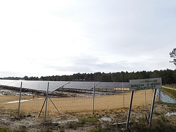
Solar power plant near Beaupouyet
.jpg)

_for%C3%AAt_Landais_depuis_Alix_(2).JPG)

See also
- Double (landscape)
- Libournais
- Périgord
- Périgord central
- Arrondissement of Bergerac
- Arrondissement of Périgueux
literature
- J. Dubreuilh: Sainte-Foy-la-Grande . In: Carte géologique de la France at 1/50 000 . BRGM, 1994, ISBN 2-7159-1805-4 .
- J.-P. Platel: Bergerac - Sud-Ouest du Périgord . In: Carte géologique de la France at 1/50 000 . BRGM, 1985.
- J.-P. Platel and others: Mussidan . In: Carte géologique de la France at 1/50 000 . BRGM, 1996, ISBN 2-7159-1782-1 .
- Frédéric Zégierman: Le Guide des Pays de France, Sud . Fayard, 1999.
Individual evidence
- ^ Bénédicte and Jean-Jacques Fénié: Dictionnaire des pays et provinces de France . Éditions Sud Ouest, 2000, ISBN 978-2-87901-367-1 , p. 349 .