
VI. Budapest district
|
VI. Budapest district Terézváros ( German ) Theresienstadt |
|||
|
|||
| Basic data | |||
|---|---|---|---|
| State : | Hungary | ||
| Region : | Central Hungary | ||
| County : | Budapest | ||
| Coordinates : | 47 ° 31 ' N , 19 ° 4' E | ||
| Area : | 2.38 km² | ||
| Residents : | 42,979 (Jan. 1, 2011) | ||
| Population density : | 18,058 inhabitants per km² | ||
| Postal code : | 1061-1068 | ||
| KSH kódja: | 16586 | ||
| Structure and administration (as of 2016) | |||
| Community type : | district | ||
| Structure : | Districts
|
||
| Mayoress : | Zsófia Hassay (Fidesz-KDNP) | ||
| Postal address : | Eötvös u. 3 1067 Budapest |
||
| Website : | |||
| (Source: A Magyar Köztársaság helységnévkönyve 2011. január 1st at Központi statisztikai hivatal ) | |||


The VI. District is the second smallest district in the Hungarian capital Budapest and is also known as Terézváros ( German "Theresienstadt").
Since 2005 the VI. District Partner District of Berlin city district center .
location
The district is located in the Pest district . In the north it borders on the XIII. District . In the northeast to the XIV. District , in the southeast to the VII. District , and in the west to the V district .
The area between Dózsa György Street, Városligeti Fasor, Lövölde Square, Király Street, Deák Ferenc Square, Bajcsy Zsilinszky Street, Nyugati Square, Váci Street, Lehel Street, Bulcsú Street and West Railway Station is called Terézváros designated.
The district is on average 103-104 m above sea level.
Individual evidence
photos

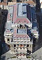


Aerial view


Web links
Commons : Budapest District VI - collection of pictures, videos and audio files