Ting Kau Bridge
Coordinates: 22 ° 21 '48 " N , 114 ° 4' 48" E
| Ting Kau Bridge 汀 九 橋 |
||
|---|---|---|
| Ting Kau Bridge as seen from Tsing Yi, 2007 | ||
| Official name | Ting Kau Bridge | |
| use | 6 tracks, |
|
| Crossing of | Rambler channel | |
| place | Hong Kong , China | |
| construction | Cable-stayed bridge | |
| overall length | 1,177 m | |
| width | 42.8 m | |
| Longest span | 475 m | |
| height | 201.55 m | |
| building-costs | HKD 1.94 billion | |
| start of building | 1994 | |
| completion | 1998 | |
| opening | 1998 | |
| planner | Schlaich Bergermann partner | |
| toll | free for all vehicles | |
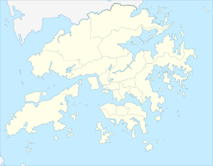
| location | ||
|
|
||
The Ting Kau Bridge ( Chinese 汀 九 橋 / 汀 九 桥 , Pinyin Tīngjiǔ Qiáo , Jyutping Ding 1 gau 2 Kiu 4 ) is a 1,177 meter long cable-stayed bridge in Hong Kong , which extends from northwestern Tsing Yi Island to Tuen Mun Road in Tsuen Wan District extends. It is within sight of the Tsing Ma Bridge , which serves as an essential link to Hong Kong International Airport and Lantau Island . The bridge was completed in 1998. It can be crossed free of charge.
Infrastructure
The bridge is one of many infrastructure projects as part of the new construction of the Chek Lap Kok International Airport , which is located around 30 kilometers from Hong Kong Island north of Lantau Island . Together with the Tsing Ma Bridge and the Cape Shui Mun Bridge , the Hong Kong landscape creates an interesting panorama on the way from the city center to the airport. The Ting Kau Bridge has the highest traffic volume of the three bridges mentioned. Many trucks drive along this route between the home country PR China and the container port of Hong Kong. A special color match and lighting adapted to the architecture lift the bridge out of its surroundings.
Construction and special features
The Ting Kau Bridge was the world's first large cable-stayed bridge with three pylons and four main spans . The pylons have heights of 170 meters on the Ting Kau side, 194 meters on an artificial island and 158 meters above sea level on the northwest coast of Tsing Yi. The design of the pylons is another special feature of the building. Due to the high wind loads from typhoons , these are designed as slim, guyed masts. In the transverse direction, the stabilization is carried out by ropes and transverses, similar to the mast bracing on sailboats. In the longitudinal direction, the middle main pylon also has stay cables for longitudinal stabilization, which connect the pylon tip with the roadway girder on the neighboring pylons.
To improve wind stability, the 42.8 meter wide main bridge has two 18.77 meter wide superstructures, separated by a 5.26 meter wide gap, each suspended on two rope levels. The 1.75-meter-high superstructures have a composite cross-section consisting of a 24-centimeter-thick deck made of precast reinforced concrete and longitudinal and cross members.
The Ting Kau Bridge and its approach bridges as part of the Route 3 motorway connect the western New Territories , an administrative district in Hong Kong , with the home country of China to the Lantau Link motorway connection (also known as " Lantau Fixed Crossing "), which is the new airport Kowloon and Hong Kong Island connects. The junction is only 500 meters from Tsing Ma Bridge on Tsing Yi Island . With approach bridges, the bridge has a total length of 1,875 meters of which the main bridge occupies 1,177 meters. The bridge crosses the Rambler Channel , which is approximately 900 meters wide. Each direction of travel has three lanes and the usual fall protection.
Dimensions
- Total length: 1,177 m
- Spans: 127 + 448 + 475 + 127 m
- Main pylon height: 201.55 m
- Ting Kau pylon height: 173.30 m
- Tsing Yi pylon height: 164.30 m
- Bridge surface: 46,000 m²
- Steel cable tensioning of the roadway: 2,800 tons
- Structural steel roadway: 8,900 tons
- Weight of concrete segments: 29,000 tons
- Reinforcement in the roadway: 90 kg / m²
- Number of stay cables: 384
- Movements
- vertical with medium span: 1.6 m
- across with medium span: 0.4 m
- Longitudinal extension at the end pillar or Tsing Yi abutment: 390 mm
Planning and construction
The bridge was designed and built by the Ting Kau Conctractors Joint Venture between 1994 and 1998. The joint venture consisted of Cubiertas Y Mzov (22%), Entrecanales Y Tavora (22%), both from Spain and parts of Acciona SA, Züblin (22%) from Germany, Downer & Co. (22%) from Australia and Paul Y (12%) from Hong Kong. Schlaich Bergermann und Partner from Stuttgart was responsible for planning and construction management .
costs
The planning and total costs were HK $ 1.94 billion. The bridge is one of the world's longest of this type. Together with the Tsing Ma Bridge and the Kap Shui Mun Bridge , it is continuously monitored by the Wind and Structural Health Monitoring System (WASHMS).
See also
Web links
Individual evidence
- ↑ a b Roads in New Territories - Ting Kau Bridge: (Chinese, English) [1] , In: www.hyd.gov.hk, accessed March 19, 2019 - online
- ↑ Ting Kau Bridge: (Chinese, English) [2] , In: www.hyd.gov.hk, ( Memento from March 19, 2019 in the Internet Archive ), accessed March 19, 2019 - online
- ↑ Ting Kau Bridge: (English) Hong Kong Highways Department PDF file 208 kB , In: www.hyd.gov.hk, accessed March 19, 2019 - online


