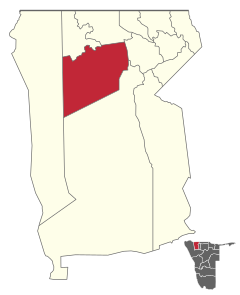
Tsandi (constituency)
 Details |
Tsandi constituency |
| Basic data | |
|---|---|
|
State region |
Namibia Omusati |
|
Population area District administrative seat |
27,435 (2011) 5363 km² Tsandi |
| Election information | |
|
Registered voters |
14831 |

Tsandi is a constituency in the region Omusati in Namibia . The administrative seat is the village of the same name, Tsandi .
The constituency has almost 27,500 inhabitants (as of 2011) on an area of 5363 square kilometers .
The constituency borders on the Kunene region of Namibia and has a certain development potential due to the good pastureland and the rapidly developing tourism.
politics
Nangolo Mutota of the ruling SWAPO has been the representative of the constituency in the regional administration since the beginning of 2011 .
In the 2010 regional council elections , the following official final result was determined for the constituency of Tsandi.
| Political party | be right | Share of votes |
|---|---|---|
| SWAPO | 7986 | 98.43% |
| RDP | 67 | 0.83% |
| invalid | 60 | 0.74% |
| All in all | 8113 | 100% |
economy
Agricultural production continues to play an important role in the Tsandi constituency today. The cultivation of Omahangu and cattle farming play key roles. In 2003 the constituency generated a monthly income of around 2.8 million Namibian dollars .
Culture and sights
In the village of Ongulumbashe , a 15-minute drive from the settlement of Tsandi , the Ongulumbashe Monument can be visited. This memorial was erected in memory of the first violent confrontation between activists of the Namibian liberation movement and the South African authorities, which took place in Ongulumbashe in 1966.
In Tsandi and the surrounding area there are some very stately and well-known baobab trees, such as B. the King Nashilongos Baobab , whose hollow trunk served that king as an " office ". In addition, the Sir Howards Baobab should be mentioned, which is a particularly stately specimen. This tree was named in honor of the first South African caretaker who visited the region in 1916.
Individual evidence
- ↑ 2011 Population and Housing Census, Omusati Regional Tables based on the 4th Delimitation. Namibia Statistics Agency, 2014. p. 3ff ( Memento of the original from April 2, 2015 in the Internet Archive ) Info: The archive link was inserted automatically and has not yet been checked. Please check the original and archive link according to the instructions and then remove this notice.
- ↑ VIABILITY OF COMMERCIAL BANK BRANCHES IN RURAL COMMUNITIES IN NAMIBIA. Bank of Namibia, Windhoek 2004, p. 27 ( Memento from January 17, 2012 in the Internet Archive )
- ^ Tsandi counselor to focus on development . New Era, January 11, 2011 ( Memento from September 10, 2012 in the web archive archive.today )
- ↑ 2010 Regional Elections . ElectionWatch ( December 2, 2011 memento in the Internet Archive ) accessed on August 1, 2011
- ↑ VIABILITY OF COMMERCIAL BANK BRANCHES IN RURAL COMMUNITIES IN NAMIBIA. Bank of Namibia, Windhoek 2004, p. 28 ( Memento from January 17, 2012 in the Internet Archive )
- ↑ a b Between Mahangu fields and Makalani palms - in the far north of Namibia . Namibia Tourism Board, Frankfurt 2005 ( Memento of the original dated August 13, 2011 in the Internet Archive ) Info: The archive link was inserted automatically and has not yet been checked. Please check the original and archive link according to the instructions and then remove this notice. (PDF; 1.3 MB)
Coordinates: 17 ° 45 ′ 0 ″ S , 14 ° 53 ′ 0 ″ E

