Tsandi
| Village Tsandi
|
|||
|---|---|---|---|
|
|||
| Tsandi main street with informal market stalls | |||
| motto | - | ||
| Basic data | |||
|
Population Area Population Density |
around 2000 (2009) |
||
|
State Region Constituency |
Namibia Omusati Tsandi |
||
| Establishment date | |||
|
License plate phone code |
|
||
| Website | |||
|
Geographical data
Geographical coordinates : 17 ° 45′00 "S., 14 ° 53′00" E. |
|||
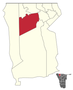
Tsandi is a village in the Omusati region in Namibia with around 2000 inhabitants (as of 2011). It is located 30 kilometers south of Outapi and about 125 kilometers from Oshakati . Tsandi is 1,102 meters above sea level in the constituency of the same name . Tsandi lies on a plateau with flat ephemeral watercourses ( Oshanas ) on the western edge of the so-called Oshana system .
Tsandi lost its official settlement status, granted on July 15, 1997, on April 1, 2015, and was elevated to village status on the same day .
Local politics
In the local elections in 2015 , no other party besides SWAPO ran , so it received all five seats on the local council.
Economy and Infrastructure
Within the constituency of the same name, only Tsandi is connected to the country's electricity network. A fiber optic cable connects the place to the Namibian telephone network. There is also a post office, a police station, a gas station, a hotel, a bakery and numerous shops and supermarkets in the village. In addition, local branches of numerous national ministries are located in the village. In January 2014 a local initiative accepted the challenge of installing a municipal sewer system. It is unclear when the work will be completed.
Attractions
The residence of the Uukwaluudhi king is located in Tsandi . This office is currently held by King Shikongo Josea Taapopi , whose traditional residence can be visited today, while he himself now lives in a solid stone house near this traditional residence (2005).
Photo gallery
Individual evidence
- ↑ Vegetation and forage quality aspects of the communal grassland in Ovamboland / Namibia - determining factors and development opportunities . Institute for Plant Production and Plant Breeding II - Grassland Management and Forage Production, Justus Liebig University, Giessen 2004. (PDF; 7.7 MB)
- ^ Government Gazette of the Republic of Namibia. Republic of Namibia, April 30, 2015, No. 5721, Note 60/61, p. 6f
- ↑ Official election results of the regional and local elections 2015, ECN, December 4, 2015 ( Memento of December 10, 2015 in the Internet Archive ) (PDF; 150 kB)
- ^ Namibian Sun - Tsandi community takes development into own hands from January 19, 2014
- ↑ Between mahangu fields and makalani palms - in the far north of Namibia . Namibia Tourism Board, Frankfurt 2005 ( Memento from August 13, 2011 in the Internet Archive ) (PDF; 303 kB)
Coordinates: 17 ° 45 ′ S , 14 ° 53 ′ E


