Tschegem Wtoroi
Village
|
||||||||||||||||||||||||||||||||
|
||||||||||||||||||||||||||||||||
|
||||||||||||||||||||||||||||||||
| List of large settlements in Russia | ||||||||||||||||||||||||||||||||
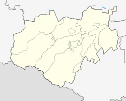
Tschegem Wtoroi ( Russian Чегем Второй , often Tschegem 2-j, Чегем й 2 or Tschegem-2, Чегем-2 ; Kabardian Шэджэм ЕтӀуанэ ) is a village (selo) in the Republic of Kabardino-Balkaria in Russia (with 10,769 residents as of October 14, 2010).
geography
The place is located on the northern edge of the Greater Caucasus a good 10 km as the crow flies north of the republic capital Nalchik , on the left bank of the Tschegem River .
Tschegem Wtoroi belongs to the Tschegemski Rajon and connects directly to the north, across the river, to its administrative center Tschegem . The village is the seat and only locality of the rural community (selskoje posselenije) Tschegem Vtoroi.
history
The village was founded towards the end of the 18th century by a Kabardian ( Circassian ) prince with the (Russified) name Kundetow and therefore called Kundetowo . The Aul , today's town of Tschegem, which was built on the opposite bank of the river in 1822 , initially bore the same name. After the October Revolution , this name was replaced in 1920 as a derivation from the name of a noble family by the name of the river, now, contrary to the order in which it was founded, differentiated into Tschegem Pervy, "First Tschegem" and Tschegem Wtoroi, "Second Tschegem".
While Tschegem Pervy, the administrative seat of the Tschegemski rajon created in 1935 since 1944, overtook Tschegem Wtoroi in terms of population in the 1960s, became an urban-type settlement in 1972 and town in 2000 without the addition of Pervy to its name , Tschegem Wtoroi has retained its village status to this day.
Population development
| year | Residents |
|---|---|
| 1959 | 5,303 |
| 1970 | 6,419 |
| 1979 | 6,502 |
| 2002 | 10,632 |
| 2010 | 10,769 |
Note: census data
traffic
The old route of the federal trunk road R217 Kawkas (formerly M29) runs past the western edge of the village, which since the 1970s has been expanding into a multi-lane expressway connecting Nalchik via Tschegem with Baksan to the north . In a westerly direction, a regional road branches off up the Tschegem via Letschinkai and Nizhny Tschegem to Verkhny Tschegem . The new route of the R217, opened as a motorway between 1999 and 2011, bypasses Tschegem Wtoroi together with the cities of Nalschik and Tschegem to the north.
The nearest train station is in Nalchik.
Web links
- Official website of the local government (Russian)
Individual evidence
- ↑ a b Itogi Vserossijskoj perepisi naselenija 2010 goda. Tom 1. Čislennostʹ i razmeščenie naselenija (Results of the All-Russian Census 2010. Volume 1. Number and distribution of the population). Tables 5 , pp. 12-209; 11 , pp. 312–979 (download from the website of the Federal Service for State Statistics of the Russian Federation)

