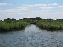
Unteruckersee
| Unteruckersee | ||
|---|---|---|

|
||
| Unteruckersee with a view of Prenzlau | ||
| Geographical location | Uckermark district | |
| Tributaries | Ucker- (Canal) , Dreescher Seegraben, Schäfergraben Prenzlau , Höftgraben | |
| Drain | Ucker | |
| Places on the shore | Prenzlau | |
| Data | ||
| Coordinates | 53 ° 17 '0 " N , 13 ° 52' 0" E | |
|
|
||
| Altitude above sea level | 17.5 m above sea level HN | |
| surface | 10.3 km² | |
| volume | 0,102.24 km³ | |
| Maximum depth | 19.3 m | |
The Unteruckersee in the northeast of Brandenburg is the largest lake in the course of the Ucker . The district town of Prenzlau extends around the northernmost part of the lake on the lakeshore . The places Röpersdorf and Zollchow are on the west bank .
The time of origin can be traced back to the late Pleistocene . In the Vistula Ice Age, a glacial channel typical of northern Germany was created .
The Uckerkanal forms the main inflow of the Unteruckersee . This connects the two Uckerseen . The flow of the Unteruckersee is regulated by a weir system, which is an important function for the city of Prenzlau, especially during floods.
The Unteruckersee has an area of about ten square kilometers, with an effective width of 2.13 kilometers and an effective length of about seven kilometers. It is about 19 meters deep at its deepest point. This makes it the fourth largest natural lake in Brandenburg. The water has a catchment area of about 39 km². The lake is designated as a state waterway .
Naming
Around the 6th century, the Ukranians immigrated to the Uckermark . The center of the tribe was around both Uckerseen.
Tributaries

The largest tributary is the Uckerkanal from the Oberuckersee. Other tributaries are the Dreescher Seegraben, the Schäfergraben and the Höftgraben.
Lake cruises
On the Unteruckersee a trip with the passenger ship "Onkel Albert" is possible. Round trips on the Unteruckersee, trips to Warnitz and back or combined boat and bike tours are offered. There are three landing stages in Unteruckersee: Röpersdorf, Prenzlau “Uckerpromenade” and Prenzlau “Am Kap”.
Region / origin
The Uckermark as a moraine landscape was shaped by the Ice Age . The receding ice masses left behind a hilly flat land that is dotted with many small lakes. These lakes, including the Unteruckersee, are the remnants of residual ice that collected large amounts of water when thawing in the hollows and hollows. Many remaining boulders, so-called boulders , are evidence of the enormous ice movements around 14,200 years ago.
The extraordinary wealth of lakes is a special characteristic of the young moraine landscape in northeast Brandenburg. There are over 250 lakes in the Schorfheide-Chorin Biosphere Reserve alone .
See also
Web links
- Documentation of the condition and development of the most important lakes in Germany of the TU Cottbus, part 5: Brandenburg (PDF file; 1.92 MB)
Individual evidence
- ^ Federal and state waterways 2015 in the state of Brandenburg. In: brandenburg.de. Retrieved August 28, 2020 .


