
Administrative community Gera-Aue
| coat of arms | Germany map | |
|---|---|---|

|
Coordinates: 51 ° 7 ' N , 10 ° 55' E |
|
| Basic data | ||
| State : | Thuringia | |
| County : | Sömmerda | |
| Area : | 54.33 km 2 | |
| Residents: | 5034 (Dec. 31, 2019) | |
| Population density : | 93 inhabitants per km 2 | |
| License plate : | SÖM | |
| Association key : | 16 0 68 5002 | |
| Association structure: | 4 municipalities | |
| Association administration address : |
Marktplatz 13 99189 Gebesee |
|
| Website : | ||
| Chairman : | Rudiger Kleppe | |
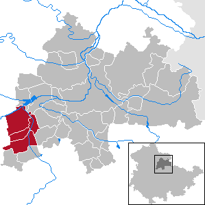
| Location of the Gera-Aue administrative community in the Sömmerda district | ||
  |
||

In the administrative community of Gera-Aue from the Thuringian district of Sömmerda , the city of Gebesee and three municipalities have come together to handle their administrative business. The administrative community was founded on April 9, 1994.
The administrative association is based in Gebesee .
Communities
- Andisleben
- Gebesee , city
- Ring life
- Whale life
Web links
Individual evidence
- ^ Population of the municipalities from the Thuringian State Office for Statistics ( help on this ).
existing: Gera-Aue | Gramme-Vippach | Kindelbrück | Kölleda | Straussfurt
former: At the mark | Buttstädt | Gram level | Gramme floodplain | Großrudestedt | Scherkondetal | Castle Vippach