
Administrative community Königsbrück
| coat of arms | Germany map | |
|---|---|---|
 Help on coat of arms |
Coordinates: 51 ° 15 ' N , 13 ° 53' E |
|
| Basic data | ||
| State : | Saxony | |
| County : | Bautzen | |
| Area : | 181.76 km 2 | |
| Residents: | 8010 (Dec. 31, 2019) | |
| Population density : | 44 inhabitants per km 2 | |
| License plate : | BZ, BIW, HY, KM | |
| Association key : | 14 6 25 5218 | |
| Association structure: | 3 municipalities | |
| Association administration address : |
Markt 20 01936 Koenigsbrück |
|
| Website : | ||
| Administrative Chairman: | Heiko Driesnack | |
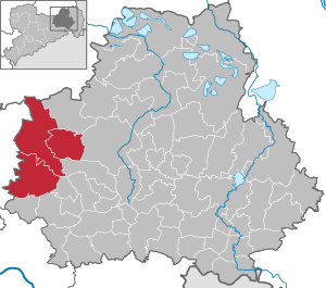
| Location of the Königsbrück administrative community in the Bautzen district | ||
  |
||

The administrative association Königsbrück is an administrative association in the Free State of Saxony in the district of Bautzen . It is located in the west of the district, about 15 km west of the city of Kamenz and 30 km northeast of the state capital Dresden . The community area is located in the predominantly wooded heathland of the Königsbrücker Heide , which is partly part of the Westlausitz landscape protection area. In the north of the community area there is a former military training area, which today is known as Königsbrücker Heide and is the largest nature reserve in Saxony. The Laußnitzer Heide joins in a south-westerly direction .
The city of Königsbrück is traversed by the Pulsnitz . The federal highway 97 and the federal highway 98 as well as the railway line Dresden – Königsbrück run through the community area . Federal motorway 4 runs south of the community area and can be reached via the Hermsdorf and Ottendorf-Okrilla connections. The federal highway 13 runs to the west with the junction Thiendorf .
The municipalities with their districts
- Königsbrück with the districts of Königsbrück (city), Graefenhain and Röhrsdorf
- Laußnitz with the districts Laußnitz, Glauschnitz and Höckendorf
- Neukirch with the districts of Neukirch, Schmorkau, Gottschdorf, Weißbach and Koitzsch