
Administrative community Neschwitz
| coat of arms | Germany map | |
|---|---|---|
 Help on coat of arms |
Coordinates: 51 ° 16 ' N , 14 ° 20' E |
|
| Basic data | ||
| State : | Saxony | |
| County : | Bautzen | |
| Area : | 57.8 km 2 | |
| Residents: | 3221 (Dec. 31, 2019) | |
| Population density : | 56 inhabitants per km 2 | |
| License plate : | BZ, BIW, HY, KM | |
| Association key : | 14 6 25 5223 | |
| Association structure: | 2 municipalities | |
| Association administration address : |
Bahnhofstrasse 1 02699 Neschwitz |
|
| Website : | ||
| Administrative Chairman: | Gerd Schuster | |
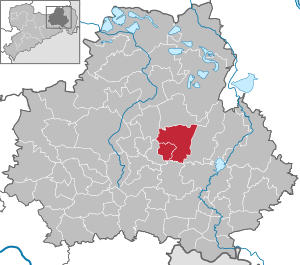
| Location of the administrative community Neschwitz in the district of Bautzen | ||
  |
||

The administrative community Neschwitz , Upper Sorbian Zarjadniske zhromadźenstwo Njeswačidło , is an administrative community in the Free State of Saxony in the district of Bautzen . It is located in the center of the district, around 10 km northwest of the district town of Bautzen , south of the Upper Lusatian Heath and Pond Landscape Biosphere Reserve . The federal highway 96 runs through the community area . The federal motorway 4 runs through the south of the community area . This can be reached via the Bautzen-West connection .
The municipalities with their districts
- Neschwitz with the districts Neschwitz ( sorbisch Njeswačidło ) Caßlau ( Koslow ), Doberschütz ( Dobrošicy ) Holscha ( Holešow ) Holschdubrau ( Holešowska Dubrawka ) Kleinholscha , Krinitz ( Króńca ) Lissahora ( LISA Hora ), Loga ( Łahow ) Lomske ( Łomsk ), Luga ( Łuh ), Neudorf ( Nowa Wjes ), Pannewitz ( Banecy ), Saritsch ( Zarěč ), Uebigau ( Wbohow ), Weidlitz ( Wutołčicy ) and Zescha ( Šešow )
- Puschwitz with the districts of Puschwitz ( Sorbian Bóšicy ), Guhra ( Hora ), Jeßnitz ( Jaseńca ), Lauske ( Łusč ), Neu-Jeßnitz ( Nowa Jaseńca ), Neu-Lauske ( Nowy Łusč ), Neu-Puschwitz ( Nowe Bóšicy ) and Wetro ( Wětrow )