Desert (remscheid)
|
desert
City of Remscheid
Coordinates: 51 ° 12 ′ 43 " N , 7 ° 12 ′ 28" E
|
||
|---|---|---|
| Height : | 260 m above sea level NN | |
| Postal code : | 42369 | |
| Area code : | 0202 | |
|
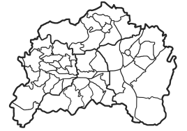
Location of desert in Remscheid |
||
Desert is a court in the north of the Bergisch city of Remscheid (district Lüttringhausen ) in North Rhine-Westphalia / Germany directly on the city border with Wuppertal - Ronsdorf .
Location and description
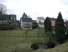
It stretches from the Leyerbachtal up the ridge towards the wing and is about 260 meters above sea level . There are around 20 residential buildings in the desert today. In the valley there was the no longer existing Wüster Hammer . Friedrich Wilhelm Erbschloe jun. built the so-called "Erbschloe Hammer" in 1779. The associated former mill ditch is the last visible piece of associated history, because the building was demolished in 1996 to make way for a rainwater retention basin. The Wüsterkotten was an old Schleifkotten that lay down the stream in the direction of August-Erbschloe-Strasse.
The Ronsdorf-Müngstener railway line, which opened on August 21, 1891 and closed on August 30, 1959, also ran here in the valley . Railway stations were in Graben and Halbach . Today there is a regional bus route (670) between Remscheid and Ronsdorf.
history
The first mention of the place took place in 1520. In the Topographia Ducatus Montani by Erich Philipp Ploennies from 1715 it is recorded as "adWüsten".
Around 1710 desert was part of the Honschaft Erbschlö of the parish Lüttringhausen in the office of Beyenburg under the name Halbachswüsten . In the 19th century, however, the membership in the Hohenhagen honor of the mayor of Lüttringhausen is documented.
100 inhabitants were counted in 1815/16. The place, categorized as a hamlet according to the statistics and topography of the Düsseldorf administrative district in 1832 , was called a desert and at that time had nine residential buildings, six factories and mills and seven agricultural buildings. At that time, 66 residents lived in the village, 62 of them Protestant and four Catholic. In the municipality lexicon for the Rhineland province from 1888, seven houses with 57 inhabitants are given for desert .
literature
- Hans Kadereit : Where there is still celebrations, reeling and pounding , a historical illustrated book. Lüttringhausen, RGA-Buchverlag, Remscheid 2009, ISBN 978-3-940491-07-7
Individual evidence
- ^ Company-Erbschloe
- ^ Klaus-Günther Conrads, Günter Konrad: Ronsdorfer Heimat- und Bürgererverein | from 1246 to 1699. In: ronsdorfer-buergerverein.de. www.ronsdorfer-buergerverein.de, accessed on February 1, 2016 .
- ^ Ernst Erwin Stursberg : Alt-Lüttringhausen , Mann Verlag, 1950
- ↑ a b Johann Georg von Viebahn : Statistics and Topography of the Administrative District of Düsseldorf , 1836
- ^ Community encyclopedia for the province of Rhineland. Based on materials from the census of December 1, 1885 and other official sources, edited by the Royal Statistical Bureau. In: Royal Statistical Bureau (Hrsg.): Community encyclopedia for the Kingdom of Prussia. tape XII , 1888, ZDB -ID 1046036-6 ( digitized version ).


