Baur (Wuppertal)
|
Baur
City of Wuppertal
Coordinates: 51 ° 14 ′ 19 ″ N , 7 ° 11 ′ 2 ″ E
|
||
|---|---|---|
| Height : | 315 m above sea level NHN | |
|
Location of Baur in Wuppertal |
||
|
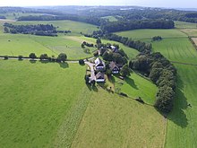
The two old living spaces plus the new living space (first third of the 20th century) of the Baur court, above Friedrichshöhe
|
||
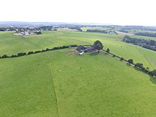
Baur is a court in the Ronsdorf district of the Bergisch city of Wuppertal in North Rhine-Westphalia . It consists of two neighboring living spaces.
Location and geography
Baur is located northwest of the center of Ronsdorf in the residential area of Ronsdorf-Mitte / Nord south of the Lichtscheids at an altitude of 315 m above sea level. NHN . The Dornbach, one of the source tributaries of the Gelpe, rises in Baur .
history
In 1426 " Buer " was first mentioned in a document. The same spelling can be found in the Topographia Ducatus Montani by Erich Philipp Ploennies , another spelling of the early modern period is " Auf'm Bawer ".
In the Middle Ages, Bauer was at the northernmost point of the parish of Lüttringhausen in the Bergisches Amt Beyenburg on the border with the Amt Elberfeld .
Baur belonged to the late Middle Ages and early modern period to Honschaft Erbschloe , but was not the bergischen dukes or their Beyenburger bailiff dutiable, but was subject to a tax and special leave by Duke Adolf of Juelich-Berg the monastery stone house in Beyenburg. Baur probably had its own chapel as a monastery property . This is accepted in the neighboring village of Kapellen .
The Elberfeld line of the Bergische Landwehr ran east and south of Baur in the late Middle Ages . The Baurer turnpike in the Landwehr is documented from documents from the 18th century , so that one can assume that the road through Baur is more important. In 1710 three houses were counted in the place called aufm Bawer .
On the Topographia Ducatus Montani by Erich Philipp Ploennies from 1715, the two farms are listed as Buer and S.Buer . On the topographical survey of the Rhineland from 1824, the places are referred to as Aufm Bauer . Schulten Bauer recorded. On the Prussian first recording from 1843, both are recorded as Baur .
In 1832 Baur belonged to the Holthauser Rotte in the rural outskirts of the city of Ronsdorf . The place, categorized as a hamlet according to the statistics and topography of the Düsseldorf administrative district , had six residential buildings and four agricultural buildings at that time. At that time 70 people lived in the place, seven Catholic and 63 Protestant faith. In the municipality lexicon for the province of Rhineland from 1888, five houses with 75 inhabitants are given.
Individual evidence
- ^ Klaus-Günther Conrads, Günter Konrad: Ronsdorfer Heimat- und Bürgererverein | from 1246 to 1699. In: ronsdorfer-buergerverein.de. www.ronsdorfer-buergerverein.de, accessed on February 1, 2016 .
- ^ A b Gerd Helbeck : Beyenburg. History of a place on the Bergisch-Mark border and its surrounding area. Volume 1: The Middle Ages. Basics and advancement. Association for local history, Schwelm 2007, ISBN 978-3-9811749-1-5 .
- ^ Klaus-Günther Conrads, Günter Konrad: Ronsdorfer Heimat- und Bürgererverein | from 1700 to 1724. In: ronsdorfer-buergerverein.de. www.ronsdorfer-buergerverein.de, accessed on February 1, 2016 .
- ↑ Johann Georg von Viebahn : Statistics and Topography of the Administrative District of Düsseldorf , 1836
- ↑ Königliches Statistisches Bureau (Prussia) (Ed.): Community encyclopedia for the Rhineland Province, based on the materials of the census of December 1, 1885 and other official sources, (Community encyclopedia for the Kingdom of Prussia, Volume XII), Berlin 1888.


