Waldau (Osterfeld)
|
Waldau
City of Osterfeld
Coordinates: 51 ° 4 ′ 0 ″ N , 11 ° 55 ′ 59 ″ E
|
|
|---|---|
| Height : | 228 m |
| Area : | 5.55 km² |
| Residents : | 492 (December 31, 2008) |
| Population density : | 89 inhabitants / km² |
| Incorporation : | January 1, 2010 |
| Postal code : | 06721 |
| Area code : | 034422 |
Waldau is a district of the city of Osterfeld in the Burgenland district in Saxony-Anhalt .
geography
Waldau is approx. 13 km southeast of Naumburg (Saale) am Steinbach.
Haardorf was designated as a district of the former municipality .
history
Waldau was first mentioned in a document in 1256 .
On July 1, 1950, the Haardorf community was incorporated into Waldau.
On January 1, 2010, the previously independent community of Waldau was incorporated into the city of Osterfeld together with the communities of Heidegrund and Goldschau .
Culture and sights
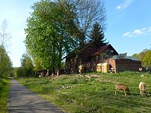
The church with the baroque tower tower was built in its current form in the 18th century.
Economy and Infrastructure
traffic
For federal highway 180 , the Naumburg (Saale) to Zeitz runs and the junction Osterfeld at the Federal Highway 9 are northeast of the community there km approx. 4
The railway connection ( Zeitz – Camburg railway ) was discontinued in 1998, and an asphalt bike path was laid out on the route between Zeitz and Schkölen.
economy
From 1830 to 1930, lignite was mined near Waldau, which was transported away by rail from 1897. In 1873 a sweltering factory and a mineral oil factory were built.
Personalities
- Paul Schreck (1892–1948), politician, born in Haardorf


