Wallücke
| Wallücke | |||
|---|---|---|---|
|
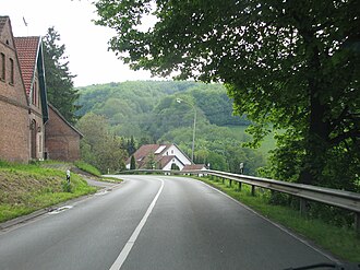
The pass road from the northeast to Wallücke |
|||
| Compass direction | North | south | |
| Pass height | 152 m above sea level NN | ||
| district | Minden-Lübbecke | ||
| Valley locations | Oberlübbe | Schnathorst | |
| expansion | Landstrasse 876 (formerly also railway) |
||
| Mountains | Wiehengebirge | ||
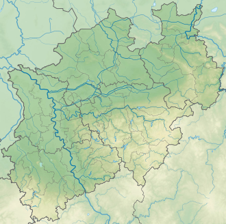
| map | |||
|
|
|||
| Coordinates | 52 ° 16 '31 " N , 8 ° 45' 24" E | ||
The Wallücke is a pass in the Wiehengebirge near Hille in North Rhine-Westphalia . In the Wiehengebirge, such mountain cuts are also called dorers . The saddle is on the border between the city of Bad Oeynhausen and the municipality of Hille in the Minden-Lübbecke district .
The main ridge of the Wiehengebirge, which is otherwise 200 to 250 meters high, is only 152 m above sea level here. NN . This natural circumstance and the fact that the Wallücke lies roughly in the middle of the mountain barrier (based on the section between the river breakthroughs of Großer Aue near Neue Mühle and Weser ( Porta Westfalica )) were the reason that a pass road was established here early on crossed the mountains. In earlier times a railway line, the Wallücker Willem , ran up to this saddle. The route was built mainly in order to be able to transport the iron ore extracted in a quarry ("Steinbruch Störmer") on the mountain ridge to the south. Fossils have been found in the quarry itself. In 1985 the planned construction of a connecting motorway to the federal motorway 30 Bad Oeynhausen / Bremen (continuation of the federal motorway 5 ) was finally rejected by the Wallücke. A few hundred meters further east is another pass over the Wiehengebirge near Bergkirchen .
The pass is flanked by the elevations Elfter Kopf ( 233 m above sea level , west) and the Bergkirchener Kopf ( 255.4 m , east). The closed forest belt, which otherwise covers the eastern Wiehengebirge in a width of 0.5 to 2.2 kilometers, is interrupted on the Wallücke, albeit at only around 100 meters.
Origin of name
There is no evidence of the origin of the name. It seems, however, that the Wallücke describes an interruption, i.e. a gap , in the wall- like Wiehen Mountains quite aptly. The Wallücke is in a certain way one of the few areas where the Lübbecker Loessland borders directly on the Ravensberg hill country in the north .
Today's meaning
At present, Landstrasse 876 runs over the Wallücke, which ensures the connection to Bundesstrasse 65 and thus to the district town of Minden for the Schnathorst - Tengern - Wulferdingsen area . The traffic load is around 6,600 vehicles per day. In addition, a high-voltage line runs over this mountain saddle.
literature
- Joannis Michelis, Martin P, Sander, Ralf Metzdorf, Harry Breitkreuz: The vertebrate fauna of the Callovian (Middle Jura) from the Störmer quarry (Wallücke, Wiehengebirge) . Ed .: Alfred Hendricks. 1st edition. Westphalian Museum of Natural History, 1996, ISBN 3-924590-56-7 .

