Warmersdorf (Bodenwoehr)
|
Warmersdorf
City of Bodenwohr
Coordinates: 49 ° 16 ′ 54 ″ N , 12 ° 13 ′ 39 ″ E
|
||
|---|---|---|
| Height : | 425 m above sea level NHN | |
| Incorporation : | May 1, 1978 | |
| Postal code : | 92439 | |
| Area code : | 09439 | |
|
Location of Warmersdorf in Bavaria |
||
|
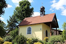
Lady Chapel (2017)
|
||
Warmersdorf is a village in the municipality of Bodenwöhr in the Upper Palatinate district of Schwandorf ( Bavaria ).
geography
Warmersdorf is located in the east of Bavaria in the Upper Palatinate, one kilometer south of the federal highway 85 , which leads from Schwandorf to Cham . The pilgrimage chapel of St. Koloman is located about 600 meters south of the village .
history
In 1364 Albrecht the Freudenberger sold his estate in Warinstorf (Warmersdorf) and other goods in Meltaw (Meldau) to the Reichenbach monastery . In 1402 a Reichenbach fiefdom is entered in a Salbuch near Warmstor . The Schottenkloster St. Jakob in Regensburg had little real estate in Warmsdorf from 1390 to 1561.
Tax district
The Kingdom of Bavaria was divided into 15 districts in 1808. These districts were named after rivers based on the French model ( Naabkreis , Regenkreis , Unterdonaukreis , etc.). The districts were divided into district courts. The district court district of Neunburg vorm Wald had 55 tax districts. At the beginning of the 19th century, Altenschwand, Mappenberg, Meldau, Neuenschwand and Warmersdorf belonged to the tax district of Altenschwand.
Community membership
The municipality of Altenschwand included the villages, hamlets and wastelands Altenschwand (24 families), Warmersdorf (5 families), Meldau (4 families) and Mappenberg (2 families). On May 1, 1978, the Altenschwand community with Altenschwand (Kirchdorf and Weiler), Mappenberg, Meldau and Warmersdorf was dissolved and incorporated into the Bodenwöhr community.
Attractions
- Pilgrimage Chapel of St. Koloman
Individual evidence
- ^ Wilhelm Nutzinger, Historical Atlas of Bavaria, Neunburg vorm Wald, p. 82
- ^ Wilhelm Nutzinger, Historical Atlas of Bavaria, Neunburg vorm Wald, p. 87
- ^ Ernst Emmering: The government of the Upper Palatinate, history of a Bavarian central authority. In: Contributions to the history and regional studies of the Upper Palatinate. Issue 20, Regensburg 1981, p. 12ff.
- ^ Wilhelm Nutzinger, Historical Atlas of Bavaria, Neunburg vorm Wald, p. 330
- ^ Wilhelm Nutzinger, Historical Atlas of Bavaria, Neunburg vorm Wald, p. 417
literature
- Wilhelm Nutzinger: Historical Atlas of Bavaria, Part of Old Bavaria, Issue 52, Neunburg vorm Wald , Munich 1982, ISBN 3-7696-9928-9


