Werheide
|
Werheide
City of Bergisch Gladbach
Coordinates: 50 ° 57 ′ 41 ″ N , 7 ° 6 ′ 44 ″ E
|
||
|---|---|---|
|
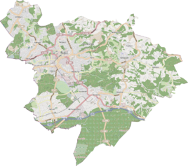
Location of Werheide in Bergisch Gladbach |
||
|
Houses in Werheide 2015
|
||
Werheide is a district in the Alt Refrath district of Bergisch Gladbach .
history
The name Werheide takes up the old trade name Auf der Werheide , which is recorded in the original cadastre north of the Steinbreche in the area of today's street. The Werheide farm originated from a medieval court establishment. The defining word Wer goes back to the Middle High German wer / were (= right of possession, possession) or gewer (= legally secured possession). It referred to the right of use of the respective farmer on the commons . The tub designation Auf der Werheide therefore describes a hallway that belongs to a common land. Another interpretation of the defining word who brings a reference to the ram , according to which it was a pasture for rams.
The place is regularly recorded as Werheide or without a name on the Prussian new record of 1892 and on later measuring table sheets .
Due to the Cologne Act , the city of Bensberg was merged with Bergisch Gladbach to form the city of Bergisch Gladbach with effect from January 1, 1975. Werheide also became part of Bergisch Gladbach.
| year | Residents | Residential
building |
category | Political / Church affiliation |
|---|---|---|---|---|
| 1845 | 10 | 1 | Farm | Bensberg mayor's office, Bensberg parish |
| 1871 | 13 | 2 | Yard | Mayor's office Bensberg |
| 1885 | 14th | 4th | Locality | Bensberg mayor, Refrath parish |
| 1895 | 14th | 2 | Locality | Bensberg mayor, Refrath parish |
| 1905 | 9 | 2 | Locality | Refrath mayor's office, Refrath Catholic parish |
Individual evidence
- ^ Andree Schulte, Bergisch Gladbach, city history in street names , published by the Bergisch Gladbach city archive, volume 3, and by the Bergisches Geschichtsverein department Rhein-Berg e. V., Volume 11, Bergisch Gladbach 1995, p. 236, ISBN 3-9804448-0-5
- ↑ Overview of the components and list of all the localities and individually named properties of the government district of Cologne: by districts, mayor's offices and parishes, with information on the number of people and the residential buildings, as well as the Confessions, Jurisdictions, Military and former state conditions. / ed. from the Royal Government of Cologne [Cologne], [1845]
- ↑ Royal Statistical Bureau Prussia (ed.): The communities and manor districts of the Prussian state and their population . The Rhine Province, No. XI . Berlin 1874.
- ↑ Königliches Statistisches Bureau (Prussia) (Ed.): Community encyclopedia for the Rhineland Province, based on the materials of the census of December 1, 1885 and other official sources, (Community encyclopedia for the Kingdom of Prussia, Volume XII), Berlin 1888.
- ↑ Königliches Statistisches Bureau (Prussia) (Ed.): Community encyclopedia for the Rhineland Province, based on the materials of the census of December 1, 1895 and other official sources, (Community encyclopedia for the Kingdom of Prussia, Volume XII), Berlin 1897.
- ↑ Königliches Statistisches Bureau (Prussia) (Ed.): Community encyclopedia for the Rhineland Province, based on the materials of the census of December 1, 1905 and other official sources, (Community encyclopedia for the Kingdom of Prussia, Issue XII), Berlin 1909.
literature
- Gerd Müller: Refrath, history of the districts of Bensberg-Refrath and -Frankenforst , published by Peter Bürling in collaboration with the city of Bensberg, 1974
Web links
- Archive of the Bergisches Geschichtsverein Rhein-Berg, Altrefrath, accessed on July 17, 2015

