Wiedener Eck
| Wiedener Eck | |||
|---|---|---|---|
| Compass direction | west | east | |
| Pass height | 1035 m above sea level NHN | ||
| state | Baden-Württemberg | ||
| Valley locations | Staufen im Breisgau | Utzenfeld | |
| expansion | L 123 / L 142 | ||
| Mountains | Black Forest | ||
| profile | |||
| Max. Incline | 6% | 6/12% | |
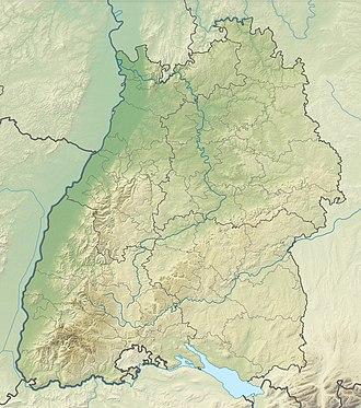
| Map (Baden-Württemberg) | |||
|
|
|||
| Coordinates | 47 ° 50 ′ 42 " N , 7 ° 52 ′ 1" E | ||
The Wiedener Eck is a 1035 m above sea level. NHN high pass crossing between Staufen im Breisgau and Utzenfeld in the southern Black Forest and thus between the Upper Rhine Plain and the Wiesental . The pass road running in an east-west direction is a good 30 kilometers long. The pass can also be reached from the south side via federal road 317 and Belchenstrasse. The pass is named after the municipality of Wieden a few kilometers to the east . At the top of the pass, the district boundary runs between the Breisgau-Hochschwarzwald district and the Lörrach district .
profile
The western ramp from Staufen over the Münstertal up to the Wiedener Eck bridges a difference in altitude of 743 meters over a distance of 20 kilometers, which corresponds to an average gradient of 3.7%. The maximum gradient on state road 123 is 6%. The course of the road has several hairpin bends in the upper third. At the Neuhof ski lift, the pass road can be shortened using a steeper road. The route is shortened to 18.4 kilometers, the maximum gradient on this section is up to 21%.
The southern ramp via Utzenfeld is the continuation of the western ramp and bridges 480 meters of altitude over a distance of 10.6 kilometers, which corresponds to an average gradient of 4.5%. The gradient maxima are also 6%.
The Wiedener Eck can be reached from Aitern via another southern ramp . The L 142, which also leads to the Belchen and is therefore called Belchenstrasse, bridges 634 meters in altitude at 12.2 kilometers. This means that it has an average gradient of 5.2% with a gradient of 12% at the hamlet of Holzinshaus. About 200 meters after the Hotel-Restaurant Multen, the road branches off to the left to the valley station of the Belchenbahn. The street continues straight to the Wiedener Eck. In the further course it reaches the Hohtannhöhe at 1180 m , which is its own pass. The culmination point is close to the Hohtann-Belchen cross-country skiing center and leads down a gentle slope to the Wiedener Eck.
Pass height
At the pass of the Wiedener Eck, the three ramps meet in a star shape. The three-story Berghotel Wiedener Eck, which has been in existence since 1901, has several extensions and numerous parking spaces at the top of the pass. This residential space consists of these buildings and bears the same name as the pass. The Wiedener Eck is used from all three sides by intercity buses and served via the stop of the same name on the pass. Both its proximity to the Belchen and the good transport connections make the pass a comparatively busy crossing.
The pass is often the starting point for the cross-country skiing area to the south, between Wiedener Eck and Belchen . In addition, after 93 of 100 kilometers, the Wiedener Eck is a station on the Schonach-Belchen long-distance ski trail and heralds the last stage of the longest ski trail in the Black Forest. In addition, in the Münstertal-Wieden ski area , which is between 880 and 1240 meters above sea level, there are six ski lifts with tow lengths of 400 to 1300 meters around the pass. Five of the lifts are interconnected. The ski area extends over both valleys and offers slopes of up to 24 kilometers in all levels of difficulty. This makes the ski area around the Wiedener Eck the second largest in the Black Forest after the Feldberg - Seebuck area .
The Wiedener Eck is also an important starting point or stage for (long-distance) hikers. For example, the pass is the end point of the tenth and the starting point of the eleventh stage of the Westweg . One of the twelve individually designed, three-meter-high information portals is located at the Wiedener Eck. The Westweg portal Wiedener Eck made of Douglas fir trees was inaugurated in 2009.
Others
The Wiedener Eck pass became a popular excursion destination at the end of the 19th century.
The Protestant theologian Rudolf Bultmann and his wife Helene married in August 1917. Their honeymoon in the Black Forest took them to the Münstertal and the mountain house of the Wiedener Eck.
literature
- Department of State Description of the State Archives Freiburg im Breisgau: The district of Lörrach. Volume II: B. Community descriptions Kandern to Zell im Wiesental. Published by the Baden-Württemberg State Archives Directorate in conjunction with the Lörrach district. Jan Thorbecke Verlag Sigmaringen 1994, ISBN 3-7995-1354-X , p. 828.
Web links
- Wiedener Eck (1035 m) - pass description
- Regional information system for Baden-Württemberg (LeoBW): Wiedener Eck - living space - archive material
Individual evidence
- ↑ a b The district of Loerrach . Volume II, p. 828.
- ↑ Hohtann-Belchen: Information on the cross-country trails on the Belchen , last accessed on June 4, 2019
- ↑ Description of the stages of the Schonach-Belchen long-distance skiing trail , last accessed on June 4, 2019
- ^ Badische Zeitung : Westweg-Portal am Wiedener Eck , article from June 7, 2009, last accessed on June 4, 2019
- ^ Konrad Hammann: Rudolf Bultmann: A biography. Mohr Siebeck, Tübingen 2009, ISBN 3-16-150204-3 , pp. 86-87.
