Wietze (Örtze)
| Wietze | ||
|
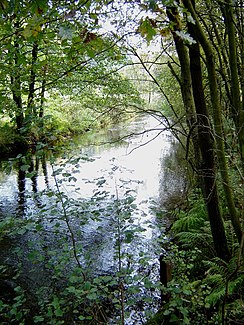
The Wietze north of Müden / Örtze |
||
| Data | ||
| Water code | EN : 4866 | |
| location | Germany , Lower Saxony | |
| River system | Weser | |
| Drain over | Örtze → Aller → Weser → North Sea | |
| source | east of Moide , on Mathberg (87.5 m) 52 ° 59 ′ 28 ″ N , 9 ° 57 ′ 33 ″ E |
|
| Source height | 83 m above sea level NHN | |
| muzzle | in Müden in die Örtze coordinates: 52 ° 52 ′ 22 ″ N , 10 ° 6 ′ 50 ″ E 52 ° 52 ′ 22 ″ N , 10 ° 6 ′ 50 ″ E |
|
| Mouth height | 54 m above sea level NHN | |
| Height difference | 29 m | |
| Bottom slope | 1.1 ‰ | |
| length | 27 km | |
| Catchment area | 193 km² | |
| Left tributaries | Aue, Reininger Moorgraben | |
| Right tributaries | Suhrbach | |
| Communities | Wietzendorf , Reddingen , Müden (Örtze) | |
The Wietze is a 27 km long river in the south of the Lüneburg Heath in Lower Saxony and the largest tributary of the Örtze .
The headwaters of the Wietze are located east of the village of Moide, which belongs to Soltau . The stream that then heads south to Wietzendorf was once the upper reaches of the Meiße , which begins further south, in the Great Moor near Becklingen . Today's sharp eastward turn of the Wietze near Wietzendorf was the result of a river tapping as a result of receding erosion towards the parallel but deeper flowing Örtze.
The Aue (GKZ 48664, 10.6 and 17.4 km, 56.36 km²) flows into Wietzendorf as the largest tributary. Its right source stream, the Hötzinger Aue (GKZ: 486642, 5.6 km, EZG = 11.45 km²), rises north of Stübeckshorn at a height of 98 m above sea level, and the Alvernsche Aue (GKZ: 486641, 6.6 km, EZG = 15.57 km²), the left source brook has its source northwest of Alvern at an altitude of 86 m. At the mouth, the floodplain surpasses the Wietze both in terms of water flow and length (17.4 km versus 12.0 km) and is therefore the main hydrological branch of the Wietze river system . The catchment area of the Wietze above the Aue measures only 37.40 km².
To the east of Wietzendorf, the river touches the town of Reddingen and flows through the associated hamlets of Halmern and Reiningen and past the Winterhoff farm. Here the valley with gently sloping, wooded slopes is sunk about 30 meters into the surrounding undulating plateau. Below Reiningen, the river briefly runs in the southern part of the Munster-Süd military training area . There the Reininger Moorgraben flows from the left. At the Reiningen gauge , the NLWKN also operates a hydrological measuring point to collect environmental data. Then the river turns south again and flows into the Örtze in Müden .
The Wietze is a very clean river. It has consistently polluted the water quality class II moderately ( betamesosaprob ). The water maintenance is the responsibility of the maintenance association Örtze , based in Müden.
Individual evidence
- ^ Environment Lower Saxony - Area Directory Weser
- ↑ Drawn GPS track: Aue (Wietze) with Alvernsche (r) Aue
- ↑ Drawn GPS track: Hötzinger Aue
- ↑ Water quality map of the NLWKN


