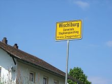
Wischlburg
Wischlburg is a district of the Stephansposching community in the Deggendorf district in Lower Bavaria .
location
The village of Wischlburg is located about two kilometers northwest of Stephansposching an der Donau on its southern high terrace , which slopes down to the river in a 10 to 12 meter high slope . In 1970 Wischlburg had around 140 residents. In Wischlburg there is a large rampart , the so-called " Römerschanze ".
history
The place is located on the oldest settlement land and is part of a settlement line on the south bank of the Danube. The Herzogshof in Wischlburg belonged to the Luitpolders in 919 . Emperor Otto II moved it in and, according to a certificate issued in Regensburg from July 21, 976 , gave it to the Metten Monastery ("famulantium Vuisciliburg"). In the second Herzogsurbar (before 1300) Wischelburch is registered as belonging to the Deggendorf office . After the establishment of the Natternberg court it belonged to this and was one of the four Schrannen places along with Plattling , Wallersdorf and Loh . Unlike in the main Schrannenort Plattling, Schrannen , that is, public court sessions in the name of the caretaker von Natternberg, only took place occasionally.
In 1464 Wischlburg was run as the main team, from 1474, initially in conjunction with Loh, as a chairman . In 1752, 15 properties in lower jurisdiction were not subject to the Natternberg nursing court, but to the Metten monastery. When the community was formed in 1821, Wischlburg became part of the Stephansposching community.
Attractions
In addition to three prehistoric burial mounds on the eastern edge, Wischlburg has a ring wall ( Ringwall Wischlburg ) in the town center that is still largely preserved above ground . The complex was probably built in the early 10th century on the occasion of the Hungarian invasions . Today's place has grown into this extensive security system.
The partially built-up walls are 35 to 40 meters wide and seal off the interior of the place. The wall is 3.5 meters high and the moat is just as deep. The interior has an expansion of 260 by 220 meters with an area of 5.5 hectares.
The function is controversial: Refuge during the Hungarian invasions, fortified manor or fortified administrative seat. The extent of the security structures suggests that there once was a lordly castle that could accommodate both troops and supplies. The relationship to the Metten Monastery, documented in 976, does not allow any further reaching conclusions, and assumptions about its use as an administrative or military site cannot yet be substantiated.
During a construction site observation carried out in 2004, another trench was unexpectedly discovered within the existing rampart, so that a system of two ramparts and two trenches is now assumed. The function of securing a Danube crossing is clarified by a gate on the river side.
societies
- Loh / Wischlburg volunteer fire department
- Warrior and reservist comradeship Loh / Wischlburg
literature
- Donatus Moosauer, Günther Michler, Ulrich Pietrusky: Niederbayern - rediscovered in flight , Morsak Verlag, Grafenau, 2nd edition 1982, ISBN 3-87553-135-3
Web links
Coordinates: 48 ° 50 ' N , 12 ° 47' E


