Wurschen
|
Wurschen
Worcyn City of Weißenberg
Coordinates: 51 ° 11 ′ 36 ″ N , 14 ° 34 ′ 52 ″ E
|
|
|---|---|
| Height : | 158 m above sea level NHN |
| Residents : | 312 (Dec. 31, 2016) |
| Incorporation : | March 1, 1994 |
| Postal code : | 02627 |
| Area code : | 035939 |
Wurschen , in Sorbian , is a village with 318 inhabitants in the east of the Saxon district of Bautzen . The village is located in Upper Lusatia and is officially part of the Sorbian settlement area . It has belonged to the city of Weißenberg since 1994 and is the most populous district after the old town.
geography
Wurschen is located eleven kilometers east of Bautzen in the lowland of the Kotitzer water at 158 m above sea level. NHN . While the southern area - in the direction of Drehsa - is hilly, the flatter landscape north of Wurschen is characterized by numerous watercourses, of which the Kotitzer and Löbauer water are the most important.
The place consists of the old Wurschen estate in the northern part and the spatially separated settlement in the south, on State Road 111 (Bautzen – Weißenberg), which also includes the Am Kirschgarten development area . The manor forms the eastern part of the old village. To the northeast of Wurschen there is a large fish pond, the Belgerner Teich .
history

The first mention of the place as Wursyn is documented for 1359. The manor is mentioned from 1390. The current spelling appears for the first time in 1697. The manor had been in different hands since 1382 and was passed on to different families from the end of the 17th century. Since 1828 it has been in the possession of the Counts of Solms-Sonnenwalde , who have owned it again through repurchase since 1997.
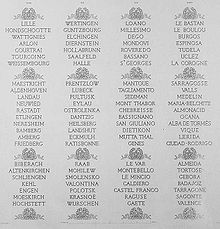
During the Battle of Bautzen on May 20 and 21, 1813, the headquarters of the allied Russians and Prussians was located in Wurschen Castle; therefore the battle of the Arc de Triomphe in Paris is recorded as Bataille de Wurschen .
Wurschen was an independent rural community until 1936, when it was incorporated into Nechern . The municipality of Nechern was renamed the municipality of Wurschen in 1957 and the village of Belgern was incorporated. In 1993 Wurschen merged with the neighboring Drehsa under this name before it was incorporated into the city of Weißenberg in the following year with the municipal reform.
population
In 1890 Wurschen had 221 inhabitants.
For his statistics on the Sorbian population in Upper Lusatia, Arnošt Muka determined a population of 242 in the 1880s; 216 of them were Sorbs (89%) and 26 Germans. In 1956 Ernst Tschernik still had a Sorbian-speaking majority of 56% in Wurschen and Nechern. As everywhere in the Protestant part of the settlement area, the proportion of Sorbian speakers has continued to decrease significantly since then.
The last population data for the independent community of Wurschen indicate 472 inhabitants for 1991. Since the reunification the population has decreased. For 2016, the statistics indicate 312 inhabitants.
religion
Wurschen has been parish in Gröditz since the 16th century . The last information on religious affiliation comes from 1925. At that time 194 of 196 inhabitants were Evangelical Lutheran (99%).
Sons and daughters (selection)
- Peter zu Solms-Sonnenwalde (1840–1922), German nobleman and politician
literature
- Cornelius Gurlitt : Wurschen. In: Descriptive representation of the older architectural and art monuments of the Kingdom of Saxony. 32nd issue: Bautzen Official Authority (Part II) . CC Meinhold, Dresden 1908, p. 319.
swell
- ^ Information from the municipality of Weißenberg; As of December 31, 2008
- ^ Wurschen in the Digital Historical Directory of Saxony
- ^ History of the moated castle on Wurschen.de
- ↑ Ernst Tschernik: The development of the Sorbian population . Akademie-Verlag, Berlin 1954, p. 54 .
- ^ Ludwig Elle: Language policy in the Lausitz . Domowina-Verlag, Bautzen 1995, p. 245 .

