Zieselbach
| Zieselbach | ||
|
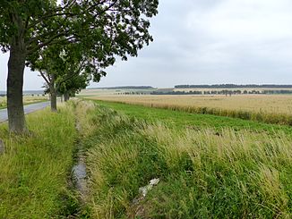
Zieselbach below Rhoden, looking up, on the right the Kleine Fallstein |
||
| Data | ||
| Water code | DE : 4824882 | |
| location | Saxony-Anhalt and Lower Saxony , Germany | |
| River system | Weser | |
| Drain over | Mühlen-Ilse → Oker → Aller → Weser → North Sea | |
| source | On the Großer Fallstein east of Rhoden 52 ° 0 ′ 30 ″ N , 10 ° 42 ′ 25 ″ E |
|
| Source height | 230 m above sea level NHN | |
| muzzle |
Hornburg coordinates: 52 ° 2 '28 " N , 10 ° 36' 44" E 52 ° 2 '28 " N , 10 ° 36' 44" E |
|
| Mouth height | 87 m above sea level NHN | |
| Height difference | 143 m | |
| Bottom slope | 14 ‰ | |
| length | 10 km (including dashed line) | |
| Catchment area | 16.46 km² thereof 11.2 in Saxony-Anhalt | |
| Small towns | Osterwieck | |
| Communities | Schladen-Werla | |
| Water body NLWKN: 15016 LHW: WESOW26-00 |
||
|
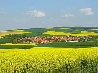
View of Rhoden and the headwaters of the Zieselbach as well as its course in the valley between Großes and Kleines Fallstein. |
||
The Zieselbach is a creek about 10 km long, which rises at the Großer Fallstein east of Rhoden in the Harz district , Saxony-Anhalt and runs between the Großer Fallstein and the Großer Bruch . It flows into a branch of the Ilse , the Mühlen-Ilse , in Hornburg in the Wolfenbüttel district in Lower Saxony .
Geography and water quality
course
The upper reaches of the Zieselbach in its headwaters on the western slope of the Großer Fallstein are only shown in dashed lines on the official maps of Lower Saxony and Saxony-Anhalt. The source is therefore in the edge of the forest at about 230 m above sea level. To assume NHN and located in a karst environment. Below the extension of the district road 1342, the regular course of the stream begins (geographic coordinates 52 ° 0 '5 " N , 10 ° 40' 46" E ) at a height of about 140 m above sea level. NHN . From here it flows mainly in a north-westerly direction and passes Rhoden on the south-western edge of the town. About one kilometer below the village, it reaches the state border at an altitude of 95 m above sea level. NHN . Here it bends slightly to the north and strives towards the west of the Schiffgraben, but turns sharply to the west 300 meters above. After another very straight route and another north and west turn before the federal road 82, it reaches the Mühlen-Ilse at the site of the former sewage treatment plant Hornburg. On its last section, several ditches cross the stream towards the north to the Schiffgraben-West, which in the lists of the LHW Sachsen-Anhalt is indicated as an estuary, deviating from the mapped course.
The brook is assigned to the flowing water type "6: Fine-material, carbonatic low mountain brooks ".
Water quality
The length of the river is distributed roughly equally between Lower Saxony and Saxony-Anhalt, the catchment area is predominantly in Saxony-Anhalt. The monitoring of the water quality and the water development within the framework of the European Water Framework Directive is the responsibility of the Lower Saxony State Office NLWKN . In its water quality report from 2002, only the Lower Saxon share is rated with quality class II to III and as poor in species. In the current data sheet of the Saxony-Anhalt state company, the Lower Saxony data are cited, according to which the ecological potential is only rated “unsatisfactory” and the overall assessment for the chemical condition is rated “not good”. With regard to the structure, it is classified as "significantly changed" (HMWB).
Elbe-Weser watershed
The Zieselbach belongs to the catchment area of the Weser . On the east side of the Großer Fallstein, the waters flow to the Deersheimer Aue or directly into the Schiffgraben-Ost , which in turn drains via the Bode and Saale to the Elbe .
Web links
- Publications of the state of Lower Saxony on the water quality of the Oker on www.wasserblick.net
- List of water bodies in the Outer catchment area with data Publication by NLWKN on www.wasserblick.net
- Water quality report Oker 2002 Internet platform of the NLWKN
- Map of surface water bodies : Observation area WES (Oker) , State Office for Flood Protection and Water Management (LHW), on wrrl.sachsen-anhalt.de (without link to Zieselbach)
- Water report on surface water 2005–2008 - tabular part , State Office for Flood Protection and Water Management (LHW) Saxony-Anhalt, State Service for Water Sciences, on lhw.sachsen-anhalt.de
Individual evidence
- ↑ a b c State Office for Geoinformation and Land Surveying Lower Saxony: Top 50 - Topographic Map 1: 50,000 Lower Saxony / Bremen , status 2000.
- ↑ NLWKN : List of areas for the Lower Saxony Hydrographic Map , as of 2010, p. 56. FV_Weser.pdf, accessed on Umwelt.niedersachsen.de on August 19, 2013
- ↑ According to the LHW Saxony-Anhalt, there are 14.6 in total and 11.2 in Saxony-Anhalt.
- ↑ Saxony-Anhalt Viewer. Retrieved March 14, 2015 .
- ↑ GeoLife. (No longer available online.) Archived from the original on March 19, 2015 ; accessed on March 14, 2015 . Info: The archive link was inserted automatically and has not yet been checked. Please check the original and archive link according to the instructions and then remove this notice.
- ↑ Tabular part WES_db_web.pdf Water body data sheet Zieselbach WESOW26-00 on sheet 62.
- ↑ NLWKN : Water quality report Oker 2002 , Braunschweig October 2002, p. 47 ff.
- ↑ Sachsen-Anhalt-Gewässerbericht_OW_2005-2008_web.pdf Table on page 3 (p. 135 of the entire document) Zieselbach

