Alhóndiga: Difference between revisions
Content deleted Content added
m robot Adding: pam:Alhóndiga |
m Disambiguating links to Hospitaller (link changed to Knights Hospitaller) using DisamAssist. |
||
| (32 intermediate revisions by 24 users not shown) | |||
| Line 1: | Line 1: | ||
{{other uses|Alhóndiga (disambiguation)}} |
|||
{{Infobox settlement |
{{Infobox settlement |
||
official_name = Alhóndiga |
| official_name = Alhóndiga |
||
| ⚫ | |||
| settlement_type = [[Municipalities of Spain|Municipality]] |
|||
image_flag = | |
|||
| image_skyline = Alhóndiga, Guadalajara, España, 2018-01-04, DD 15.jpg |
|||
image_seal = | |
|||
| ⚫ | |||
| ⚫ | |||
| image_flag = Bandera de Alhóndiga.svg |
|||
| ⚫ | |||
| image_seal = Escudo de Alhóndiga.svg |
|||
| ⚫ | |||
| ⚫ | |||
| ⚫ | |||
| ⚫ | |||
| ⚫ | |||
| pushpin_map =Spain Province of Guadalajara#Spain Castilla-La Mancha#Spain |
|||
| ⚫ | |||
| ⚫ | |||
subdivision_type2 = [[List of municipalities in Guadalajara|Municipality]] | |
|||
| ⚫ | |||
subdivision_name2 = Alhóndiga | |
|||
| subdivision_type1 = Autonomous community |
|||
| ⚫ | |||
| subdivision_name1 = [[Castilla–La Mancha]] |
|||
| ⚫ | |||
| ⚫ | |||
| ⚫ | |||
| ⚫ | |||
| ⚫ | |||
| ⚫ | |||
| ⚫ | |||
| ⚫ | |||
| ⚫ | |||
| ⚫ | |||
| ⚫ | |||
| ⚫ | |||
population_as_of = 2004 | |
|||
| ⚫ | |||
| ⚫ | |||
| ⚫ | |||
population_total = 244 | |
|||
| ⚫ | |||
| ⚫ | |||
| ⚫ | |||
| ⚫ | |||
| population_as_of = {{Spain metadata Wikidata|population_as_of}} |
|||
utc_offset = +1 | |
|||
| population_footnotes = {{Spain metadata Wikidata|population_footnotes}} |
|||
| ⚫ | |||
| population_total = {{Spain metadata Wikidata|population_total}} |
|||
| ⚫ | |||
| ⚫ | |||
latitude = | |
|||
| ⚫ | |||
longitude = | |
|||
| utc_offset = +1 |
|||
| ⚫ | |||
| ⚫ | |||
| ⚫ | |||
| ⚫ | |||
| website = |
|||
| ⚫ | |||
}} |
}} |
||
'''Alhóndiga''' is a municipality located in the [[Guadalajara (province)|province of Guadalajara]], [[ |
'''Alhóndiga''' is a municipality located in the [[Guadalajara (province)|province of Guadalajara]], [[Castilla–La Mancha]], Spain.<ref name="rel">{{Cite web|url=https://ssweb.seap.minhap.es/REL/frontend/inicio/municipios/8/13413|title=Datos del Registro de Entidades Locales|publisher=[[Ministry of Economy (Spain)|Ministerio de Asuntos Económicos y Transformación Digital]]|access-date=9 September 2023}}</ref> As of 1 January 2022 it had a registered population of 158.<ref name="rel" /> The municipality spans across a total area of 19.26 km<sup>2</sup>.<ref name="rel" /> |
||
The locality was an early instance of [[Knights Hospitaller|Hospitaller]] settlement south of the [[Sistema Central]], and it was granted a ''[[fuero]]'' in 1170.<ref>{{Cite journal|title=La repoblación hospitalaria en la Corona de Castilla (siglos XII-XVI)|journal=Historia. Instituciones. Documentos|issn=0210-7716|issue=24|year=1997|first=Carlos|last=Barquero Goñi|page=73|url=https://revistascientificas.us.es/index.php/HID/article/view/4379/3822|location=Seville|publisher=[[University of Seville|Universidad de Sevilla]]}}</ref> Upon the 1170 donation to the Order of St. John, the previous link of Alhóndiga with [[Zorita de los Canes|Zorita]] was severed.<ref>{{Cite journal|url=https://revistas.uned.es/index.php/RDUNED/article/view/16290/14037|publisher=[[Universidad Nacional de Educación a Distancia]]|location=Madrid|journal=Revista de Derecho UNED|year=2015|issue=17|title=Derecho de frontera en las villas de la Orden de San Juan. Peñalver y Alhóndiga a mediados del siglo XII|first=Gonzalo|last=Oliva Manso|doi=10.5944/rduned.17.2015.16290|issn=2255-3436|pages=1135−1136|doi-access=free}}</ref> |
|||
| ⚫ | |||
==References== |
|||
| ⚫ | |||
{{reflist}} |
|||
| ⚫ | |||
| ⚫ | |||
{{authority control}} |
|||
| ⚫ | |||
| ⚫ | |||
[[an:Alhóndiga]] |
|||
| ⚫ | |||
[[ca:Alhóndiga]] |
|||
[[es:Alhóndiga (Guadalajara)]] |
|||
[[fr:Alhóndiga]] |
|||
[[gl:Alhóndiga]] |
|||
[[it:Alhóndiga]] |
|||
[[pam:Alhóndiga]] |
|||
[[nl:Alhóndiga]] |
|||
[[pt:Alhóndiga]] |
|||
[[ru:Альхондига]] |
|||
[[vi:Alhóndiga]] |
|||
Latest revision as of 10:49, 30 December 2023
Alhóndiga | |
|---|---|
 | |
| Coordinates: 40°31′37″N 2°49′18″W / 40.52694°N 2.82167°W | |
| Country | Spain |
| Autonomous community | Castilla–La Mancha |
| Province | Guadalajara |
| Area | |
| • Total | 19.26 km2 (7.44 sq mi) |
| Population (2018)[1] | |
| • Total | 157 |
| • Density | 8.2/km2 (21/sq mi) |
| Time zone | UTC+1 (CET) |
| • Summer (DST) | UTC+2 (CEST) |
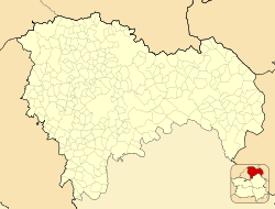
Alhóndiga is a municipality located in the province of Guadalajara, Castilla–La Mancha, Spain.[2] As of 1 January 2022 it had a registered population of 158.[2] The municipality spans across a total area of 19.26 km2.[2]
The locality was an early instance of Hospitaller settlement south of the Sistema Central, and it was granted a fuero in 1170.[3] Upon the 1170 donation to the Order of St. John, the previous link of Alhóndiga with Zorita was severed.[4]
References[edit]
- ^ Municipal Register of Spain 2018. National Statistics Institute.
- ^ a b c "Datos del Registro de Entidades Locales". Ministerio de Asuntos Económicos y Transformación Digital. Retrieved 9 September 2023.
- ^ Barquero Goñi, Carlos (1997). "La repoblación hospitalaria en la Corona de Castilla (siglos XII-XVI)". Historia. Instituciones. Documentos (24). Seville: Universidad de Sevilla: 73. ISSN 0210-7716.
- ^ Oliva Manso, Gonzalo (2015). "Derecho de frontera en las villas de la Orden de San Juan. Peñalver y Alhóndiga a mediados del siglo XII". Revista de Derecho UNED (17). Madrid: Universidad Nacional de Educación a Distancia: 1135−1136. doi:10.5944/rduned.17.2015.16290. ISSN 2255-3436.


