Palliser Islands
| Palliser Islands | ||
|---|---|---|
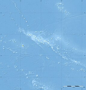
| Map of the Tuamotu Archipelago, the Palliser Islands are in the extreme northwest | ||
| Waters | Pacific Ocean | |
| archipelago | Tuamotu Archipelago | |
| Geographical location | 15 ° 8 ′ S , 147 ° 39 ′ W | |
|
|
||
| Number of islands | 10 atolls | |
| Main island | Rangiroa | |
| Total land area | 202.8 km² | |
| Residents | 6076 (2007) | |
The Palliser Islands ( French Îles Palliser ) are a group of islands within the Tuamotu Archipelago in French Polynesia . The ten coral atolls of the archipelago are located in the extreme northwest of the Tuamotus. About a third of the population of the Tuamotu Archipelago lives on the Palliser Islands.
The Palliser Islands include the following atolls:
history
The atoll group got its name from James Cook , who discovered it on April 19 and 20, 1774 respectively. Hugh Palliser was a good, long-time friend of Cook, who financially supported Cook's expeditions and promoted their publication. Cook named a bay on New Zealand's North Island ( Palliser Bay ) and the southernmost point of the North Island ( Cape Palliser ) after his sponsor.

