
Toau
| Toau | ||
|---|---|---|
 |
||
| Waters | Pacific Ocean | |
| archipelago | Tuamotu Archipelago | |
| Geographical location | 15 ° 54 ′ S , 146 ° 2 ′ W | |
|
||
| Number of islands | - | |
| Main island | Maragai | |
| length | 35 km | |
| width | 18 km | |
| Land area | 12 km² | |
| Lagoon area | 561 km² | |
| total area | 652 km² | |
| Residents | uninhabited (2007) | |

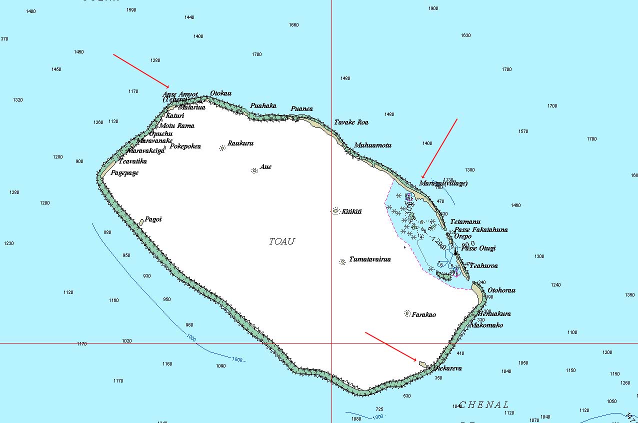
Toau (also called Pakuria or Taha-a-titi ) is an atoll in the Tuamotu Archipelago in French Polynesia .
geography
The lagoon is 35 × 18 km and up to 25 meters deep. The total area of the atoll is 652 km², and the area of the lagoon is 561 km². The closest atoll is Fakarava , 14 km southeast of Toau. Administratively, the atoll belongs to the municipality of Fakarava and therein to the commune associée Fakarava.
history
James Cook was the first to sight the atoll in April 1774. In some maps the atoll is marked with the name Elizabeth .
The only village is Maragai on the island of the same name in the east of the atoll. The 2002 census counted 24 inhabitants here, but according to the 2012 census only 18. The inhabitants live mainly from fish farming, pearls are also dipped and copra is made from coconuts.
Individual evidence
- ↑ Loïc Charpy, Philippe Dufour, Nicole Garcia: Particulate organic matter in sixteen Tuamotu atoll lagoons (French Polynesia) (PDF; 1.2 MB)
Web links
- Picture and short description ( memento from December 23, 2010 in the Internet Archive )
- Pictures (english)
- JL Young: Names Of The Paumotu Islands, with the old names so far as they are known. December 1899, pp. 264–268 , accessed January 30, 2019 (English).
- Detailed travel report (English)
- Atoll map
Ahe | Ahunui | Akiaki | Amanu | Anaa | Anuanuraro | Anuanurunga | Apataki | Aratika | Arutua | Faaite | Fakahina | Fakarava | Fangatau | Fangataufa | Hao | Haraiki | Héréhérétué | Hikueru | Hiti | Katiu | Kauehi | Kaukura | Makatea | Makemo | Manihi | Manuhangi | Maria Est | Morocco | Marutea North | Marutea Sud | Mataiva | Matureivavao | Morane | Motutunga | Mururoa | Napuka | Nengonengo | Niau | Nihiru | Nukutavake | Nukutepipi | Paraoa | Pinaki | Puka-puka | Puka Rua | Rangiroa | Raraka | Raroia | Ravahere | Reao | Reitoru | Rekareka | Taenga | Tahanea | Taiaro | Takapoto | Takaroa | Takume | Tatakoto | Tauere | Tekokota | Tematangi | Temoe | Tenararo | Tenarunga | Tepoto North | Tepoto Sud | Tikehau | Tikei | Toau | Tuanake | Tureia | Vahanga | Vahitahi | Vairaatea | Vanavana