Rekareka
| Rekareka | ||
|---|---|---|
| Map of Rekareka | ||
| Waters | Pacific Ocean | |
| archipelago | Tuamotu Archipelago | |
| Geographical location | 16 ° 49 ′ S , 141 ° 55 ′ W | |
|
|
||
| Number of islands | 4th | |
| Main island | - | |
| Land area | 1.6 km² | |
| Lagoon area | 2.5 km² | |
| Residents | uninhabited | |
| Location of Rekareka (red, 6) | ||
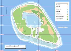
Rekareka , Tehuata or Tu-henua is an atoll in the Tuamotu Archipelago in French Polynesia . The atoll's lagoon has navigable access to the sea in the south. The nearest atoll is Tauere , 70 km northwest. Administratively, Rekareka belongs to the municipality of Hao .
history
The Spanish explorer Pedro Fernández de Quirós discovered Rekareka on a Pacific expedition on February 13, 1606. The Spaniards named the atoll "Sagitaria". Even at that time the atoll was uninhabited. On some maps the atoll is also shown under the name "Bonne Esperance" or "Good Hope".
There are no fresh water resources on the atoll.
Web links
- Picture and short description ( memento from December 23, 2010 in the Internet Archive )
- JL Young: Names Of The Paumotu Islands, with the old names so far as they are known. December 1899, pp. 264–268 , accessed January 30, 2019 (English).
- The Spanish South Sea Expedition (Spanish)
- Pedro Fernández de Quirós (Spanish)


