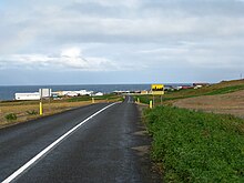
Langanesbyggð
| Basic data | |
|---|---|
| State : |
|
| Region: | Norðurland eystra |
| Constituency : | Norðausturkjördæmi |
| Sýsla : | Norður-Þingeyjarsýsla |
| Population: | 504 (January 1, 2019) |
| Surface: | 1333 km² |
| Population density: | 0.38 inhabitants / km² |
| Post Code: | 680, 681 (Þórshöfn) 685 (Bakkafjörður) |
| politics | |
| Community number | 6709 |
| Contact | |
| Address of the municipal administration: | Fjarðarvegi 3 680 Þórshöfn |
| map | |

Coordinates: 66 ° 12 ′ N , 15 ° 20 ′ W |
|
The municipality of Langanesbyggð is located in northeast Iceland in the Norðurland eystra region .
On January 1, 2019, the community had 504 inhabitants. The two largest settlements are Þórshöfn (369 inhabitants) and Bakkafjörður (69 inhabitants).
geography
The northern part of Langanesbyggð is on joining to the northeast around 30 kilometers sprawling peninsula Langanes the northwest to the Þistilfjörður , east of the bay Bakkaflói borders. The foothills of this bay are the three fjords Finnafjörður , Miðfjörður and Bakkafjörður , they border on Langanesströmnd . The southern tip of the parish is Anbúi .
history
The municipality was formed in 2006 through the merger of the rural community Þórshöfn (isl. Þórshafnarhreppur ) and the rural community of Skeggjastaðir (isl. Skeggjastaðahreppur ). Skeggjastaðir moved from the Austurland region to the Norðurland eystra region . The alternative name suggestions Gunnólfsbyggð, Hafnarbyggð and Langaneshreppur could not prevail among the electorate.
Þórshöfn
Þórshöfn (dt. Thor's harbor ) is located on the eastern edge of Lónafjörður , an offshoot of Þistilfjörður . Þórshöfn had been a trading center since 1846, although residents did not live here permanently until 1875. At the beginning of the 20th century, herring fishing and processing gained in importance. Despite the fact that the herring fishing has stopped, the inhabitants live mainly from fishing. The largest employer is the fish factory at the port, a branch of Ísfélag Vestmannaeyja.
Þórshöfn is the municipality's most important supply point, there is the only bank, post office, health center, school, kindergarten, supermarket, restaurant, swimming pool, police station, Þórshöfn airport and one of 2 petrol stations in the area.
The capital Reykjavík is 629 kilometers away, the closest Raufarhöfn to the northwest is around 66 kilometers.
Population development
Like most areas of Iceland now, except for the southwest around the capital Reykjavík, Langanesbyggð is affected by severe rural exodus. From 1997 to 2006 the population decrease in the area of today's municipality was 17%.
However, there has been a slight increase in Þórshöfn since 2007.
| Year * | Residents |
|---|---|
| 1997 | 626 (territory from 2006) |
| 2003 | 533 (territory from 2006) |
| 2004 | 548 (territory from 2006) |
| 2005 | 542 (territory from 2006) |
| 2006 | 518 |
* on December 1st
Former parishes
| Þórshöfn | Skeggjastaðir | |
|---|---|---|
| Municipality number: | 6707 | 7501 |
| Area in km²: | 728 | 605 |
| Population on Dec. 1, 1997: | 485 | 141 |
| Population on Dec. 1, 2003: | 400 | 133 |
| Population on December 1st, 2004: | 411 | 137 |
| Population on Dec. 1, 2005: | 417 | 125 |
| Population change 1997-2005: | −14% | −11% |
| Post Code: | 680, 681 | 685 |
| Settlements: | Þórshöfn | Bakkafjörður |


